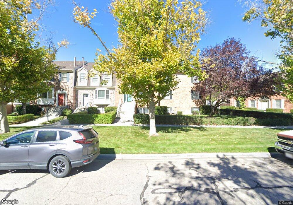
357 W 4650 N Provo, UT 84604
Riverside NeighborhoodEstimated Value: $623,306 - $725,000
About This Home
This home is located at 357 W 4650 N, Provo, UT 84604 and is currently estimated at $685,577, approximately $268 per square foot. 357 W 4650 N is a home located in Utah County with nearby schools including Canyon Crest Elementary School, Centennial Middle School, and Timpview High School.
Ownership History
We collect this data history from publicly available records. To have your information removed, we recommend requesting removal directly through your county’s website.
Purchase Details
Purchase Details
Home Financials for this Owner
Home Financials are based on the most recent Mortgage that was taken out on this home.Purchase Details
Home Financials for this Owner
Home Financials are based on the most recent Mortgage that was taken out on this home.Purchase Details
Home Financials for this Owner
Home Financials are based on the most recent Mortgage that was taken out on this home.Purchase Details
Home Values in the Area
Average Home Value in this Area
Purchase History
We collect this data history from publicly available records. To have your information removed, we recommend requesting removal directly through your county’s website.
| Date | Buyer | Sale Price | Title Company |
|---|---|---|---|
| -- | Title West Midvale | ||
| -- | Title West Title Company | ||
| -- | First American Title Insuran | ||
| -- | First American Title Co | ||
| -- | -- |
Mortgage History
We collect this data history from publicly available records. To have your information removed, we recommend requesting removal directly through your county’s website.
| Date | Status | Borrower | Loan Amount |
|---|---|---|---|
| Previous Owner | $341,682 | ||
| Previous Owner | $280,000 | ||
| Previous Owner | $183,200 |
Tax History
We collect this data history from publicly available records. To have your information removed, we recommend requesting removal directly through your county’s website.
| Year | Tax Paid | Tax Assessment Tax Assessment Total Assessment is a certain percentage of the fair market value that is determined by local assessors to be the total taxable value of land and additions on the property. | Land | Improvement |
|---|---|---|---|---|
| 2026 | $3,100 | $317,295 | ||
| 2025 | $3,037 | $309,375 | ||
| 2024 | $3,037 | $298,980 | $0 | $0 |
| 2023 | $2,951 | $286,330 | $0 | $0 |
| 2022 | $2,567 | $251,185 | $0 | $0 |
| 2021 | $2,012 | $343,400 | $51,500 | $291,900 |
| 2020 | $2,137 | $341,800 | $79,000 | $262,800 |
| 2019 | $2,054 | $341,800 | $79,000 | $262,800 |
| 2018 | $2,026 | $341,800 | $42,000 | $299,800 |
| 2017 | $1,913 | $177,375 | $0 | $0 |
| 2016 | $1,871 | $161,700 | $0 | $0 |
| 2015 | $1,760 | $153,780 | $0 | $0 |
| 2014 | $1,689 | $153,780 | $0 | $0 |
Map
- 148 W 4750 N
- 1245 N 590 E Unit 122
- 536 E 1265 N Unit 107
- 1271 N 590 E Unit 121
- 80 N 1200 E
- 4394 Stafford Ct
- 110 N Palisade Dr
- 1030 E 20 N
- 85 S 1000 E
- 127 N 1080 E
- 1148 E 250 N
- 5005 N Edgewood Dr Unit 301
- 157 E 4380 N
- 31 S 860 E
- 4036 N 380 W
- 292 E 4960 N
- 331 N 1100 E
- 4861 N 300 St E
- 24 S 800 E
- 5198 N University Ave Unit 107
Ask me questions while you tour the home.