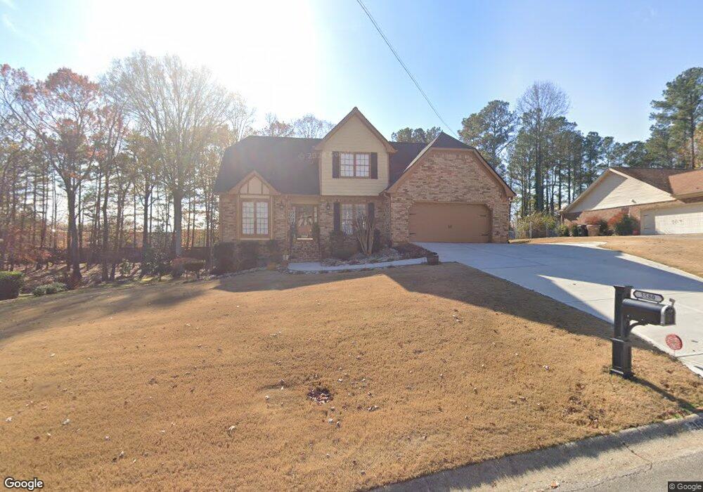
3580 Hanover Dr Buford, GA 30519
Estimated Value: $371,000 - $436,000
3
Beds
3
Baths
2,274
Sq Ft
$181/Sq Ft
Est. Value
About This Home
This home is located at 3580 Hanover Dr, Buford, GA 30519 and is currently estimated at $412,238, approximately $181 per square foot. 3580 Hanover Dr is a home located in Gwinnett County with nearby schools including Harmony Elementary School, Glenn C. Jones Middle School, and Sugar Hill Christian Academy.
Ownership History
Date
Name
Owned For
Owner Type
Purchase Details
Closed on
Oct 30, 2008
Sold by
Greenpoint Mtg Funding Inc
Bought by
Lyles Cory
Current Estimated Value
Home Financials for this Owner
Home Financials are based on the most recent Mortgage that was taken out on this home.
Original Mortgage
$134,228
Outstanding Balance
$87,509
Interest Rate
6.11%
Mortgage Type
FHA
Estimated Equity
$324,729
Purchase Details
Closed on
Jul 1, 2008
Sold by
English Shirley M
Bought by
Greenpoint Mtg Funding Inc
Purchase Details
Closed on
Feb 1, 1999
Sold by
Simmons Laverne P
Bought by
Thompson Susan and Hall Rebecc
Create a Home Valuation Report for This Property
The Home Valuation Report is an in-depth analysis detailing your home's value as well as a comparison with similar homes in the area
Home Values in the Area
Average Home Value in this Area
Purchase History
| Date | Buyer | Sale Price | Title Company |
|---|---|---|---|
| Lyles Cory | $136,100 | -- | |
| Greenpoint Mtg Funding Inc | $125,132 | -- | |
| Thompson Susan | $130,000 | -- |
Source: Public Records
Mortgage History
| Date | Status | Borrower | Loan Amount |
|---|---|---|---|
| Open | Lyles Cory | $134,228 |
Source: Public Records
Tax History
| Year | Tax Paid | Tax Assessment Tax Assessment Total Assessment is a certain percentage of the fair market value that is determined by local assessors to be the total taxable value of land and additions on the property. | Land | Improvement |
|---|---|---|---|---|
| 2025 | $4,201 | $151,080 | $40,000 | $111,080 |
| 2024 | $3,902 | $130,280 | $39,200 | $91,080 |
| 2023 | $3,902 | $146,760 | $39,200 | $107,560 |
| 2022 | $3,561 | $116,400 | $27,960 | $88,440 |
| 2021 | $3,109 | $92,600 | $27,960 | $64,640 |
| 2020 | $2,947 | $84,120 | $23,840 | $60,280 |
| 2019 | $2,856 | $84,120 | $23,840 | $60,280 |
| 2018 | $2,698 | $76,800 | $18,400 | $58,400 |
| 2016 | $2,773 | $69,840 | $14,800 | $55,040 |
| 2015 | $2,068 | $49,160 | $14,800 | $34,360 |
| 2014 | -- | $49,160 | $14,800 | $34,360 |
Source: Public Records
Map
Nearby Homes
- 1970 Sturbridge Ln Unit 1
- 3534 Fallen Oak Ln
- 3503 Fallen Oak Dr
- 1781 Plunketts Rd
- 2190 Copper Trail Ln
- 3402 Rustic Trail Ln
- 2153 Splitrail Trail
- 2275 Copper Trail Ln
- 2162 Mill Garden Run
- 2320 Copper Trail Ln
- 2123 Mill Garden Run
- 3214 Mill Springs Cir
- 3187 Mill Springs Cir
- 3267 Mill Springs Cir
- 3160 Mill Springs Cir
- 3843 Morning Meadow Ln
- 2287 Tortuga Pass
- 3058 Cedar Glade Ln
- 2182 Hyssop Way Unit 2
- 3139 Cedar Glade Ln
- 3570 Hanover Dr
- 3590 Hanover Dr
- 3581 Hanover Dr
- 3560 Hanover Dr
- 3571 Hanover Dr Unit 3571
- 3571 Hanover Dr
- 3600 Hanover Dr Unit 1
- 3591 Hanover Dr
- 3561 Hanover Dr
- 3550 Hanover Dr
- 4463 S Bogan Rd
- 4503 S Bogan Rd
- 4493 S Bogan Rd
- 4483 S Bogan Rd
- 1970 Wessington Ct Unit 1
- 3601 Hanover Dr
- 3540 Hanover Dr Unit 1
- 3541 Hanover Dr
- 1980 Wessington Ct
- 3530 Hanover Dr
Your Personal Tour Guide
Ask me questions while you tour the home.