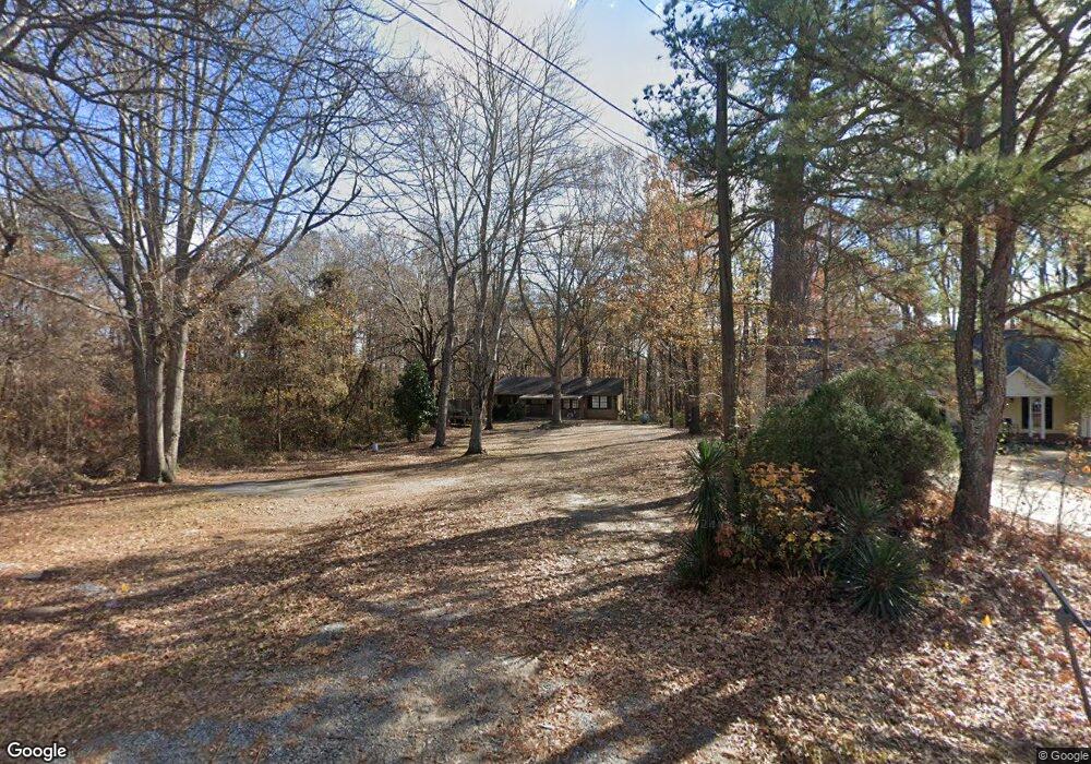
3583 S Bogan Rd Buford, GA 30519
Estimated Value: $317,000 - $447,951
3
Beds
1
Bath
1,000
Sq Ft
$362/Sq Ft
Est. Value
About This Home
This home is located at 3583 S Bogan Rd, Buford, GA 30519 and is currently estimated at $362,488, approximately $362 per square foot. 3583 S Bogan Rd is a home located in Gwinnett County with nearby schools including Harmony Elementary School, Glenn C. Jones Middle School, and Sugar Hill Christian Academy.
Ownership History
Date
Name
Owned For
Owner Type
Purchase Details
Closed on
Feb 21, 2014
Sold by
Ameris Bank
Bought by
Chen Alexander
Current Estimated Value
Purchase Details
Closed on
Mar 5, 2013
Sold by
Patel Trushad
Bought by
Ameris Bank
Purchase Details
Closed on
Oct 29, 2007
Sold by
Pollard Michael D
Bought by
Patel Trushad and Patel Chhumal
Home Financials for this Owner
Home Financials are based on the most recent Mortgage that was taken out on this home.
Original Mortgage
$304,000
Interest Rate
6.15%
Mortgage Type
New Conventional
Purchase Details
Closed on
Aug 9, 2004
Sold by
Pollard Willie M
Bought by
Pollard Michael D
Create a Home Valuation Report for This Property
The Home Valuation Report is an in-depth analysis detailing your home's value as well as a comparison with similar homes in the area
Home Values in the Area
Average Home Value in this Area
Purchase History
| Date | Buyer | Sale Price | Title Company |
|---|---|---|---|
| Chen Alexander | $109,900 | -- | |
| Ameris Bank | $200,000 | -- | |
| Patel Trushad | $380,000 | -- | |
| Pollard Michael D | -- | -- |
Source: Public Records
Mortgage History
| Date | Status | Borrower | Loan Amount |
|---|---|---|---|
| Previous Owner | Patel Trushad | $304,000 |
Source: Public Records
Tax History
| Year | Tax Paid | Tax Assessment Tax Assessment Total Assessment is a certain percentage of the fair market value that is determined by local assessors to be the total taxable value of land and additions on the property. | Land | Improvement |
|---|---|---|---|---|
| 2025 | $3,537 | $91,520 | $67,200 | $24,320 |
| 2024 | $3,573 | $91,520 | $67,200 | $24,320 |
| 2023 | $3,573 | $91,520 | $67,200 | $24,320 |
| 2022 | $2,336 | $57,760 | $39,200 | $18,560 |
| 2021 | $2,360 | $57,760 | $39,200 | $18,560 |
| 2020 | $2,372 | $57,760 | $39,200 | $18,560 |
| 2019 | $1,784 | $43,280 | $27,600 | $15,680 |
| 2018 | $1,779 | $43,280 | $27,600 | $15,680 |
| 2016 | $1,798 | $43,280 | $27,600 | $15,680 |
| 2015 | $1,819 | $43,280 | $27,600 | $15,680 |
| 2014 | $1,590 | $36,600 | $21,600 | $15,000 |
Source: Public Records
Map
Nearby Homes
- 1970 Sturbridge Ln Unit 1
- 3534 Fallen Oak Ln
- 3503 Fallen Oak Dr
- 1781 Plunketts Rd
- 2190 Copper Trail Ln
- 3402 Rustic Trail Ln
- 2153 Splitrail Trail
- 2154 Millgate Ln NE
- 3843 Morning Meadow Ln
- 2275 Copper Trail Ln
- 2162 Mill Garden Run
- 2320 Copper Trail Ln
- 2123 Mill Garden Run
- 3214 Mill Springs Cir
- 3187 Mill Springs Cir
- 2287 Tortuga Pass
- 3267 Mill Springs Cir
- 3263 Mill Springs Cir NE
- 2380 Black Bear Ct
- 3297 Mill Springs Cir
- 3565 S Bogan Rd
- 3565 S Bogan Rd
- 3606 Harvest Ridge Ln
- 1915 Harvest Ridge Cir
- 3596 Harvest Ridge Ln
- 3596 Harvest Ridge Ln Unit LM
- 3601 Hanover Dr
- 3586 Harvest Ridge Ln
- 3591 Hanover Dr
- 3596 Harvest Ridge Ln NE
- 3576 Harvest Ridge Ln
- 3566 Harvest Ridge Ln
- 3556 Harvest Ridge Ln
- 3581 Hanover Dr
- 3571 Hanover Dr Unit 3571
- 3571 Hanover Dr
- 3546 Harvest Ridge Ln
- 1980 Wessington Ct
- 3536 Harvest Ridge Ln
- 1920 Harvest Ridge Cir
Your Personal Tour Guide
Ask me questions while you tour the home.