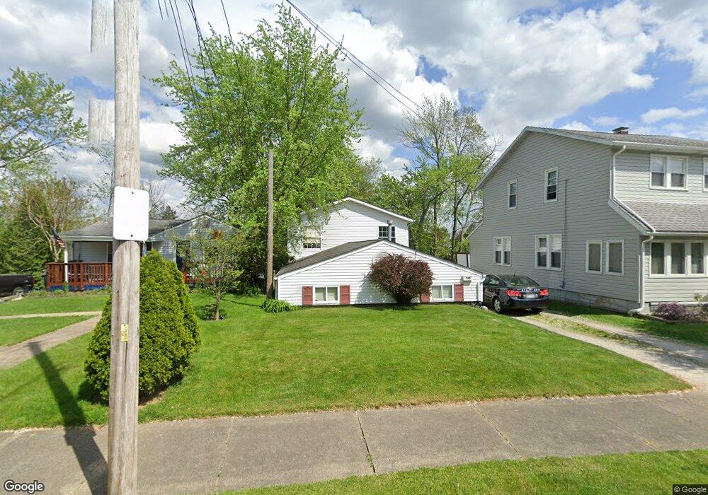
359 Wirth Ave Akron, OH 44312
Ellet NeighborhoodEstimated Value: $164,651 - $197,000
4
Beds
2
Baths
1,344
Sq Ft
$136/Sq Ft
Est. Value
About This Home
This home is located at 359 Wirth Ave, Akron, OH 44312 and is currently estimated at $182,913, approximately $136 per square foot. 359 Wirth Ave is a home located in Summit County with nearby schools including Ellet High School, Summit Academy Akron Elementary School, and Hatton Community Learning Center.
Ownership History
Date
Name
Owned For
Owner Type
Purchase Details
Closed on
Jun 29, 1999
Sold by
Lynch John M and Lynch Sheri L
Bought by
Dodson John R and Dodson Gail M
Current Estimated Value
Home Financials for this Owner
Home Financials are based on the most recent Mortgage that was taken out on this home.
Original Mortgage
$33,600
Interest Rate
7.29%
Purchase Details
Closed on
Jul 9, 1996
Sold by
Est Harvey J Richie
Bought by
Lynch John M and Lynch Sheri L
Create a Home Valuation Report for This Property
The Home Valuation Report is an in-depth analysis detailing your home's value as well as a comparison with similar homes in the area
Home Values in the Area
Average Home Value in this Area
Purchase History
We collect this data history from publicly available records. To have your information removed, we recommend requesting removal directly through your county’s website.
| Date | Buyer | Sale Price | Title Company |
|---|---|---|---|
| Dodson John R | $48,000 | Midland Commerce Group | |
| Lynch John M | $10,000 | -- |
Source: Public Records
Mortgage History
We collect this data history from publicly available records. To have your information removed, we recommend requesting removal directly through your county’s website.
| Date | Status | Borrower | Loan Amount |
|---|---|---|---|
| Closed | Dodson John R | $33,600 |
Source: Public Records
Tax History
| Year | Tax Paid | Tax Assessment Tax Assessment Total Assessment is a certain percentage of the fair market value that is determined by local assessors to be the total taxable value of land and additions on the property. | Land | Improvement |
|---|---|---|---|---|
| 2024 | $2,381 | $45,067 | $7,361 | $37,706 |
| 2023 | $2,381 | $45,067 | $7,361 | $37,706 |
| 2022 | $2,186 | $32,421 | $5,296 | $27,125 |
| 2021 | $2,188 | $32,421 | $5,296 | $27,125 |
| 2020 | $2,155 | $32,430 | $5,300 | $27,130 |
| 2019 | $1,813 | $24,620 | $5,300 | $19,320 |
| 2018 | $1,789 | $24,620 | $5,300 | $19,320 |
| 2017 | $1,589 | $24,620 | $5,300 | $19,320 |
| 2016 | $1,591 | $21,400 | $5,300 | $16,100 |
| 2015 | $1,589 | $21,400 | $5,300 | $16,100 |
| 2014 | $1,577 | $21,400 | $5,300 | $16,100 |
| 2013 | $1,557 | $21,580 | $5,300 | $16,280 |
Source: Public Records
Map
Nearby Homes
- 404 Wirth Ave
- 412 Stevenson Ave
- 359 High Grove Blvd
- 403 High Grove Blvd
- V/L Trenton Rd
- 391 Alpha Ave
- 400 Ripley Ave
- 186 Pocantico Ave
- 2566 & 2568 Albrecht Ave
- 210 Davenport Ave
- 2522 Ogden Ave
- 2562 Graham Ave
- 2603 Graham Ave
- 0 Kreiner Ave
- 64 Kreiner Ave
- 6 Kreiner Ave
- 5 Kreiner Ave
- 643 Stevenson Ave
- 2904 Pepper Hill Cir
- 484 Stull Ave
- 353 Wirth Ave
- 363 Wirth Ave
- 351 Wirth Ave
- 347 Wirth Ave
- 373 Wirth Ave
- 344 Stevenson Ave
- 360 Wirth Ave
- 356 Wirth Ave
- 352 Wirth Ave
- 368 Wirth Ave
- 348 Stevenson Ave
- 348 Stevenson Ave
- 332 Stevenson Ave
- 374 Wirth Ave
- 344 Wirth Ave
- 320 Stevenson Ave
- 335 Wirth Ave
- 383 Wirth Ave
- 308 Stevenson Ave
- 331 Wirth Ave
Your Personal Tour Guide
Ask me questions while you tour the home.