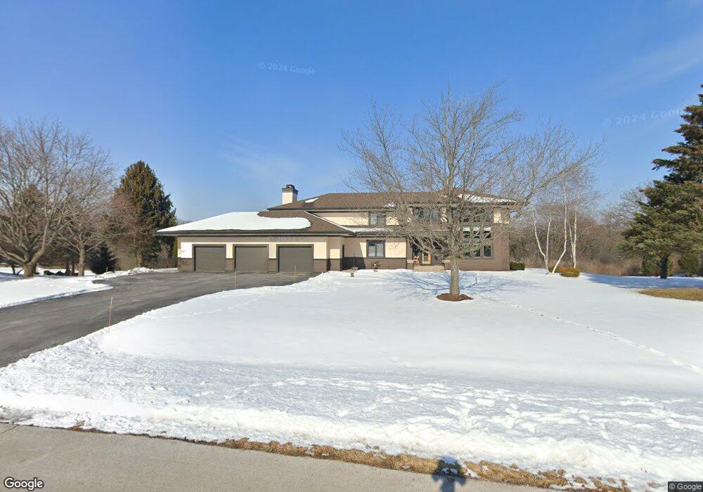
35W611 Parsons Rd Dundee, IL 60118
Estimated Value: $699,426 - $754,000
About This Home
This home is located at 35W611 Parsons Rd, Dundee, IL 60118 and is currently estimated at $730,607, approximately $184 per square foot. 35W611 Parsons Rd is a home located in Kane County with nearby schools including Liberty Elementary School, Dundee Middle School, and Harry D Jacobs High School.
Ownership History
We collect this data history from publicly available records. To have your information removed, we recommend requesting removal directly through your county’s website.
Purchase Details
Home Financials for this Owner
Home Financials are based on the most recent Mortgage that was taken out on this home.Purchase Details
Home Values in the Area
Average Home Value in this Area
Purchase History
We collect this data history from publicly available records. To have your information removed, we recommend requesting removal directly through your county’s website.
| Date | Buyer | Sale Price | Title Company |
|---|---|---|---|
| $700,000 | Chicago Title Insurance Co | ||
| -- | Republic Title |
Mortgage History
We collect this data history from publicly available records. To have your information removed, we recommend requesting removal directly through your county’s website.
| Date | Status | Borrower | Loan Amount |
|---|---|---|---|
| Closed | $400,000 | ||
| Closed | $150,000 | ||
| Closed | $15,198 | ||
| Closed | $188,000 |
Tax History
We collect this data history from publicly available records. To have your information removed, we recommend requesting removal directly through your county’s website.
| Year | Tax Paid | Tax Assessment Tax Assessment Total Assessment is a certain percentage of the fair market value that is determined by local assessors to be the total taxable value of land and additions on the property. | Land | Improvement |
|---|---|---|---|---|
| 2024 | $13,169 | $193,805 | $36,790 | $157,015 |
| 2023 | $12,512 | $174,379 | $33,102 | $141,277 |
| 2022 | $11,608 | $156,900 | $33,102 | $123,798 |
| 2021 | $11,261 | $148,145 | $31,255 | $116,890 |
| 2020 | $11,033 | $144,814 | $30,552 | $114,262 |
| 2019 | $12,281 | $156,615 | $29,003 | $127,612 |
| 2018 | $13,373 | $165,523 | $30,984 | $134,539 |
| 2017 | $12,812 | $154,839 | $28,984 | $125,855 |
| 2016 | $13,143 | $149,922 | $28,064 | $121,858 |
| 2015 | -- | $140,482 | $26,297 | $114,185 |
| 2014 | -- | $132,333 | $25,571 | $106,762 |
| 2013 | -- | $136,384 | $26,354 | $110,030 |
Map
- 35W543 Miller Rd
- 3510 High Hill Cir Unit 6
- 3371 Blue Ridge Dr
- 3355 Blue Ridge Dr
- 1161 Sedgewood Trail
- Lot 14 Route 25
- Route 31 Route
- Lot 15 Route 25
- LOT 19 & LOT 18 Williams Rd
- Lot 12 Route 25
- Lot 13 Route 25
- 1220 Sedgewood Trail
- 6 Yorkshire Ct
- 1600 Creeks Crossing Dr
- 1820 Broadsmore Dr
- 5718 Breezeland Rd
- Lot 21 State Route 31
- 3102 Merrywell Ct
- 1961 Broadsmore Dr
- 36W340 Huntley Rd
- 35W625 Parsons Rd
- 35W547 Parsons Rd
- 35W550 Parsons Rd
- 35W636 Parsons Rd
- 35W635 Parsons Rd Unit 2
- 35W537 Parsons Rd
- 35W637 Parsons Rd
- 35W532 Parsons Rd
- 35W640 Parsons Rd
- 35W535 Parsons Rd
- 18N600 Westhill Rd
- 35W645 Parsons Rd
- 35W533 Parsons Rd
- 18N614 Westhill Rd
- 35W530 Parsons Rd
- 35W646 Parsons Rd
- 35W744 Valley View Rd
- 35W741 Valley View Rd
- 35W740 Valley View Rd
- 35W707 Parsons Rd
Ask me questions while you tour the home.