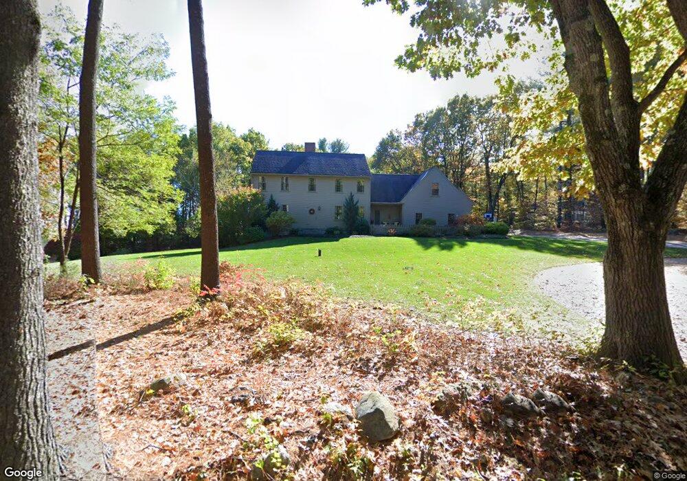
36 Bathrick Rd Westminster, MA 01473
Estimated Value: $699,707 - $795,000
3
Beds
4
Baths
2,562
Sq Ft
$294/Sq Ft
Est. Value
About This Home
This home is located at 36 Bathrick Rd, Westminster, MA 01473 and is currently estimated at $753,927, approximately $294 per square foot. 36 Bathrick Rd is a home located in Worcester County with nearby schools including Oakmont Regional High School.
Ownership History
Date
Name
Owned For
Owner Type
Purchase Details
Closed on
Apr 8, 2005
Sold by
Ouellet Andre
Bought by
Lizotte Brian R and Cucchiara Melissa A
Current Estimated Value
Home Financials for this Owner
Home Financials are based on the most recent Mortgage that was taken out on this home.
Original Mortgage
$402,500
Outstanding Balance
$206,627
Interest Rate
5.7%
Mortgage Type
Purchase Money Mortgage
Estimated Equity
$547,300
Create a Home Valuation Report for This Property
The Home Valuation Report is an in-depth analysis detailing your home's value as well as a comparison with similar homes in the area
Home Values in the Area
Average Home Value in this Area
Purchase History
| Date | Buyer | Sale Price | Title Company |
|---|---|---|---|
| Lizotte Brian R | $114,900 | -- |
Source: Public Records
Mortgage History
| Date | Status | Borrower | Loan Amount |
|---|---|---|---|
| Open | Lizotte Brian R | $402,500 |
Source: Public Records
Tax History
| Year | Tax Paid | Tax Assessment Tax Assessment Total Assessment is a certain percentage of the fair market value that is determined by local assessors to be the total taxable value of land and additions on the property. | Land | Improvement |
|---|---|---|---|---|
| 2025 | $7,760 | $630,900 | $123,000 | $507,900 |
| 2024 | $7,357 | $600,100 | $123,000 | $477,100 |
| 2023 | $7,362 | $563,700 | $115,000 | $448,700 |
| 2022 | $7,556 | $478,200 | $100,000 | $378,200 |
| 2021 | $7,549 | $450,400 | $87,000 | $363,400 |
| 2020 | $7,506 | $427,700 | $79,000 | $348,700 |
| 2019 | $7,559 | $414,200 | $65,500 | $348,700 |
| 2018 | $7,351 | $396,300 | $65,500 | $330,800 |
| 2017 | $7,132 | $392,100 | $65,500 | $326,600 |
| 2016 | $6,997 | $372,600 | $54,500 | $318,100 |
| 2015 | $6,958 | $367,200 | $54,500 | $312,700 |
| 2014 | $6,969 | $367,200 | $54,500 | $312,700 |
Source: Public Records
Map
Nearby Homes
- 2 Roberts Way
- 2 Taymax Rd
- 20 Battles Rd
- 0 Syd Smith Rd (Rear)
- 0 Syd Smith Rd Map 71 Lot 4-2
- 0
- 0 Syd Smith Rd Unit 73395578
- Lot 0 Narrows Rd
- 46 N Common Rd
- 3 Linda Dr
- 169 Narrows Rd
- 5 Notown Rd
- 0 Worcester Rd Unit 73326124
- 2 Seaver St
- 17 Leominster St
- 23 Hager Park Rd
- 76 Saw Mill Pond Rd
- 64 Loiselle Ave
- 18 Downy Cir
- 147 Constitution Dr Unit 147
- 36 Bartherick Rd
- 34 Bartherick Rd
- 38 Bartherick Rd
- 35 Bathrick Rd
- 31 Bathrick Rd
- 12 Kimberly Ln Unit Littleton
- 12 Kimberly Ln
- 14 Kimberly Ln
- 10 Kimberly Ln
- 10 Kimberly Ln Unit A
- 8 Kimberly Ln Unit Littleton
- 8 Kimberly Ln
- 39 Bathrick Rd
- 68 Kimberly Ln Unit Ashby
- 64 Kimberly Ln Unit Ashby
- 64 Kimberly Ln
- 68 Kimberly Ln
- 68 Kimberly Ln Unit Harvard
- 6 Kimberly Ln Unit HARVARD
- 6 Kimberly Ln Unit LOT23
Your Personal Tour Guide
Ask me questions while you tour the home.