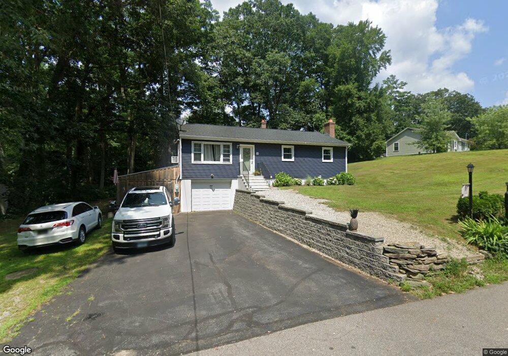
36 Kara Rd Brooklyn, CT 06234
Brooklyn NeighborhoodEstimated Value: $356,000 - $393,000
3
Beds
1
Bath
1,120
Sq Ft
$330/Sq Ft
Est. Value
About This Home
This home is located at 36 Kara Rd, Brooklyn, CT 06234 and is currently estimated at $369,253, approximately $329 per square foot. 36 Kara Rd is a home located in Windham County with nearby schools including Brooklyn Elementary School, Brooklyn Middle School, and Learning Clinic.
Ownership History
Date
Name
Owned For
Owner Type
Purchase Details
Closed on
Oct 6, 2021
Sold by
Citizens Bank Na
Bought by
Sharkey Phelan
Current Estimated Value
Purchase Details
Closed on
Oct 22, 2018
Sold by
Fnma
Bought by
Citizens Bank Na
Purchase Details
Closed on
Nov 7, 2016
Sold by
Citizens Bank Na
Bought by
Federal National Mortgage Association
Purchase Details
Closed on
Oct 11, 2016
Sold by
Portella Jennifer M
Bought by
Citizens Bank
Purchase Details
Closed on
May 15, 2007
Sold by
Portella Jennifer M
Bought by
Bee Investments Llc
Home Financials for this Owner
Home Financials are based on the most recent Mortgage that was taken out on this home.
Original Mortgage
$163,000
Interest Rate
6.18%
Create a Home Valuation Report for This Property
The Home Valuation Report is an in-depth analysis detailing your home's value as well as a comparison with similar homes in the area
Home Values in the Area
Average Home Value in this Area
Purchase History
We collect this data history from publicly available records. To have your information removed, we recommend requesting removal directly through your county’s website.
| Date | Buyer | Sale Price | Title Company |
|---|---|---|---|
| Sharkey Phelan | $150,000 | None Available | |
| Sharkey Phelan | $150,000 | None Available | |
| Sharkey Phelan | $150,000 | None Available | |
| Citizens Bank Na | -- | -- | |
| Federal National Mortgage Association | -- | -- | |
| Citizens Bank | -- | -- | |
| Bee Investments Llc | $55,000 | -- | |
| Citizens Bank Na | -- | -- | |
| Federal National Mortgage Association | -- | -- | |
| Citizens Bank | -- | -- | |
| Bee Investments Llc | $55,000 | -- |
Source: Public Records
Mortgage History
We collect this data history from publicly available records. To have your information removed, we recommend requesting removal directly through your county’s website.
| Date | Status | Borrower | Loan Amount |
|---|---|---|---|
| Previous Owner | Bee Investments Llc | $163,000 |
Source: Public Records
Tax History
| Year | Tax Paid | Tax Assessment Tax Assessment Total Assessment is a certain percentage of the fair market value that is determined by local assessors to be the total taxable value of land and additions on the property. | Land | Improvement |
|---|---|---|---|---|
| 2025 | $5,000 | $214,780 | $32,380 | $182,400 |
| 2024 | $4,292 | $145,300 | $25,300 | $120,000 |
| 2023 | $4,156 | $145,300 | $25,300 | $120,000 |
| 2022 | $3,012 | $109,600 | $25,300 | $84,300 |
| 2021 | $2,896 | $109,600 | $25,300 | $84,300 |
| 2020 | $2,759 | $95,400 | $31,200 | $64,200 |
| 2019 | $2,759 | $95,400 | $31,200 | $64,200 |
| 2018 | $2,680 | $95,400 | $31,200 | $64,200 |
| 2017 | $2,584 | $95,400 | $31,200 | $64,200 |
| 2016 | $2,513 | $95,400 | $31,200 | $64,200 |
| 2015 | $2,648 | $113,000 | $39,400 | $73,600 |
| 2014 | $2,648 | $113,000 | $39,400 | $73,600 |
Source: Public Records
Map
Nearby Homes
- 251 Wauregan Rd
- 279 Gorman Rd
- 68 Anderson Rd
- 111 Grand View Terrace
- 17 Blackwells Landing
- 81 Grand View Terrace
- 38 Canterbury Rd
- 230 Bailey Woods Rd
- 173 Mason Rd
- 0 Wauregan Rd
- 365 Canterbury Rd
- 159 Old Tatnic Hill Rd
- 165 Old Tatnic Hill Rd Unit Lot 8-5
- 167 Old Tatnic Hill Rd Unit Lot 8-6
- 00 Wolf Den Rd
- 24 Providence Rd
- 316 Allen Hill Rd
- 747 Allen Hill Rd
- 524 Wauregan Rd
- 416 Canterbury Rd
Your Personal Tour Guide
Ask me questions while you tour the home.