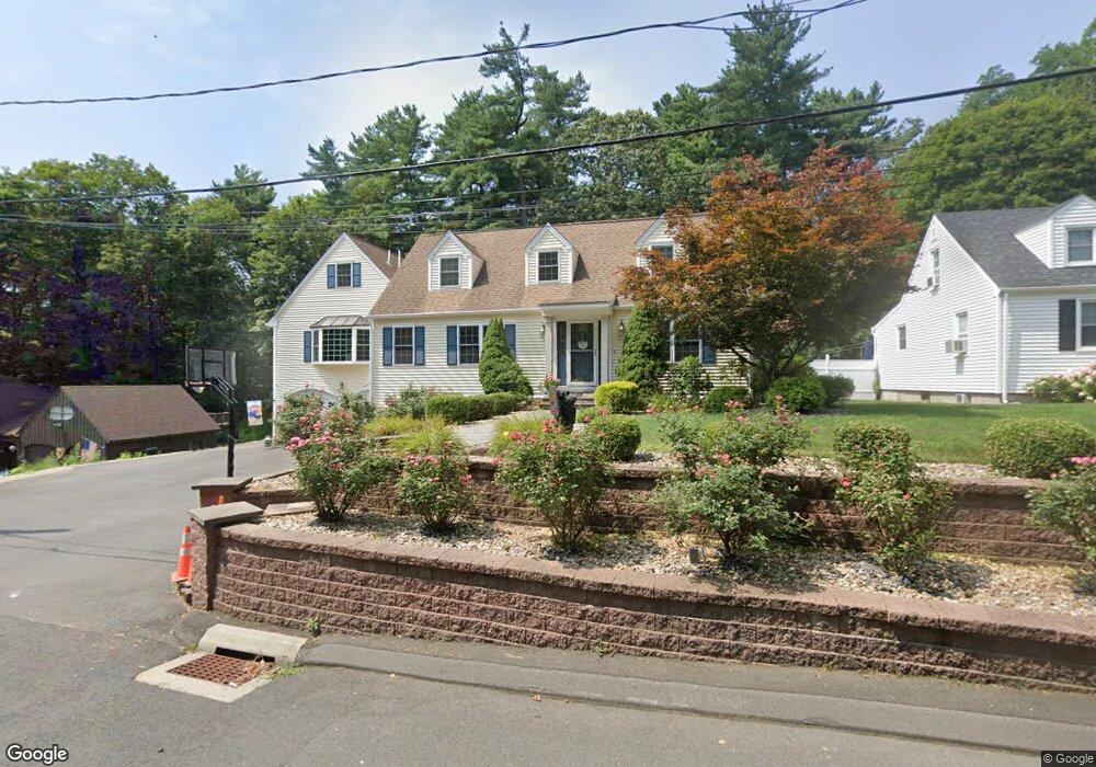
36 Progress Ave Unionville, CT 06085
Estimated Value: $621,684 - $672,000
4
Beds
3
Baths
2,930
Sq Ft
$219/Sq Ft
Est. Value
About This Home
This home is located at 36 Progress Ave, Unionville, CT 06085 and is currently estimated at $640,671, approximately $218 per square foot. 36 Progress Ave is a home located in Hartford County with nearby schools including Union School, West Woods Upper Elementary School, and Irving A. Robbins Middle School.
Ownership History
Date
Name
Owned For
Owner Type
Purchase Details
Closed on
Apr 1, 1997
Sold by
American Mortgage Corp
Bought by
Lebouthiller Patrick P and Lebouthiller Carrine F
Current Estimated Value
Create a Home Valuation Report for This Property
The Home Valuation Report is an in-depth analysis detailing your home's value as well as a comparison with similar homes in the area
Home Values in the Area
Average Home Value in this Area
Purchase History
| Date | Buyer | Sale Price | Title Company |
|---|---|---|---|
| Lebouthiller Patrick P | $45,000 | -- |
Source: Public Records
Mortgage History
| Date | Status | Borrower | Loan Amount |
|---|---|---|---|
| Open | Lebouthiller Patrick P | $178,500 | |
| Closed | Lebouthiller Patrick P | $145,400 | |
| Closed | Lebouthiller Patrick P | $143,419 |
Source: Public Records
Tax History
| Year | Tax Paid | Tax Assessment Tax Assessment Total Assessment is a certain percentage of the fair market value that is determined by local assessors to be the total taxable value of land and additions on the property. | Land | Improvement |
|---|---|---|---|---|
| 2025 | $8,749 | $328,650 | $73,780 | $254,870 |
| 2024 | $8,364 | $328,650 | $73,780 | $254,870 |
| 2023 | $7,957 | $328,650 | $73,780 | $254,870 |
| 2022 | $6,726 | $229,410 | $64,180 | $165,230 |
| 2021 | $6,609 | $229,410 | $64,180 | $165,230 |
| 2020 | $6,417 | $229,410 | $64,180 | $165,230 |
| 2019 | $6,417 | $229,410 | $64,180 | $165,230 |
| 2018 | $6,235 | $229,410 | $64,180 | $165,230 |
| 2017 | $6,078 | $227,800 | $60,270 | $167,530 |
| 2016 | $5,873 | $227,800 | $60,270 | $167,530 |
| 2015 | $5,697 | $227,800 | $60,270 | $167,530 |
| 2014 | $5,567 | $227,800 | $60,270 | $167,530 |
Source: Public Records
Map
Nearby Homes
- 23 Keyes St
- 726 Lovely St
- 55 Depot Place
- 32 Canterbury Ln
- 29 Crocus Ln
- 27 Canterbury Ln Unit 27
- 9 Putnam Ln
- 39 Heritage Dr Unit 39
- 9 White Oak Ln
- 8919 Taine Mountain Rd
- 14 Walnut Ln
- 42 Keene Place
- 7 Maple Ln
- 7 Chestnut Dr
- 28 Cottonwood Dr
- 589 Huckleberry Hill Rd
- 18 Ledgewood Dr
- 8 Gateshead Way
- 8 Old Field Rd
- 50 Northwoods Rd
Your Personal Tour Guide
Ask me questions while you tour the home.