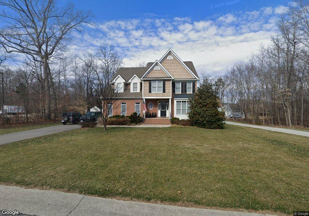
3600 Lenox Forest Dr Midlothian, VA 23113
Tarrington NeighborhoodEstimated Value: $686,000 - $821,000
5
Beds
4
Baths
3,095
Sq Ft
$247/Sq Ft
Est. Value
About This Home
This home is located at 3600 Lenox Forest Dr, Midlothian, VA 23113 and is currently estimated at $764,088, approximately $246 per square foot. 3600 Lenox Forest Dr is a home located in Chesterfield County with nearby schools including Bettie Weaver Elementary School, Robious Middle School, and James River High School.
Ownership History
Date
Name
Owned For
Owner Type
Purchase Details
Closed on
Aug 25, 2005
Sold by
Tomac Corp
Bought by
Fudala Paul J
Current Estimated Value
Home Financials for this Owner
Home Financials are based on the most recent Mortgage that was taken out on this home.
Original Mortgage
$297,413
Outstanding Balance
$156,436
Interest Rate
5.68%
Mortgage Type
New Conventional
Estimated Equity
$607,652
Purchase Details
Closed on
Jan 4, 2005
Sold by
River Downs L L C
Bought by
Tomac Corp
Create a Home Valuation Report for This Property
The Home Valuation Report is an in-depth analysis detailing your home's value as well as a comparison with similar homes in the area
Home Values in the Area
Average Home Value in this Area
Purchase History
| Date | Buyer | Sale Price | Title Company |
|---|---|---|---|
| Fudala Paul J | $423,435 | -- | |
| Tomac Corp | $1,807,300 | -- |
Source: Public Records
Mortgage History
| Date | Status | Borrower | Loan Amount |
|---|---|---|---|
| Open | Fudala Paul J | $297,413 |
Source: Public Records
Tax History
| Year | Tax Paid | Tax Assessment Tax Assessment Total Assessment is a certain percentage of the fair market value that is determined by local assessors to be the total taxable value of land and additions on the property. | Land | Improvement |
|---|---|---|---|---|
| 2025 | $5,839 | $653,300 | $165,800 | $487,500 |
| 2024 | $5,839 | $595,600 | $153,000 | $442,600 |
| 2023 | $5,183 | $569,600 | $132,600 | $437,000 |
| 2022 | $4,859 | $528,200 | $122,400 | $405,800 |
| 2021 | $4,414 | $457,700 | $113,900 | $343,800 |
| 2020 | $4,348 | $457,700 | $113,900 | $343,800 |
| 2019 | $4,266 | $449,000 | $113,900 | $335,100 |
| 2018 | $4,082 | $429,700 | $113,900 | $315,800 |
| 2017 | $4,085 | $425,500 | $113,900 | $311,600 |
| 2016 | $4,263 | $444,100 | $119,000 | $325,100 |
| 2015 | $4,288 | $444,100 | $119,000 | $325,100 |
| 2014 | $3,791 | $392,300 | $85,500 | $306,800 |
Source: Public Records
Map
Nearby Homes
- 3618 Riverdowns North Dr
- 3230 Queens Grant Dr
- 14112 Grace Wood Ct
- 453 Bel Bridge Cir
- 14307 Abbots Ridge Ct
- 521 Bel Crest Terrace
- 13637 Langford Dr
- 3718 Ellerton Dr
- 2911 Vistapoint Rd
- 3107 Handley Rd
- 13155 Sodbury Dr
- 3201 Handley Rd
- 12813 Yatesbury Ln
- 4001 Bircham Loop
- 273 Pembroke Ln
- 3100 Sodbury Ct
- 2540 Kentford Rd
- 13311 Glendower Rd
- 3301 Seaford Crossing Dr
- 13407 Westwell Dr
- 3606 Lenox Forest Dr
- 3612 Lenox Forest Dr
- 3601 Lenox Forest Dr
- 3607 Lenox Forest Dr
- 3540 Kings Farm Dr
- 3618 Lenox Forest Dr
- 3613 Lenox Forest Dr
- 3706 Kings Farm Dr
- 3607 Stone Harbor Dr
- 3601 Stone Harbor Dr
- 3613 Stone Harbor Dr
- 3613 Stone Harbor Dr Unit 9
- 3619 Lenox Forest Dr
- 3624 Lenox Forest Dr
- 3606 Planters Walk Ct
- 3606 Stone Harbor Dr
- 3600 Planters Walk Ct
- 3600 Stone Harbor Dr
- 3612 Stone Harbor Dr
- 3619 Stone Harbor Dr
Your Personal Tour Guide
Ask me questions while you tour the home.