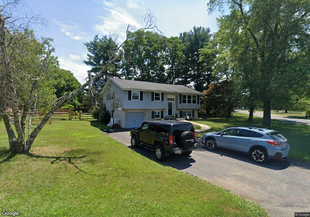
3610 Emerson Cir Bethlehem, PA 18017
Hanover AreaEstimated Value: $402,000 - $461,000
About This Home
This home is located at 3610 Emerson Cir, Bethlehem, PA 18017 and is currently estimated at $423,243, approximately $213 per square foot. 3610 Emerson Cir is a home located in Northampton County with nearby schools including Asa Packer Elementary School, Nitschmann Middle School, and Liberty High School.
Ownership History
We collect this data history from publicly available records. To have your information removed, we recommend requesting removal directly through your county’s website.
Purchase Details
Home Financials for this Owner
Home Financials are based on the most recent Mortgage that was taken out on this home.Purchase Details
Home Financials for this Owner
Home Financials are based on the most recent Mortgage that was taken out on this home.Home Values in the Area
Average Home Value in this Area
Purchase History
We collect this data history from publicly available records. To have your information removed, we recommend requesting removal directly through your county’s website.
| Date | Buyer | Sale Price | Title Company |
|---|---|---|---|
| -- | Old Republic National Title | ||
| $215,000 | First American Title Ins Co |
Mortgage History
We collect this data history from publicly available records. To have your information removed, we recommend requesting removal directly through your county’s website.
| Date | Status | Borrower | Loan Amount |
|---|---|---|---|
| Open | $25,000 | ||
| Open | $155,500 | ||
| Closed | $171,500 | ||
| Closed | $172,000 | ||
| Previous Owner | $200,000 |
Tax History
We collect this data history from publicly available records. To have your information removed, we recommend requesting removal directly through your county’s website.
| Year | Tax Paid | Tax Assessment Tax Assessment Total Assessment is a certain percentage of the fair market value that is determined by local assessors to be the total taxable value of land and additions on the property. | Land | Improvement |
|---|---|---|---|---|
| 2026 | $714 | $66,100 | $24,200 | $41,900 |
| 2025 | $714 | $66,100 | $24,200 | $41,900 |
| 2024 | $4,819 | $66,100 | $24,200 | $41,900 |
| 2023 | $4,835 | $66,100 | $24,200 | $41,900 |
| 2022 | $4,790 | $66,100 | $24,200 | $41,900 |
| 2021 | $4,751 | $66,100 | $24,200 | $41,900 |
| 2020 | $4,757 | $66,100 | $24,200 | $41,900 |
| 2019 | $4,737 | $66,100 | $24,200 | $41,900 |
| 2018 | $4,644 | $66,100 | $24,200 | $41,900 |
| 2017 | $4,610 | $66,100 | $24,200 | $41,900 |
| 2016 | -- | $66,100 | $24,200 | $41,900 |
| 2015 | -- | $66,100 | $24,200 | $41,900 |
| 2014 | -- | $66,100 | $24,200 | $41,900 |
Map
- 3650 Stephen Crane Ln
- 1611 Mark Twain Cir
- 1371 Stoke Park Rd
- 4065 Airport Rd
- 3350 Airport Rd
- 3350 Airport Rd Unit 5
- 3350 Airport Rd Unit Lot 53
- 2275 Irma Dr
- 1225 Brentwood Ave
- 1225 Brentwood Ave
- 1150 Claire St
- 968 Rainbow Dr
- 4416 Tracey Ln
- 4568 Greenfield Rd
- 1345 W MacAda Rd
- 1105 Brentwood Ave
- 3350 5 Airport Rd
- 5331 Greenbriar Dr
- 1220 Oakwood Dr
- 6202 Dove Dr
- 3620 Emerson Cir
- 3605 Walt Whitman Ln
- 3615 Walt Whitman Ln
- 3609 Emerson Cir
- 1731 Lord Byron Dr
- 3630 Emerson Cir
- 3625 Walt Whitman Ln
- 1751 Lord Byron Dr
- 3619 Emerson Cir
- 1721 Lord Byron Dr
- 3635 Walt Whitman Ln
- 1920 Mark Twain Cir
- 1890 Mark Twain Cir
- 3610 Walt Whitman Ln
- 3645 Walt Whitman Ln
- 3640 Emerson Cir
- 3629 Emerson Cir
- 3561 Chippendale Cir
- 1930 Mark Twain Cir
- 3620 Walt Whitman Ln
Ask me questions while you tour the home.