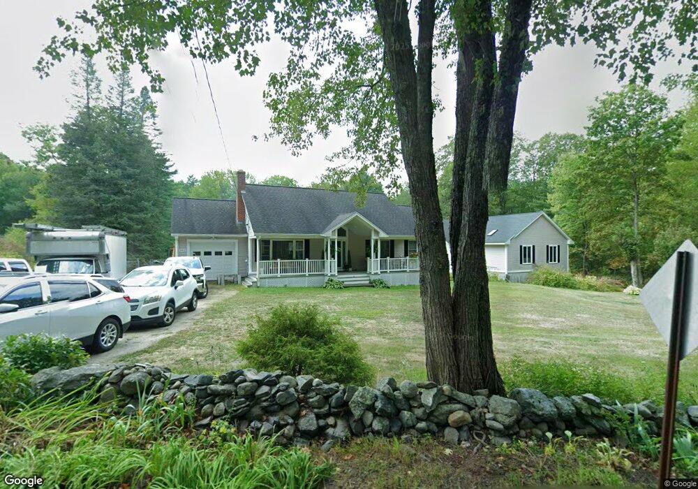
362 Burrage St Lunenburg, MA 01462
Lunenburg AreaEstimated Value: $455,000 - $551,847
About This Home
This home is located at 362 Burrage St, Lunenburg, MA 01462 and is currently estimated at $505,462, approximately $361 per square foot. 362 Burrage St is a home located in Worcester County with nearby schools including Lunenburg Primary School and Lunenburg High School.
Ownership History
We collect this data history from publicly available records. To have your information removed, we recommend requesting removal directly through your county’s website.
Purchase Details
Purchase Details
Home Values in the Area
Average Home Value in this Area
Purchase History
We collect this data history from publicly available records. To have your information removed, we recommend requesting removal directly through your county’s website.
| Date | Buyer | Sale Price | Title Company |
|---|---|---|---|
| $176,000 | -- | ||
| $130,000 | -- |
Mortgage History
We collect this data history from publicly available records. To have your information removed, we recommend requesting removal directly through your county’s website.
| Date | Status | Borrower | Loan Amount |
|---|---|---|---|
| Closed | $30,000 | ||
| Closed | $75,000 | ||
| Closed | $181,500 | ||
| Closed | $175,000 | ||
| Previous Owner | $35,000 |
Tax History
We collect this data history from publicly available records. To have your information removed, we recommend requesting removal directly through your county’s website.
| Year | Tax Paid | Tax Assessment Tax Assessment Total Assessment is a certain percentage of the fair market value that is determined by local assessors to be the total taxable value of land and additions on the property. | Land | Improvement |
|---|---|---|---|---|
| 2025 | $7,012 | $488,300 | $141,900 | $346,400 |
| 2024 | $6,604 | $468,400 | $133,900 | $334,500 |
| 2023 | $6,306 | $431,300 | $121,700 | $309,600 |
| 2022 | $5,858 | $340,800 | $101,500 | $239,300 |
| 2020 | $6,239 | $344,300 | $101,200 | $243,100 |
| 2019 | $6,047 | $323,700 | $95,300 | $228,400 |
| 2018 | $5,754 | $292,100 | $95,300 | $196,800 |
| 2017 | $5,642 | $282,400 | $91,000 | $191,400 |
| 2016 | $5,412 | $276,000 | $86,600 | $189,400 |
| 2015 | $4,587 | $250,400 | $82,200 | $168,200 |
Map
- 312 Burrage St
- 607-609 Flat Hill Rd
- 11 Longwood Dr
- 878 Flat Hill Rd
- 878 Flat Hill Rd
- 171 Burrage St
- 881 Flat Hill Rd
- 51 Spring St
- 241 Reservoir Rd
- 176 Robbs Hill Rd
- 411 Goodrich St
- 450 Lancaster Ave
- 1990 Massachusetts Ave Unit 10
- 1790 Mass Ave Unit T
- 1790 Massachusetts Ave Unit 25
- 194 Center Rd
- 1 Whitney Rd
- 90 Arbor St
- 125 Kilburn St
- 3 Catacunemaug Rd
- 378 Burrage St
- 371 Burrage St
- 357 Burrage St
- 381 Burrage St
- 390 Burrage St
- 320 Burrage St
- 335 Burrage St
- 393 Burrage St
- 6 Shaker Ct
- 3 Shaker Ct
- 3 Shaker Ct Unit house
- 398 Burrage St
- 323 Burrage St
- 411 Burrage St
- 10 Shaker Ct
- 598 Flat Hill Rd
- 414 Burrage St
- 9 Shaker Ct
- 590 Flat Hill Rd
- 644 Flat Hill Rd
Ask me questions while you tour the home.