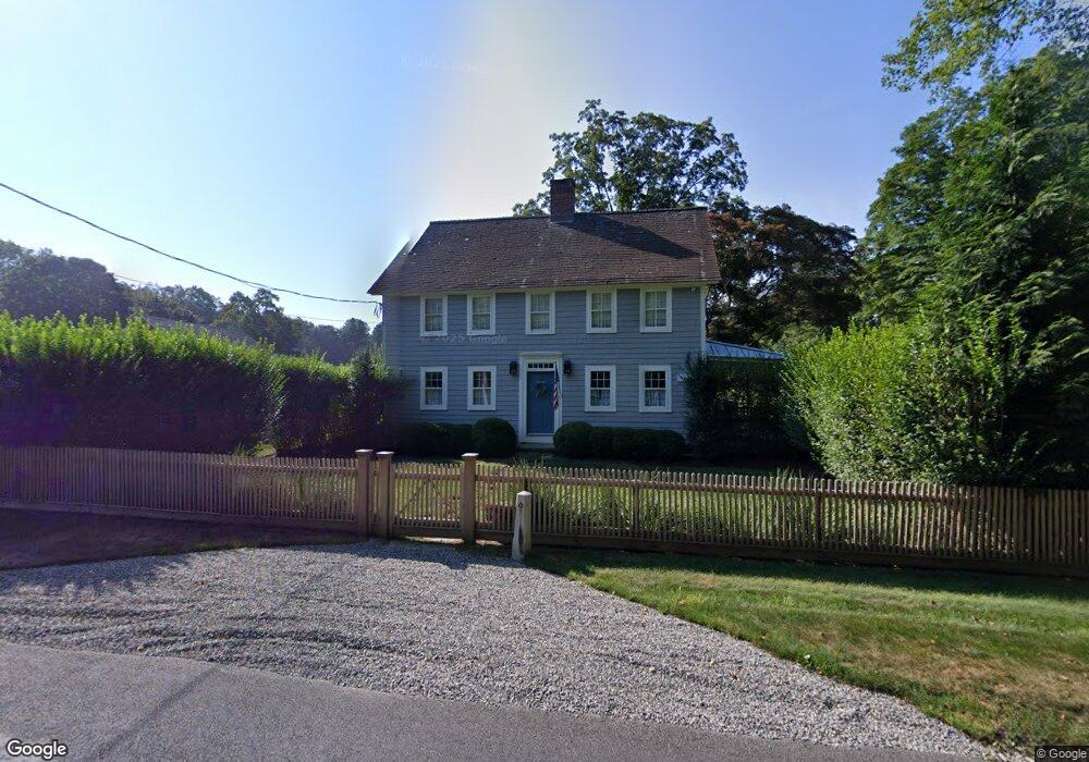
3628 Redding Rd Fairfield, CT 06824
Greenfield Hill NeighborhoodEstimated Value: $894,000 - $1,345,000
3
Beds
2
Baths
2,626
Sq Ft
$422/Sq Ft
Est. Value
About This Home
This home is located at 3628 Redding Rd, Fairfield, CT 06824 and is currently estimated at $1,108,142, approximately $421 per square foot. 3628 Redding Rd is a home located in Fairfield County with nearby schools including Burr Elementary School, Tomlinson Middle School, and Fairfield Warde High School.
Ownership History
Date
Name
Owned For
Owner Type
Purchase Details
Closed on
Feb 3, 2020
Sold by
Tallman Blaine
Bought by
Tallman Blaine T and Tallman Peter
Current Estimated Value
Home Financials for this Owner
Home Financials are based on the most recent Mortgage that was taken out on this home.
Original Mortgage
$450,000
Outstanding Balance
$395,130
Interest Rate
3.72%
Mortgage Type
New Conventional
Estimated Equity
$713,012
Purchase Details
Closed on
Aug 8, 2019
Sold by
Tallman Peter C
Bought by
Tallman Blaine
Purchase Details
Closed on
Dec 21, 2012
Sold by
Lobdell Eleanor
Bought by
Tallman Peter
Create a Home Valuation Report for This Property
The Home Valuation Report is an in-depth analysis detailing your home's value as well as a comparison with similar homes in the area
Home Values in the Area
Average Home Value in this Area
Purchase History
We collect this data history from publicly available records. To have your information removed, we recommend requesting removal directly through your county’s website.
| Date | Buyer | Sale Price | Title Company |
|---|---|---|---|
| Tallman Blaine T | -- | None Available | |
| Tallman Blaine T | -- | None Available | |
| Tallman Blaine | -- | -- | |
| Tallman Blaine | -- | -- | |
| Tallman Peter | $300,000 | -- | |
| Tallman Peter | -- | -- | |
| Tallman Peter | $300,000 | -- |
Source: Public Records
Mortgage History
We collect this data history from publicly available records. To have your information removed, we recommend requesting removal directly through your county’s website.
| Date | Status | Borrower | Loan Amount |
|---|---|---|---|
| Open | Tallman Blaine T | $450,000 | |
| Closed | Tallman Blaine T | $450,000 |
Source: Public Records
Tax History
| Year | Tax Paid | Tax Assessment Tax Assessment Total Assessment is a certain percentage of the fair market value that is determined by local assessors to be the total taxable value of land and additions on the property. | Land | Improvement |
|---|---|---|---|---|
| 2025 | $15,920 | $560,770 | $297,570 | $263,200 |
| 2024 | $15,645 | $560,770 | $297,570 | $263,200 |
| 2023 | $15,427 | $560,770 | $297,570 | $263,200 |
| 2022 | $15,275 | $560,770 | $297,570 | $263,200 |
| 2021 | $15,130 | $560,770 | $297,570 | $263,200 |
| 2020 | $15,591 | $581,980 | $286,510 | $295,470 |
| 2019 | $15,591 | $581,980 | $286,510 | $295,470 |
| 2018 | $15,341 | $581,980 | $286,510 | $295,470 |
| 2017 | $15,027 | $581,980 | $286,510 | $295,470 |
| 2016 | $14,811 | $581,980 | $286,510 | $295,470 |
| 2015 | $16,013 | $645,960 | $318,920 | $327,040 |
| 2014 | $15,761 | $645,960 | $318,920 | $327,040 |
Source: Public Records
Map
Nearby Homes
- 3725 Redding Rd
- 3509 Redding Rd
- 3808 Redding Rd
- 223 Mistywood Ln
- 301 Redding Rd
- 11 Judges Hollow Rd
- 180 Catamount Rd
- 3007 Redding Rd
- 85-95 Old Easton Turnpike
- 2010 North St
- B Bridge Rd
- 1375 Westport Turnpike
- 18 Old Kings Hwy
- 1960 North St
- 4800 Congress St
- 677 Eleven O Clock Rd
- 305 Westport Turnpike
- 16 Pilgrim Ln
- 66 Gate Stone Ln
- 38 Old Redding Rd
Your Personal Tour Guide
Ask me questions while you tour the home.