Estimated Value: $296,000 - $333,000
About This Home
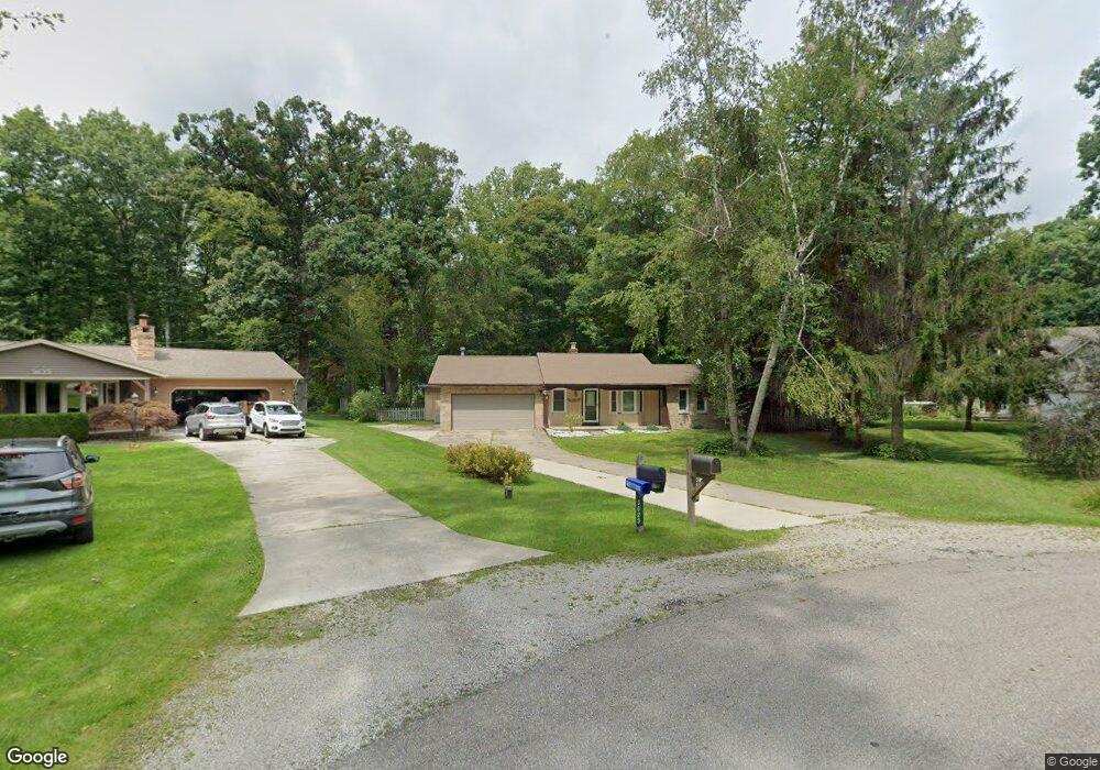
This home is located at 3629 Thornton Ln Unit Bldg-Unit, Clyde, MI 48049 and is currently estimated at $311,677, approximately $149 per square foot. 3629 Thornton Ln Unit Bldg-Unit is a home located in St. Clair County with nearby schools including Edison Elementary School, Fort Gratiot Middle School, and Port Huron Northern High School.
Ownership History
Purchase Details
Home Financials for this Owner
Home Financials are based on the most recent Mortgage that was taken out on this home.Purchase Details
Purchase Details
Home Values in the Area
Average Home Value in this Area
Purchase History
We collect this data history from publicly available records. To have your information removed, we recommend requesting removal directly through your county’s website.
| Date | Buyer | Sale Price | Title Company |
|---|---|---|---|
| Johnson Patricia | $189,000 | Franklin Title | |
| Boszko Dariusz | $120,000 | Ata National Title | |
| Haufschild Enterprises 5 Llc | $85,000 | Ata National Title |
Mortgage History
We collect this data history from publicly available records. To have your information removed, we recommend requesting removal directly through your county’s website.
| Date | Status | Borrower | Loan Amount |
|---|---|---|---|
| Open | Johnson Patricia | $174,000 |
Tax History
| Year | Tax Paid | Tax Assessment Tax Assessment Total Assessment is a certain percentage of the fair market value that is determined by local assessors to be the total taxable value of land and additions on the property. | Land | Improvement |
|---|---|---|---|---|
| 2025 | $2,173 | $147,100 | $0 | $0 |
| 2024 | $2,108 | $143,200 | $0 | $0 |
| 2023 | $1,946 | $126,400 | $0 | $0 |
| 2022 | $2,709 | $113,500 | $0 | $0 |
| 2020 | $2,456 | $98,500 | $0 | $98,500 |
| 2019 | $2,113 | $82,600 | $0 | $0 |
| 2018 | $2,002 | $58,700 | $0 | $0 |
| 2017 | $1,486 | $59,000 | $0 | $0 |
| 2016 | $991 | $59,000 | $0 | $0 |
| 2015 | -- | $58,700 | $0 | $58,700 |
| 2014 | -- | $55,800 | $0 | $55,800 |
| 2013 | -- | $62,700 | $0 | $0 |
Map
- Lot #9 Thornton Dr
- 3518 Lightle Rd
- 3645 W Surrey Ln
- 3560 North Rd
- 4570 Atkins Rd
- 4174 Old Forge Dr
- 3307 Fanone Dr
- 4063 N River Rd
- 3809 State Rd
- 0000 Atkins Atkins Rd
- 3318 Richards Dr
- 3448 Timberline Dr
- 3520 State Rd
- 5614 Atkins Rd
- 0 Atkins Rd Unit LotWP001
- 3971 N River Rd
- 3176 Yorkshire Dr
- Parcel 1-4 Maitland Rd
- 3345 Beach Rd
- 3935 Capital Ave
- 3629 Thornton Ln
- 3635 Thornton Ln
- 3623 Thornton Ln
- 00 Walker Rd
- 0 Walker Rd Unit 218024862
- 0 Walker Rd Unit 5618252
- 0 Walker Rd Unit 217061391
- 0 Walker Rd Unit 5535968
- 0 Walker Rd Unit 217002342
- 0 Walker Rd Unit R219024918
- 0 Walker Rd Unit R219000446
- 0 Walker Rd Unit R219088658
- 3641 Thornton Ln
- 3647 Thornton Ln
- 3646 Thornton Ln
- 3653 Thornton Ln
- 3675 Campbell Rd
- 3623 Campbell Rd
- 3652 Thornton Ln
- 3605 Campbell Rd
Ask me questions while you tour the home.