Estimated Value: $289,000 - $308,581
2
Beds
1
Bath
1,104
Sq Ft
$272/Sq Ft
Est. Value
About This Home
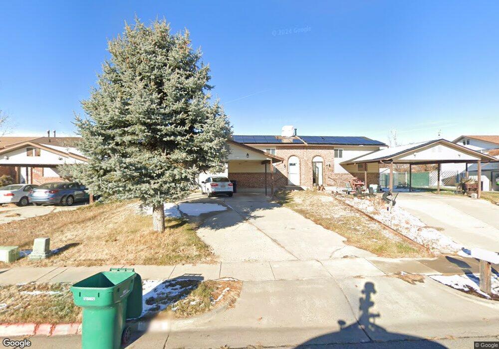
This home is located at 3638 W 4650 S, Roy, UT 84067 and is currently estimated at $300,145, approximately $271 per square foot. 3638 W 4650 S is a home located in Weber County with nearby schools including West Haven School, Sand Ridge Junior High School, and Roy High School.
Ownership History
Date
Name
Owned For
Owner Type
Purchase Details
Closed on
Jun 6, 2022
Sold by
Rae Sandoval Melonie
Bought by
Gam Mikayla and Chambers Patrick
Current Estimated Value
Home Financials for this Owner
Home Financials are based on the most recent Mortgage that was taken out on this home.
Original Mortgage
$319,113
Outstanding Balance
$303,637
Interest Rate
5.27%
Mortgage Type
FHA
Estimated Equity
-$3,492
Purchase Details
Closed on
Nov 2, 2020
Sold by
Church Melonie Rae and Sandoval Melonie Rae
Bought by
Sandoval Melonie Rae
Home Financials for this Owner
Home Financials are based on the most recent Mortgage that was taken out on this home.
Original Mortgage
$130,000
Interest Rate
2.9%
Mortgage Type
New Conventional
Purchase Details
Closed on
Jun 9, 2016
Sold by
Lutz Delos A and Lutz Stephanie E
Bought by
Church Melonie Rae
Home Financials for this Owner
Home Financials are based on the most recent Mortgage that was taken out on this home.
Original Mortgage
$116,844
Interest Rate
3.37%
Mortgage Type
FHA
Purchase Details
Closed on
Jun 6, 2016
Sold by
Lutz Delos A and Lutz Stephanie E
Bought by
Church Melonie Rae
Home Financials for this Owner
Home Financials are based on the most recent Mortgage that was taken out on this home.
Original Mortgage
$116,844
Interest Rate
3.37%
Mortgage Type
FHA
Purchase Details
Closed on
Nov 5, 2010
Sold by
Lutz Delos A
Bought by
Lutz Delos A
Purchase Details
Closed on
Feb 16, 2010
Sold by
Parker Dale
Bought by
Lutz Delos A
Home Financials for this Owner
Home Financials are based on the most recent Mortgage that was taken out on this home.
Original Mortgage
$98,090
Interest Rate
5.25%
Mortgage Type
FHA
Purchase Details
Closed on
Sep 17, 2002
Sold by
Wells Fargo Bank Minnesota Na
Bought by
Parker Dale
Purchase Details
Closed on
Jun 11, 2002
Sold by
Boyter Connie and Ameriquest Mtg Company
Bought by
Wells Fargo Bank Minnesota Na
Purchase Details
Closed on
Feb 4, 1999
Sold by
Schmitt Connie and Boyter Connie
Bought by
Boyter Connie
Create a Home Valuation Report for This Property
The Home Valuation Report is an in-depth analysis detailing your home's value as well as a comparison with similar homes in the area
Home Values in the Area
Average Home Value in this Area
Purchase History
We collect this data history from publicly available records. To have your information removed, we recommend requesting removal directly through your county’s website.
| Date | Buyer | Sale Price | Title Company |
|---|---|---|---|
| Gam Mikayla | -- | Metro National Title | |
| Sandoval Melonie Rae | -- | Us Title Insurance Agency | |
| Church Melonie Rae | -- | Old Republic Title | |
| Church Melonie Rae | -- | Old Republic Title | |
| Lutz Delos A | -- | None Available | |
| Lutz Delos A | -- | Cottonwood Title Layton | |
| Parker Dale | -- | Cardon Land Title | |
| Wells Fargo Bank Minnesota Na | $61,625 | -- | |
| Boyter Connie | -- | Associated Title |
Source: Public Records
Mortgage History
We collect this data history from publicly available records. To have your information removed, we recommend requesting removal directly through your county’s website.
| Date | Status | Borrower | Loan Amount |
|---|---|---|---|
| Open | Gam Mikayla | $319,113 | |
| Previous Owner | Sandoval Melonie Rae | $130,000 | |
| Previous Owner | Church Melonie Rae | $116,844 | |
| Previous Owner | Church Melonie Rae | $116,844 | |
| Previous Owner | Lutz Delos A | $98,090 |
Source: Public Records
Tax History
| Year | Tax Paid | Tax Assessment Tax Assessment Total Assessment is a certain percentage of the fair market value that is determined by local assessors to be the total taxable value of land and additions on the property. | Land | Improvement |
|---|---|---|---|---|
| 2025 | $1,473 | $261,014 | $96,460 | $164,554 |
| 2024 | $1,440 | $141,350 | $53,053 | $88,297 |
| 2023 | $1,387 | $136,400 | $48,337 | $88,063 |
| 2022 | $1,455 | $145,750 | $45,542 | $100,208 |
| 2021 | $1,210 | $201,000 | $58,364 | $142,636 |
| 2020 | $1,045 | $159,000 | $58,364 | $100,636 |
| 2019 | $1,036 | $149,000 | $33,723 | $115,277 |
| 2018 | $1,000 | $136,000 | $29,820 | $106,180 |
| 2017 | $866 | $111,000 | $29,820 | $81,180 |
| 2016 | $839 | $57,968 | $16,480 | $41,488 |
| 2015 | $779 | $55,518 | $16,480 | $39,038 |
| 2014 | $714 | $50,324 | $16,480 | $33,844 |
Source: Public Records
Map
Nearby Homes
- 3624 W 4650 S
- 3665 W 4650 S
- 3676 W 4700 S
- 4717 S 3700 W
- 4616 S 3900 W
- 3618 W 4835 S Unit 6
- 3618 W 4835 S
- 4685 S 3900 W
- 4813 S 3850 W
- 3506 W 4835 S Unit 25
- 3405 W 4525 S
- 4950 3900 West St
- 4815 S 3350 W
- 4510 Stone Creek Rd Unit F
- 4866 S 3975 W
- 4277 S 3475 W
- 4933 S 3900 W
- 3808 W 4300 S
- 3888 W 4350 S
- 4444 S Cross Creek Rd Unit B
Your Personal Tour Guide
Ask me questions while you tour the home.