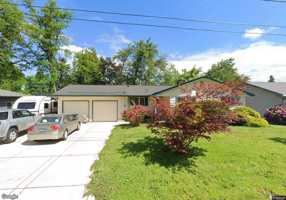
3645 Mahlon Ave Eugene, OR 97401
Harlow NeighborhoodEstimated Value: $353,000 - $419,000
3
Beds
1
Bath
1,012
Sq Ft
$387/Sq Ft
Est. Value
About This Home
This home is located at 3645 Mahlon Ave, Eugene, OR 97401 and is currently estimated at $392,051, approximately $387 per square foot. 3645 Mahlon Ave is a home located in Lane County with nearby schools including Holt Elementary School, Monroe Middle School, and Sheldon High School.
Ownership History
Date
Name
Owned For
Owner Type
Purchase Details
Closed on
Apr 17, 2003
Sold by
Horne Donald A and Horne Amy E
Bought by
Wolgamot James M
Current Estimated Value
Home Financials for this Owner
Home Financials are based on the most recent Mortgage that was taken out on this home.
Original Mortgage
$129,862
Outstanding Balance
$54,685
Interest Rate
5.6%
Mortgage Type
FHA
Estimated Equity
$337,366
Purchase Details
Closed on
Nov 5, 1999
Sold by
Foster Eric M
Bought by
Horne Donald A and Horne Amy E
Home Financials for this Owner
Home Financials are based on the most recent Mortgage that was taken out on this home.
Original Mortgage
$109,250
Interest Rate
7.75%
Create a Home Valuation Report for This Property
The Home Valuation Report is an in-depth analysis detailing your home's value as well as a comparison with similar homes in the area
Home Values in the Area
Average Home Value in this Area
Purchase History
We collect this data history from publicly available records. To have your information removed, we recommend requesting removal directly through your county’s website.
| Date | Buyer | Sale Price | Title Company |
|---|---|---|---|
| Wolgamot James M | $131,900 | American Title Group | |
| Horne Donald A | $118,347 | Cascade Title Co |
Source: Public Records
Mortgage History
We collect this data history from publicly available records. To have your information removed, we recommend requesting removal directly through your county’s website.
| Date | Status | Borrower | Loan Amount |
|---|---|---|---|
| Open | Wolgamot James M | $129,862 | |
| Previous Owner | Horne Donald A | $109,250 |
Source: Public Records
Tax History
| Year | Tax Paid | Tax Assessment Tax Assessment Total Assessment is a certain percentage of the fair market value that is determined by local assessors to be the total taxable value of land and additions on the property. | Land | Improvement |
|---|---|---|---|---|
| 2025 | $3,650 | $187,314 | -- | -- |
| 2024 | $3,604 | $181,859 | -- | -- |
| 2023 | $3,604 | $176,563 | -- | -- |
| 2022 | $3,377 | $171,421 | $0 | $0 |
| 2021 | $3,171 | $166,429 | $0 | $0 |
| 2020 | $3,183 | $161,582 | $0 | $0 |
| 2019 | $3,074 | $156,876 | $0 | $0 |
| 2018 | $2,893 | $147,871 | $0 | $0 |
| 2017 | $2,764 | $147,871 | $0 | $0 |
| 2016 | $2,695 | $143,564 | $0 | $0 |
| 2015 | $2,585 | $139,383 | $0 | $0 |
| 2014 | $2,500 | $135,323 | $0 | $0 |
Source: Public Records
Map
Nearby Homes
- 3588 Sisters View Ave
- 3492 Whisper Ln
- 349 van Duyn St
- 511 Panda Loop
- 640 N Garden Way
- 654 N Garden Way
- 393 Sunshine Acres Dr
- 3735 Harlow Rd
- 1233 Kenray Loop
- 280 Roan Dr
- 825 Waverly St
- 3095 Dapple Way
- 1148 Darlene Ave
- 2994 Dapple Way
- 1040 Martha Ct
- 1310 W Quinalt St
- 1050 President St
- 410 Dartmoor Dr
- 280 Regal Ct
- 1444 Menlo Loop
- 3663 Mahlon Ave
- 3629 Mahlon Ave
- 3660 Sisters View Ave
- 3634 Sisters View Ave
- 3636 Mahlon Ave
- 3648 Mahlon Ave
- 3667 Mahlon Ave
- 3676 Sisters View Ave
- 3624 Mahlon Ave
- 3660 Mahlon Ave
- 3596 Sisters View Ave
- 3688 Sisters View Ave
- 0 Sisters View Ave
- 3610 Mahlon Ave
- 3613 Mahlon Ave
- 3672 Mahlon Ave
- 3657 Westward ho Ave
- 3641 Westward ho Ave
- 240 N Garden Way
- 260 N Garden Way
Your Personal Tour Guide
Ask me questions while you tour the home.