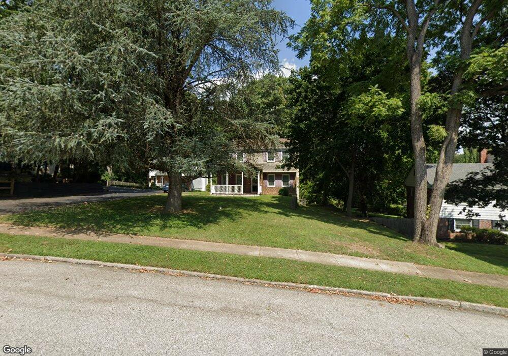
367 Lester Rd Springfield, PA 19064
Estimated Value: $529,000 - $608,000
4
Beds
3
Baths
1,932
Sq Ft
$294/Sq Ft
Est. Value
About This Home
This home is located at 367 Lester Rd, Springfield, PA 19064 and is currently estimated at $568,353, approximately $294 per square foot. 367 Lester Rd is a home located in Delaware County with nearby schools including Springfield High School, St Francis Of Assisi School, and Holy Cross School.
Ownership History
Date
Name
Owned For
Owner Type
Purchase Details
Closed on
May 11, 2007
Sold by
Cartus Financial Corp
Bought by
Burns Robert J and Burns Linda R
Current Estimated Value
Home Financials for this Owner
Home Financials are based on the most recent Mortgage that was taken out on this home.
Original Mortgage
$150,000
Interest Rate
5.88%
Mortgage Type
Purchase Money Mortgage
Purchase Details
Closed on
Mar 2, 2007
Sold by
King Michael C and King Kim
Bought by
Cartus Financial Corp
Purchase Details
Closed on
Jun 30, 2004
Sold by
Troilo Frank T and Troilo Judith F
Bought by
King Michael C and King Kim
Home Financials for this Owner
Home Financials are based on the most recent Mortgage that was taken out on this home.
Original Mortgage
$236,000
Interest Rate
4.75%
Mortgage Type
Fannie Mae Freddie Mac
Purchase Details
Closed on
Jan 26, 1996
Sold by
Louden Thomas J and Louden Patricia M
Bought by
Troilo Frank T and Troilo Judith F
Home Financials for this Owner
Home Financials are based on the most recent Mortgage that was taken out on this home.
Original Mortgage
$171,000
Interest Rate
7.25%
Mortgage Type
Purchase Money Mortgage
Create a Home Valuation Report for This Property
The Home Valuation Report is an in-depth analysis detailing your home's value as well as a comparison with similar homes in the area
Home Values in the Area
Average Home Value in this Area
Purchase History
We collect this data history from publicly available records. To have your information removed, we recommend requesting removal directly through your county’s website.
| Date | Buyer | Sale Price | Title Company |
|---|---|---|---|
| Burns Robert J | $354,900 | None Available | |
| Cartus Financial Corp | $354,900 | None Available | |
| King Michael C | $295,000 | First American Title Ins Co | |
| Troilo Frank T | $190,000 | T A Title Insurance Company |
Source: Public Records
Mortgage History
We collect this data history from publicly available records. To have your information removed, we recommend requesting removal directly through your county’s website.
| Date | Status | Borrower | Loan Amount |
|---|---|---|---|
| Closed | Burns Robert J | $150,000 | |
| Previous Owner | King Michael C | $236,000 | |
| Previous Owner | Troilo Frank T | $171,000 |
Source: Public Records
Tax History
| Year | Tax Paid | Tax Assessment Tax Assessment Total Assessment is a certain percentage of the fair market value that is determined by local assessors to be the total taxable value of land and additions on the property. | Land | Improvement |
|---|---|---|---|---|
| 2026 | $10,225 | $341,150 | $123,330 | $217,820 |
| 2025 | $9,589 | $341,150 | $123,330 | $217,820 |
| 2024 | $9,589 | $341,150 | $123,330 | $217,820 |
| 2023 | $9,233 | $341,150 | $123,330 | $217,820 |
| 2022 | $9,033 | $341,150 | $123,330 | $217,820 |
| 2021 | $13,989 | $341,150 | $123,330 | $217,820 |
| 2020 | $7,814 | $172,450 | $59,300 | $113,150 |
| 2019 | $7,631 | $172,450 | $59,300 | $113,150 |
| 2018 | $7,522 | $172,450 | $0 | $0 |
| 2017 | $7,348 | $172,450 | $0 | $0 |
| 2016 | $946 | $172,450 | $0 | $0 |
| 2015 | $946 | $172,450 | $0 | $0 |
| 2014 | $946 | $172,450 | $0 | $0 |
Source: Public Records
Map
Nearby Homes
- 308 Lewis Rd
- 359 Spring Valley Rd
- 447 Maddock Rd
- 364 S Rolling Rd
- 465 Briarhill Rd
- 71 W Sproul Rd
- 217 E Thomson Ave
- 212 E Woodland Ave
- 534 Maplewood Rd
- 231 E Woodland Ave
- 481 Maplewood Rd
- 271 Ballymore Rd
- 255 Gibbons Rd
- 320 Prospect Rd
- 304 Carolee Cir
- 345 Holt Ln
- 311 Carolee Cir
- 43 Lownes Ln
- 405 E Woodland Ave
- 93 Saxer Ave
Your Personal Tour Guide
Ask me questions while you tour the home.