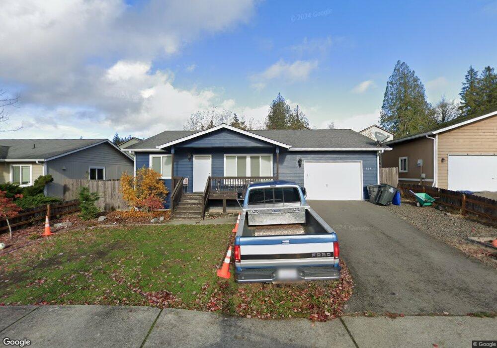
367 NE Max William Loop Poulsbo, WA 98370
Estimated Value: $468,000 - $489,000
3
Beds
2
Baths
1,230
Sq Ft
$390/Sq Ft
Est. Value
About This Home
This home is located at 367 NE Max William Loop, Poulsbo, WA 98370 and is currently estimated at $479,768, approximately $390 per square foot. 367 NE Max William Loop is a home located in Kitsap County with nearby schools including Vinland Elementary School, Poulsbo Middle School, and North Kitsap High School.
Ownership History
Date
Name
Owned For
Owner Type
Purchase Details
Closed on
Jul 18, 2007
Sold by
Kitsap Cnty Consolidated Hsng Authority
Bought by
Binford Jennifer R
Current Estimated Value
Home Financials for this Owner
Home Financials are based on the most recent Mortgage that was taken out on this home.
Original Mortgage
$34,592
Outstanding Balance
$21,857
Interest Rate
6.62%
Mortgage Type
Stand Alone Second
Estimated Equity
$457,911
Create a Home Valuation Report for This Property
The Home Valuation Report is an in-depth analysis detailing your home's value as well as a comparison with similar homes in the area
Home Values in the Area
Average Home Value in this Area
Purchase History
| Date | Buyer | Sale Price | Title Company |
|---|---|---|---|
| Binford Jennifer R | -- | Pacific Nw Title |
Source: Public Records
Mortgage History
| Date | Status | Borrower | Loan Amount |
|---|---|---|---|
| Open | Binford Jennifer R | $34,592 | |
| Open | Binford Jennifer R | $151,508 |
Source: Public Records
Tax History
| Year | Tax Paid | Tax Assessment Tax Assessment Total Assessment is a certain percentage of the fair market value that is determined by local assessors to be the total taxable value of land and additions on the property. | Land | Improvement |
|---|---|---|---|---|
| 2026 | $3,815 | $433,500 | $133,790 | $299,710 |
| 2025 | $3,815 | $433,500 | $133,790 | $299,710 |
| 2024 | $3,406 | $398,950 | $125,090 | $273,860 |
| 2023 | $3,464 | $398,950 | $125,090 | $273,860 |
| 2022 | $3,096 | $339,630 | $108,590 | $231,040 |
| 2021 | $3,007 | $305,730 | $97,290 | $208,440 |
| 2020 | $2,932 | $293,060 | $92,950 | $200,110 |
| 2019 | $2,750 | $275,090 | $86,870 | $188,220 |
| 2018 | $2,565 | $219,290 | $65,960 | $153,330 |
| 2017 | $2,459 | $219,290 | $65,960 | $153,330 |
| 2016 | $2,545 | $209,020 | $65,960 | $143,060 |
| 2015 | $2,474 | $204,350 | $65,960 | $138,390 |
| 2014 | -- | $166,580 | $54,970 | $111,610 |
| 2013 | -- | $166,580 | $54,970 | $111,610 |
Source: Public Records
Map
Nearby Homes
- 233 XX Washington 3
- 26663 Big Valley Rd NE
- 216xx Bond Rd NE
- 22628 Holgar Ct NE
- 216 XX Bond Rd NE
- 0 NE Sawdust Hill Rd Unit Lot 6
- 0 NE Sawdust Hill Rd Unit NWM2446451
- 437 Equestrian Dr
- 0 Old Military Rd NE Unit NWM2389849
- 21988 Urdahl Rd NW
- 21728 Urdahl Rd NW
- 20249 State Route 305 NE
- 1784 Ashby Ave NW
- 21555 Urdahl Rd NW
- 1777 Ashby Ave NW
- 20241 Vikings Crest Loop NE Unit 6-303
- 10 th Ave To Forest Rock Ln NE
- 22158 Calvin Place NW Unit 86
- 22164 Calvin Place NW Unit 85
- 22176 Jameson Ave NW Unit 84
- 371 NE Max William Loop
- 359 NE Max William Loop
- 372 NE O'Henry Ct
- 368 NE O'Henry Ct
- 375 NE Max William Loop
- 355 NE Max William Loop
- 376 NE Ohenry Ct
- 378 NE Ohenry Ct
- 360 NE Max William Loop
- 368 NE Max William Loop
- 356 NE Ohenry Ct
- 379 NE Max William Loop
- 356 NE O'Henry Ct
- 372 NE Max William Loop
- 348 NE Max William Loop
- 351 NE Max William Loop
Your Personal Tour Guide
Ask me questions while you tour the home.