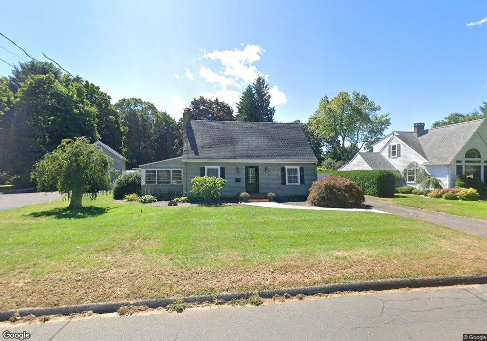
368 Carter Ln Southington, CT 06489
East Southington NeighborhoodEstimated Value: $432,000 - $531,000
3
Beds
2
Baths
1,880
Sq Ft
$248/Sq Ft
Est. Value
About This Home
This home is located at 368 Carter Ln, Southington, CT 06489 and is currently estimated at $466,528, approximately $248 per square foot. 368 Carter Ln is a home located in Hartford County with nearby schools including Derynoski Elementary School, John F. Kennedy Middle School, and Southington High School.
Ownership History
Date
Name
Owned For
Owner Type
Purchase Details
Closed on
Aug 16, 2010
Sold by
Ohlson Christopher M
Bought by
Weston Paul and Weston Christine
Current Estimated Value
Home Financials for this Owner
Home Financials are based on the most recent Mortgage that was taken out on this home.
Original Mortgage
$289,106
Outstanding Balance
$187,472
Interest Rate
4.63%
Estimated Equity
$279,056
Purchase Details
Closed on
May 3, 2007
Sold by
Tompkins Dale R and Tompkins Maureen
Bought by
Ohlson Christopher M
Home Financials for this Owner
Home Financials are based on the most recent Mortgage that was taken out on this home.
Original Mortgage
$256,000
Interest Rate
6.23%
Purchase Details
Closed on
Aug 8, 2000
Sold by
Emily H Cook and Emily Cook
Bought by
Tompkins Dale and Tompkins Maureen
Create a Home Valuation Report for This Property
The Home Valuation Report is an in-depth analysis detailing your home's value as well as a comparison with similar homes in the area
Home Values in the Area
Average Home Value in this Area
Purchase History
| Date | Buyer | Sale Price | Title Company |
|---|---|---|---|
| Weston Paul | $293,000 | -- | |
| Ohlson Christopher M | $320,000 | -- | |
| Tompkins Dale | $218,500 | -- |
Source: Public Records
Mortgage History
| Date | Status | Borrower | Loan Amount |
|---|---|---|---|
| Open | Tompkins Dale | $289,106 | |
| Previous Owner | Tompkins Dale | $257,500 | |
| Previous Owner | Tompkins Dale | $256,000 |
Source: Public Records
Tax History
| Year | Tax Paid | Tax Assessment Tax Assessment Total Assessment is a certain percentage of the fair market value that is determined by local assessors to be the total taxable value of land and additions on the property. | Land | Improvement |
|---|---|---|---|---|
| 2025 | $6,785 | $204,320 | $77,690 | $126,630 |
| 2024 | $6,424 | $204,320 | $77,690 | $126,630 |
| 2023 | $6,203 | $204,320 | $77,690 | $126,630 |
| 2022 | $5,883 | $201,950 | $77,690 | $124,260 |
| 2021 | $5,863 | $201,950 | $77,690 | $124,260 |
| 2020 | $5,900 | $192,610 | $79,280 | $113,330 |
| 2019 | $5,902 | $192,610 | $79,280 | $113,330 |
| 2018 | $5,871 | $192,610 | $79,280 | $113,330 |
| 2017 | $5,871 | $192,610 | $79,280 | $113,330 |
| 2016 | $5,709 | $192,610 | $79,280 | $113,330 |
| 2015 | $5,497 | $188,650 | $75,500 | $113,150 |
| 2014 | $5,350 | $188,650 | $75,500 | $113,150 |
Source: Public Records
Map
Nearby Homes
- 632 Meriden Ave
- 87 Carter Ln
- 37 Homesdale Ave
- 49 Mark Dr
- 175 Berlin Ave Unit 74
- 15 Woodruff St
- 86 Bristol St
- 142 Liberty St
- 885 Glacier Way
- 82 Summer St Unit A
- 82 Summer St Unit B
- 621 Overlook Path
- 40 Hickory Hill
- 70 Marcy Dr
- 962 S Main St Unit 17
- 60 Marcy Dr
- 310 Buckland St Unit Rear
- 1 Coach Dr Unit 1
- 41 Coach Dr Unit 41
- 77 Howard Ave
- 360 Carter Ln
- 380 Carter Ln
- 346 Meriden Ave
- 338 Meriden Ave
- 384 Meriden Ave
- 353 Carter Ln
- 343 Carter Ln
- 396 Meriden Ave
- 324 Meriden Ave
- 333 Carter Ln
- 27 Heritage Dr
- 316 Meriden Ave
- 11 Heritage Dr
- 317 Carter Ln
- 312 Meriden Ave
- 45 Heritage Dr
- 416 Meriden Ave
- 309 Carter Ln
- 37 Delahunty Dr
- 45 Hemlock Dr
Your Personal Tour Guide
Ask me questions while you tour the home.