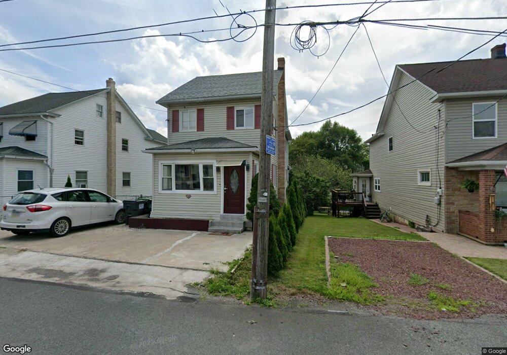
37 Bridge St McAdoo, PA 18237
Estimated Value: $162,000 - $210,000
4
Beds
2
Baths
1,704
Sq Ft
$104/Sq Ft
Est. Value
About This Home
This home is located at 37 Bridge St, McAdoo, PA 18237 and is currently estimated at $177,571, approximately $104 per square foot. 37 Bridge St is a home located in Schuylkill County with nearby schools including Hazleton Area High School and Mcadoo Catholic Elementary School.
Ownership History
Date
Name
Owned For
Owner Type
Purchase Details
Closed on
Feb 25, 2022
Sold by
Reina Deleon
Bought by
Colon Catalina Basilio and De Jesus Jose
Current Estimated Value
Home Financials for this Owner
Home Financials are based on the most recent Mortgage that was taken out on this home.
Original Mortgage
$137,464
Outstanding Balance
$126,659
Interest Rate
3.69%
Mortgage Type
FHA
Estimated Equity
$50,912
Purchase Details
Closed on
Feb 18, 2009
Sold by
Wells Fargo Bank Na
Bought by
Deleon Reina
Home Financials for this Owner
Home Financials are based on the most recent Mortgage that was taken out on this home.
Original Mortgage
$50,366
Interest Rate
4.86%
Mortgage Type
FHA
Purchase Details
Closed on
Jan 14, 2009
Sold by
Walawender Josette
Bought by
Wells Fargo Bank Na
Home Financials for this Owner
Home Financials are based on the most recent Mortgage that was taken out on this home.
Original Mortgage
$50,366
Interest Rate
4.86%
Mortgage Type
FHA
Create a Home Valuation Report for This Property
The Home Valuation Report is an in-depth analysis detailing your home's value as well as a comparison with similar homes in the area
Home Values in the Area
Average Home Value in this Area
Purchase History
| Date | Buyer | Sale Price | Title Company |
|---|---|---|---|
| Colon Catalina Basilio | $140,000 | Apex Abstract | |
| Deleon Reina | $55,000 | None Available | |
| Wells Fargo Bank Na | $775 | None Available |
Source: Public Records
Mortgage History
| Date | Status | Borrower | Loan Amount |
|---|---|---|---|
| Open | Colon Catalina Basilio | $137,464 | |
| Previous Owner | Deleon Reina | $50,366 |
Source: Public Records
Tax History
| Year | Tax Paid | Tax Assessment Tax Assessment Total Assessment is a certain percentage of the fair market value that is determined by local assessors to be the total taxable value of land and additions on the property. | Land | Improvement |
|---|---|---|---|---|
| 2026 | $6,273 | $136,200 | $12,900 | $123,300 |
| 2025 | $1,199 | $17,375 | $3,750 | $13,625 |
| 2024 | $1,112 | $17,375 | $3,750 | $13,625 |
| 2023 | $1,091 | $17,375 | $3,750 | $13,625 |
| 2022 | $1,111 | $17,375 | $3,750 | $13,625 |
| 2021 | $1,066 | $17,375 | $3,750 | $13,625 |
| 2020 | $1,060 | $17,375 | $3,750 | $13,625 |
| 2018 | $1,081 | $17,375 | $3,750 | $13,625 |
| 2017 | $1,063 | $17,375 | $3,750 | $13,625 |
| 2015 | -- | $17,375 | $3,750 | $13,625 |
| 2011 | -- | $17,375 | $0 | $0 |
Source: Public Records
Map
Nearby Homes
- 0 Tresckow Rd
- 0 Mountain Top Terrace
- 0 Mountain Top Terrace Unit LotWP001 16175658
- 110 112 E Grant St
- 25 James St
- 0 4th St
- 137 E Jackson St
- 159 Ben Titus Rd
- 794 Claremont Ave
- 780 Claremont Ave
- 1215 Four Seasons Ct
- 0 Ben Titus Rd Unit PASK2023932
- 10 E Church St
- 582 Fairview St
- 532 Buck Mountain Blvd
- 30 E Main St
- 347 Muir Ave
- 0 Claremont Ave Unit 8-8824
- 0 Claremont Ave Unit PM-138506
- 0 Claremont Ave Unit 770985
Your Personal Tour Guide
Ask me questions while you tour the home.