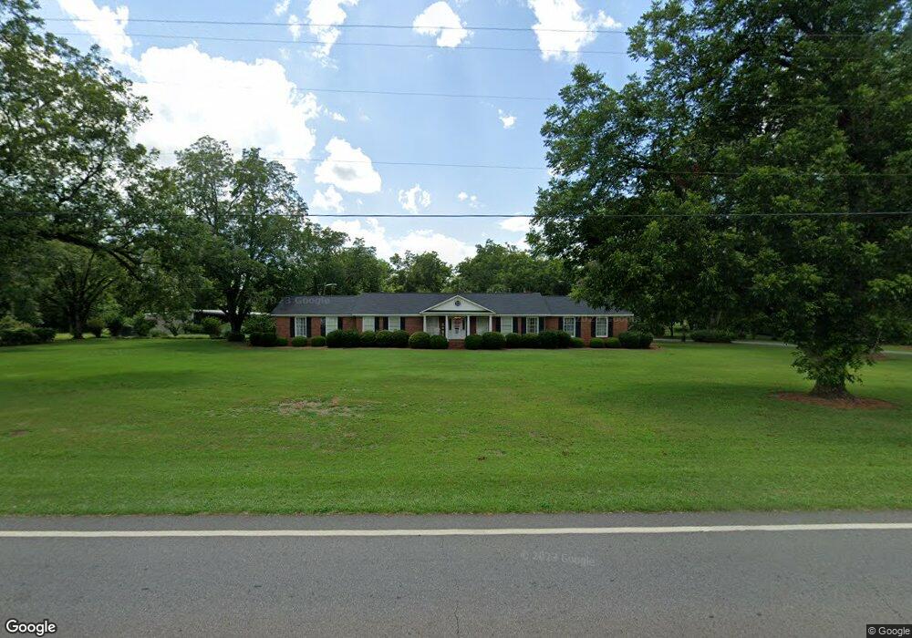
3717 Pearl St Shellman, GA 39886
Estimated Value: $213,000 - $411,000
3
Beds
3
Baths
2,650
Sq Ft
$117/Sq Ft
Est. Value
About This Home
This home is located at 3717 Pearl St, Shellman, GA 39886 and is currently estimated at $309,378, approximately $116 per square foot. 3717 Pearl St is a home with nearby schools including Randolph County Elementary School, Randolph Clay Middle School, and Randolph Clay High School.
Ownership History
Date
Name
Owned For
Owner Type
Purchase Details
Closed on
Sep 29, 2014
Sold by
Crosby Michael A
Bought by
Crosby Teri D
Current Estimated Value
Purchase Details
Closed on
Jul 19, 2014
Sold by
Crosby Michael A
Bought by
Crosby Teri
Purchase Details
Closed on
Apr 10, 2003
Sold by
Short Short T and Short Stewart
Bought by
Short Anita P
Purchase Details
Closed on
Apr 30, 1998
Sold by
T and S
Bought by
Short Short T and Short Stewart
Create a Home Valuation Report for This Property
The Home Valuation Report is an in-depth analysis detailing your home's value as well as a comparison with similar homes in the area
Home Values in the Area
Average Home Value in this Area
Purchase History
| Date | Buyer | Sale Price | Title Company |
|---|---|---|---|
| Crosby Teri D | -- | -- | |
| Crosby Teri D | -- | -- | |
| Crosby Teri | -- | -- | |
| Crosby Teri | -- | -- | |
| Short Anita P | -- | -- | |
| Short Anita P | -- | -- | |
| Short Short T | -- | -- | |
| Short Short T | -- | -- |
Source: Public Records
Tax History
| Year | Tax Paid | Tax Assessment Tax Assessment Total Assessment is a certain percentage of the fair market value that is determined by local assessors to be the total taxable value of land and additions on the property. | Land | Improvement |
|---|---|---|---|---|
| 2025 | $5,773 | $116,120 | $8,160 | $107,960 |
| 2024 | $5,080 | $99,800 | $4,080 | $95,720 |
| 2023 | $3,086 | $99,800 | $4,080 | $95,720 |
| 2022 | $3,576 | $99,800 | $4,080 | $95,720 |
| 2021 | $2,348 | $65,144 | $3,574 | $61,570 |
| 2020 | $2,418 | $65,144 | $3,574 | $61,570 |
| 2019 | $2,405 | $65,144 | $3,574 | $61,570 |
| 2018 | $3,081 | $65,144 | $3,574 | $61,570 |
| 2017 | $2,302 | $65,144 | $3,574 | $61,570 |
| 2016 | $2,308 | $65,144 | $3,574 | $61,570 |
| 2015 | -- | $65,506 | $3,574 | $61,933 |
| 2014 | -- | $57,883 | $4,298 | $53,585 |
| 2013 | -- | $53,706 | $4,298 | $49,408 |
Source: Public Records
Map
Nearby Homes
- 3845 Pearl St
- 48 Cheney St
- 3109 Calhoun St
- 0 Carver St
- 8369 Graves Hwy
- Sam Bentley Rd
- Pierce Rd
- 246 Melton Mill Rd
- 0 Bird Song Rd
- 5147 Doverel Hwy
- 0 District Line Rd Unit 10518137
- 13XX Graves Hwy
- 00 Hwy 41
- 361/552 NW Tenth Ave
- 145 Pearson Dr SW
- 226 N Main St
- XX1 Columbus Hwy
- 379 E Lee St
- 411 E Lee St
- 527 Orange St NE
Your Personal Tour Guide
Ask me questions while you tour the home.