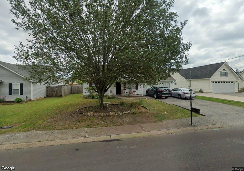
372 Colony Cir Fort Oglethorpe, GA 30742
Estimated Value: $234,000 - $304,000
3
Beds
2
Baths
1,312
Sq Ft
$204/Sq Ft
Est. Value
About This Home
This home is located at 372 Colony Cir, Fort Oglethorpe, GA 30742 and is currently estimated at $267,803, approximately $204 per square foot. 372 Colony Cir is a home located in Catoosa County with nearby schools including Cloud Springs Elementary School, Lakeview Middle School, and Lakeview-Fort Oglethorpe High School.
Ownership History
Date
Name
Owned For
Owner Type
Purchase Details
Closed on
Sep 25, 2015
Sold by
Bank Of America
Bought by
Heckman Larry J and Heckman Sharon Kay
Current Estimated Value
Purchase Details
Closed on
Jul 7, 2015
Sold by
Thomison Rita
Bought by
Bank Of America
Purchase Details
Closed on
May 25, 2010
Sold by
Bundy William A
Bought by
Thomison Rita
Home Financials for this Owner
Home Financials are based on the most recent Mortgage that was taken out on this home.
Original Mortgage
$105,061
Interest Rate
5.5%
Mortgage Type
FHA
Purchase Details
Closed on
Feb 17, 2003
Bought by
Bundy William A
Create a Home Valuation Report for This Property
The Home Valuation Report is an in-depth analysis detailing your home's value as well as a comparison with similar homes in the area
Home Values in the Area
Average Home Value in this Area
Purchase History
We collect this data history from publicly available records. To have your information removed, we recommend requesting removal directly through your county’s website.
| Date | Buyer | Sale Price | Title Company |
|---|---|---|---|
| Heckman Larry J | $87,010 | -- | |
| Bank Of America | -- | -- | |
| Thomison Rita | $107,000 | -- | |
| Bundy William A | $103,000 | -- |
Source: Public Records
Mortgage History
We collect this data history from publicly available records. To have your information removed, we recommend requesting removal directly through your county’s website.
| Date | Status | Borrower | Loan Amount |
|---|---|---|---|
| Previous Owner | Thomison Rita | $105,061 |
Source: Public Records
Tax History
| Year | Tax Paid | Tax Assessment Tax Assessment Total Assessment is a certain percentage of the fair market value that is determined by local assessors to be the total taxable value of land and additions on the property. | Land | Improvement |
|---|---|---|---|---|
| 2025 | $2,095 | $93,248 | $11,000 | $82,248 |
| 2024 | $2,363 | $89,826 | $11,000 | $78,826 |
| 2023 | $1,843 | $70,064 | $11,000 | $59,064 |
| 2022 | $1,565 | $55,712 | $11,000 | $44,712 |
| 2021 | $1,484 | $55,712 | $11,000 | $44,712 |
| 2020 | $1,476 | $49,988 | $11,000 | $38,988 |
| 2019 | $1,432 | $47,988 | $9,000 | $38,988 |
| 2018 | $1,504 | $47,988 | $9,000 | $38,988 |
| 2017 | $1,413 | $45,104 | $7,200 | $37,904 |
| 2016 | $1,139 | $42,317 | $7,200 | $35,117 |
| 2015 | -- | $43,619 | $7,200 | $36,419 |
| 2014 | -- | $43,619 | $7,200 | $36,419 |
| 2013 | -- | $41,874 | $6,912 | $34,962 |
Source: Public Records
Map
Nearby Homes
- 47 Spring Place Dr
- 699 Colony Cir
- 307 Franklin Cir
- 144 Franklin Cir
- 351 Franklin Cir
- 128 Franklin Cir
- 425 Franklin Cir
- 792 Colony Cir
- 54 Franklin Cir
- 180 Gem Dr
- 183 McDonald Dr
- 2003 Cedar Creek Dr
- 282 Glade Rd
- 1112 Park Forrest Dr
- 64 Yellow Brick Rd
- 146 Flagstone Dr
- 470 Flagstone Dr
- 120 Allison Terrace
- 239 Flagstone Dr
- 1975 Cloud Springs Rd
- 386 Colony Cir
- 358 Colony Cir
- 33 Stone Edge Ct
- 398 Colony Cir
- 43 Spring Place Dr
- 45 Stone Edge Ct
- 340 Colony Cir
- 373 Colony Cir
- 63 Spring Place Dr
- 361 Colony Cir
- 1904 Colony Cir
- 412 Colony Cir
- 347 Colony Cir
- 48 Stone Edge Ct
- 333 Colony Cir
- 89 Spring Place Dr
- 34 Spring Place Dr
- 438 Colony Cir
- 22 Spring Place Dr
- 60 Spring Place Dr
Your Personal Tour Guide
Ask me questions while you tour the home.