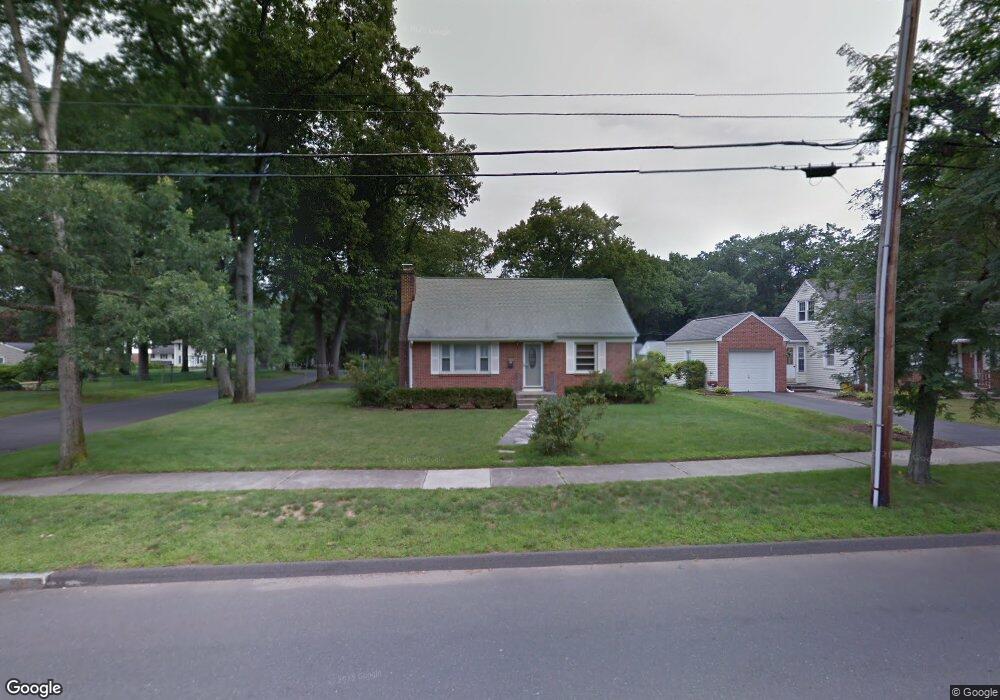
372 Maple Rd Longmeadow, MA 01106
Estimated Value: $352,000 - $391,000
About This Home
This home is located at 372 Maple Rd, Longmeadow, MA 01106 and is currently estimated at $373,436, approximately $290 per square foot. 372 Maple Rd is a home located in Hampden County with nearby schools including Wolf Swamp Road School, Glenbrook Middle School, and Longmeadow High School.
Ownership History
We collect this data history from publicly available records. To have your information removed, we recommend requesting removal directly through your county’s website.
Purchase Details
Home Financials for this Owner
Home Financials are based on the most recent Mortgage that was taken out on this home.Home Values in the Area
Average Home Value in this Area
Purchase History
We collect this data history from publicly available records. To have your information removed, we recommend requesting removal directly through your county’s website.
| Date | Buyer | Sale Price | Title Company |
|---|---|---|---|
| $220,000 | -- | ||
| $220,000 | -- | ||
| $220,000 | -- |
Mortgage History
We collect this data history from publicly available records. To have your information removed, we recommend requesting removal directly through your county’s website.
| Date | Status | Borrower | Loan Amount |
|---|---|---|---|
| Open | $151,000 | ||
| Closed | $160,000 | ||
| Previous Owner | $55,000 |
Tax History
We collect this data history from publicly available records. To have your information removed, we recommend requesting removal directly through your county’s website.
| Year | Tax Paid | Tax Assessment Tax Assessment Total Assessment is a certain percentage of the fair market value that is determined by local assessors to be the total taxable value of land and additions on the property. | Land | Improvement |
|---|---|---|---|---|
| 2025 | $6,725 | $318,400 | $135,400 | $183,000 |
| 2024 | $6,585 | $318,400 | $135,400 | $183,000 |
| 2023 | $5,835 | $254,600 | $93,500 | $161,100 |
| 2022 | $5,850 | $237,400 | $107,900 | $129,500 |
| 2021 | $5,913 | $239,000 | $109,600 | $129,400 |
| 2020 | $5,280 | $218,100 | $95,900 | $122,200 |
| 2019 | $5,146 | $213,600 | $102,800 | $110,800 |
| 2018 | $4,617 | $189,700 | $107,400 | $82,300 |
| 2017 | $4,532 | $192,200 | $107,400 | $84,800 |
| 2016 | $4,494 | $184,700 | $103,300 | $81,400 |
| 2015 | $4,337 | $183,600 | $102,200 | $81,400 |
Map
- 6 Ferncroft St
- 23 Magnolia Dr
- 131 Lincoln Rd
- 23 Berwick Rd
- 10 Tabor Rd
- 3 Concord Terrace
- 32 Lincoln Rd
- 111 Maple Rd
- 117 The Meadows Unit 117
- 233 Franklin Rd
- 82 Lincoln Park
- 30 Alban Rd
- 62 Circle Rd
- 1435 Longmeadow St
- 24 Prynne Ridge Rd
- 51 Barrington Rd
- 27 Booth St
- 33 Roy St
- 56 Liberty Ln
- 46 Liberty Ln
Ask me questions while you tour the home.