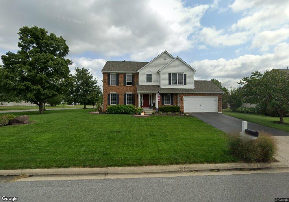
3733 Hampshire Ave Powell, OH 43065
Estimated Value: $566,387 - $595,000
4
Beds
3
Baths
2,800
Sq Ft
$206/Sq Ft
Est. Value
About This Home
This home is located at 3733 Hampshire Ave, Powell, OH 43065 and is currently estimated at $576,097, approximately $205 per square foot. 3733 Hampshire Ave is a home located in Delaware County with nearby schools including Scioto Ridge Elementary School, Olentangy Liberty Middle School, and Olentangy Liberty High School.
Ownership History
Date
Name
Owned For
Owner Type
Purchase Details
Closed on
Aug 22, 2014
Sold by
Willis Jason
Bought by
Willis Julie
Current Estimated Value
Purchase Details
Closed on
Jul 22, 2010
Sold by
Anderson Phillip E
Bought by
Willis Jason and Willis Julie
Home Financials for this Owner
Home Financials are based on the most recent Mortgage that was taken out on this home.
Original Mortgage
$209,200
Outstanding Balance
$138,877
Interest Rate
4.7%
Mortgage Type
New Conventional
Estimated Equity
$437,220
Purchase Details
Closed on
Feb 25, 1999
Sold by
Dominion Homes Inc
Bought by
Anderson Phillip E
Home Financials for this Owner
Home Financials are based on the most recent Mortgage that was taken out on this home.
Original Mortgage
$205,700
Interest Rate
6.92%
Mortgage Type
New Conventional
Create a Home Valuation Report for This Property
The Home Valuation Report is an in-depth analysis detailing your home's value as well as a comparison with similar homes in the area
Home Values in the Area
Average Home Value in this Area
Purchase History
| Date | Buyer | Sale Price | Title Company |
|---|---|---|---|
| Willis Julie | -- | None Available | |
| Willis Jason | $261,500 | Talon Title | |
| Anderson Phillip E | $216,577 | -- |
Source: Public Records
Mortgage History
| Date | Status | Borrower | Loan Amount |
|---|---|---|---|
| Open | Willis Jason | $209,200 | |
| Closed | Anderson Phillip E | $205,700 |
Source: Public Records
Tax History
| Year | Tax Paid | Tax Assessment Tax Assessment Total Assessment is a certain percentage of the fair market value that is determined by local assessors to be the total taxable value of land and additions on the property. | Land | Improvement |
|---|---|---|---|---|
| 2024 | $8,363 | $159,610 | $37,630 | $121,980 |
| 2023 | $8,396 | $159,610 | $37,630 | $121,980 |
| 2022 | $7,528 | $113,470 | $24,500 | $88,970 |
| 2021 | $7,574 | $113,470 | $24,500 | $88,970 |
| 2020 | $7,610 | $113,470 | $24,500 | $88,970 |
| 2019 | $6,877 | $106,890 | $24,500 | $82,390 |
| 2018 | $6,909 | $106,890 | $24,500 | $82,390 |
| 2017 | $6,837 | $94,920 | $21,000 | $73,920 |
| 2016 | $6,532 | $94,920 | $21,000 | $73,920 |
| 2015 | $5,907 | $94,920 | $21,000 | $73,920 |
| 2014 | $5,989 | $94,920 | $21,000 | $73,920 |
| 2013 | $5,987 | $92,750 | $21,000 | $71,750 |
Source: Public Records
Map
Nearby Homes
- 3722 Hampshire Ave
- 3956 Mead Dr
- 3721 Orchard Way
- 3839 Orchard Way
- 9472 Clermont Blvd Unit 9472
- 3606 Perennial Ln
- 4034 Pioneer Ct
- 9383 Clermont Blvd
- 9427 Clermont Cir Unit 9427
- 3638 Foresta Grand Dr
- 9430 Wilbrook Dr
- 9023 Samari Place
- 3766 Echo Place
- 354 Bear Woods Dr Unit 354
- 4316 Quail Landing
- 330 Bear Woods Dr Unit 5330
- 3697 Stoneway Point Unit 83697
- 0 Bunker Ln
- 3702 Stoneway Point
- 4470 Bobwhite Trace
- 3757 Hampshire Ave
- 9342 Brooks Close
- 3775 Hampshire Ave
- 9356 Brooks Close
- 3740 Hampshire Ave
- 9307 Hampshire Ct
- 3760 Hampshire Ave
- 3795 Hampshire Ave
- 3795 Hampshire Ave Unit 2889
- 9372 Brooks Close
- 3641 Mead Dr
- 9293 Hampshire Ct
- 9343 Brooks Close
- 3798 Hampshire Ave
- 9302 Hampshire Ct
- 3614 Mead Dr
- 9349 Auburn Ave
- 9361 Auburn Ave
- 3815 Hampshire Ave
- 3815 Hampshire Ave Unit 2890
Your Personal Tour Guide
Ask me questions while you tour the home.