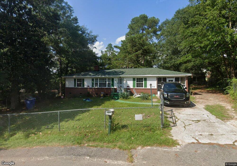
3736 Kaiser Ave Columbia, SC 29204
Estimated Value: $138,000 - $156,000
3
Beds
1
Bath
1,175
Sq Ft
$125/Sq Ft
Est. Value
About This Home
This home is located at 3736 Kaiser Ave, Columbia, SC 29204 and is currently estimated at $147,382, approximately $125 per square foot. 3736 Kaiser Ave is a home located in Richland County with nearby schools including Burton Pack Elementary School, W.G. Sanders Middle School, and W.J. Keenan High School.
Ownership History
Date
Name
Owned For
Owner Type
Purchase Details
Closed on
May 12, 2016
Sold by
Williams Kristin M
Bought by
Bowman Miguel A
Current Estimated Value
Home Financials for this Owner
Home Financials are based on the most recent Mortgage that was taken out on this home.
Original Mortgage
$5,000
Outstanding Balance
$390
Interest Rate
3.5%
Mortgage Type
FHA
Estimated Equity
$146,992
Purchase Details
Closed on
Jan 9, 2012
Sold by
Williams Herbert
Bought by
Williams Kristin M
Purchase Details
Closed on
Jul 9, 2011
Sold by
Watkins James B
Bought by
Williams Herbert
Create a Home Valuation Report for This Property
The Home Valuation Report is an in-depth analysis detailing your home's value as well as a comparison with similar homes in the area
Home Values in the Area
Average Home Value in this Area
Purchase History
We collect this data history from publicly available records. To have your information removed, we recommend requesting removal directly through your county’s website.
| Date | Buyer | Sale Price | Title Company |
|---|---|---|---|
| Bowman Miguel A | $67,000 | None Available | |
| Williams Kristin M | -- | -- | |
| Williams Herbert | $20,000 | -- |
Source: Public Records
Mortgage History
We collect this data history from publicly available records. To have your information removed, we recommend requesting removal directly through your county’s website.
| Date | Status | Borrower | Loan Amount |
|---|---|---|---|
| Open | Bowman Miguel A | $5,000 |
Source: Public Records
Tax History
| Year | Tax Paid | Tax Assessment Tax Assessment Total Assessment is a certain percentage of the fair market value that is determined by local assessors to be the total taxable value of land and additions on the property. | Land | Improvement |
|---|---|---|---|---|
| 2024 | $445 | $62,200 | $0 | $0 |
| 2023 | $430 | $2,164 | $0 | $0 |
| 2022 | $391 | $54,100 | $7,800 | $46,300 |
| 2021 | $404 | $2,160 | $0 | $0 |
| 2020 | $426 | $2,160 | $0 | $0 |
| 2019 | $429 | $2,160 | $0 | $0 |
| 2018 | $545 | $2,680 | $0 | $0 |
| 2017 | $531 | $2,680 | $0 | $0 |
| 2016 | $1,305 | $1,840 | $0 | $0 |
| 2015 | -- | $2,760 | $0 | $0 |
| 2014 | -- | $46,000 | $0 | $0 |
| 2013 | -- | $2,760 | $0 | $0 |
Source: Public Records
Map
Nearby Homes
- 3815 Webb Ct
- 3621 Maybank St
- 3408 Belvedere Dr
- 3414 Maybank St
- 4011 Baldwin Rd
- S/S Belvedere Dr
- 365 Garden Dr
- 3909 Clive St
- 4000 Maurice St
- 4019 Baldwin Rd
- 3801 Baldwin Rd
- 3224 Bronx Rd
- 3910 Highland Park Dr
- 4100 Highland Park Dr
- 4040 Conners St
- 119 Miot St
- 3116 Truman St
- 317 Ferrell Dr
- 103 Hutto Ct
- 1724 Inglewood Dr
- 3727 Kaiser Ave
- 3711 Kaiser Ave
- 3731 Kaiser Ave
- 3718 Belvedere Dr
- 3705 Kaiser Ave
- 3716 Kaiser Ave
- 3720 Kaiser Ave
- 3712 Kaiser Ave
- 3712 Belvedere Dr
- 3730 Kaiser Ave
- 3726 Kaiser Ave
- 3701 Kaiser Ave
- 3706 Kaiser Ave
- 3708 Belvedere Dr
- 3801 Webb Ct
- 3800 Webb Ct
- 3738 Kaiser Ave
- 3715 Maybank St
- 3702 Kaiser Ave
- 3629 Kaiser Ave
Your Personal Tour Guide
Ask me questions while you tour the home.