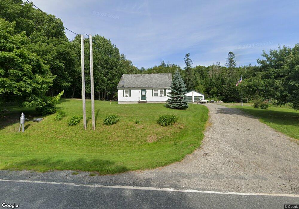
374 Castine Rd Orland, ME 04472
Estimated Value: $256,508 - $350,000
3
Beds
2
Baths
1,200
Sq Ft
$251/Sq Ft
Est. Value
About This Home
This home is located at 374 Castine Rd, Orland, ME 04472 and is currently estimated at $301,127, approximately $250 per square foot. 374 Castine Rd is a home located in Hancock County with nearby schools including G. Herbert Jewett School, Miles Lane School, and Bucksport Middle School.
Ownership History
Date
Name
Owned For
Owner Type
Purchase Details
Closed on
Jun 14, 2010
Sold by
Mcd Assoc Llc
Bought by
Peasley Melissa M and Peasley Joseph W
Current Estimated Value
Home Financials for this Owner
Home Financials are based on the most recent Mortgage that was taken out on this home.
Original Mortgage
$110,000
Interest Rate
5.11%
Mortgage Type
Commercial
Purchase Details
Closed on
Dec 17, 2009
Sold by
Us Bank Na
Bought by
Mcd Assn Llc
Purchase Details
Closed on
Mar 27, 2007
Sold by
Sullivan Floris H
Bought by
Kopeski Richard
Home Financials for this Owner
Home Financials are based on the most recent Mortgage that was taken out on this home.
Original Mortgage
$106,000
Interest Rate
8.75%
Mortgage Type
Commercial
Create a Home Valuation Report for This Property
The Home Valuation Report is an in-depth analysis detailing your home's value as well as a comparison with similar homes in the area
Purchase History
| Date | Buyer | Sale Price | Title Company |
|---|---|---|---|
| Peasley Melissa M | -- | -- | |
| Mcd Assn Llc | -- | -- | |
| Kopeski Richard | $1,001 | -- |
Source: Public Records
Mortgage History
| Date | Status | Borrower | Loan Amount |
|---|---|---|---|
| Previous Owner | Kopeski Richard | $110,000 | |
| Previous Owner | Kopeski Richard | $106,000 | |
| Previous Owner | Kopeski Richard | $26,500 |
Source: Public Records
Tax History
| Year | Tax Paid | Tax Assessment Tax Assessment Total Assessment is a certain percentage of the fair market value that is determined by local assessors to be the total taxable value of land and additions on the property. | Land | Improvement |
|---|---|---|---|---|
| 2024 | $2,352 | $193,070 | $36,340 | $156,730 |
| 2023 | $2,274 | $193,070 | $36,340 | $156,730 |
| 2022 | $1,888 | $193,070 | $36,340 | $156,730 |
| 2021 | $1,713 | $111,940 | $22,740 | $89,200 |
| 2020 | $1,713 | $111,940 | $22,740 | $89,200 |
| 2019 | $1,735 | $111,940 | $22,740 | $89,200 |
| 2018 | $1,644 | $111,940 | $22,740 | $89,200 |
| 2017 | $1,562 | $111,940 | $22,740 | $89,200 |
| 2016 | $1,534 | $111,940 | $22,740 | $89,200 |
| 2015 | $1,534 | $111,940 | $22,740 | $89,200 |
| 2014 | $1,590 | $111,940 | $22,740 | $89,200 |
| 2013 | $1,590 | $111,940 | $22,740 | $89,200 |
Source: Public Records
Map
Nearby Homes
- 207 Gray Meadow Rd
- 5-F, 4-A Leaches Point Rd
- 140 Castine Rd
- 141 Gross Point Rd
- 141 Gross Point Waterfront Rd
- 57 Dennis Rd
- 87 Beechwood Ln
- 110 Upper Falls Rd
- 7 Kindred Spirit Way
- 41 Wildwood Ln
- 7 Fox Run Rd
- 63 Pond St
- 29 Oak St
- 3 Main St
- 0 Holmes Dr
- 12 Mount View Ln
- 21 Federal St
- 6 Mount Olive Heights
- 00 Front Ridge Rd
- 54 W Side Dr
Your Personal Tour Guide
Ask me questions while you tour the home.