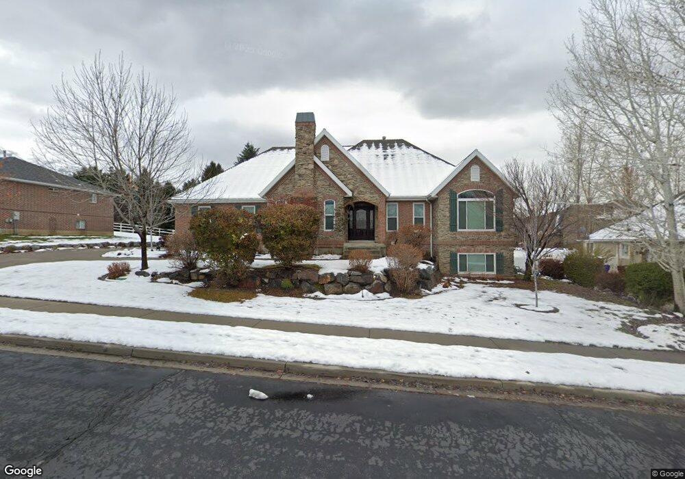
374 Maple Dr Alpine, UT 84004
Estimated Value: $1,012,000 - $1,327,000
About This Home
This home is located at 374 Maple Dr, Alpine, UT 84004 and is currently estimated at $1,146,765, approximately $461 per square foot. 374 Maple Dr is a home located in Utah County with nearby schools including Westfield School, Timberline Middle School, and Lone Peak High School.
Ownership History
We collect this data history from publicly available records. To have your information removed, we recommend requesting removal directly through your county’s website.
Purchase Details
Purchase Details
Home Financials for this Owner
Home Financials are based on the most recent Mortgage that was taken out on this home.Purchase Details
Home Financials for this Owner
Home Financials are based on the most recent Mortgage that was taken out on this home.Purchase Details
Home Financials for this Owner
Home Financials are based on the most recent Mortgage that was taken out on this home.Purchase Details
Home Financials for this Owner
Home Financials are based on the most recent Mortgage that was taken out on this home.Purchase Details
Purchase Details
Home Values in the Area
Average Home Value in this Area
Purchase History
We collect this data history from publicly available records. To have your information removed, we recommend requesting removal directly through your county’s website.
| Date | Buyer | Sale Price | Title Company |
|---|---|---|---|
| -- | None Listed On Document | ||
| -- | First American Orem | ||
| -- | Backman Stewart Title Servi | ||
| -- | First American Title Co | ||
| -- | -- | ||
| -- | First American Title Co | ||
| -- | First American Title Ins Co |
Mortgage History
We collect this data history from publicly available records. To have your information removed, we recommend requesting removal directly through your county’s website.
| Date | Status | Borrower | Loan Amount |
|---|---|---|---|
| Previous Owner | $156,500 | ||
| Previous Owner | $246,000 | ||
| Previous Owner | $231,800 |
Tax History
We collect this data history from publicly available records. To have your information removed, we recommend requesting removal directly through your county’s website.
| Year | Tax Paid | Tax Assessment Tax Assessment Total Assessment is a certain percentage of the fair market value that is determined by local assessors to be the total taxable value of land and additions on the property. | Land | Improvement |
|---|---|---|---|---|
| 2025 | $4,309 | $536,580 | -- | -- |
| 2024 | $4,309 | $502,205 | $0 | $0 |
| 2023 | $4,039 | $505,340 | $0 | $0 |
| 2022 | $3,764 | $457,435 | $0 | $0 |
| 2021 | $3,372 | $636,500 | $252,000 | $384,500 |
| 2020 | $3,281 | $606,100 | $229,100 | $377,000 |
| 2019 | $3,092 | $596,200 | $229,100 | $367,100 |
| 2018 | $2,995 | $570,700 | $203,600 | $367,100 |
| 2017 | $3,096 | $313,885 | $0 | $0 |
| 2016 | $3,346 | $316,305 | $0 | $0 |
| 2015 | $3,336 | $298,320 | $0 | $0 |
| 2014 | $3,259 | $288,310 | $0 | $0 |
Map
- 811 S High Ridge Dr
- 4848 W Sampson Ct
- 682 Healey Blvd
- 578 S High Bench Rd
- 130 Sunset Dr
- 250 S Main St Unit 25
- 250 S Main St Unit 24
- 250 S Main St Unit 9
- 250 S Main St Unit 7
- 815 E Alpine Dr
- 11398 Jonathan Rd Unit 9
- 630 E Center St
- 1284 N Sagewood Ln E
- 30 S Main St
- 121 N 300 E
- 868 S Braddock Ln
- 259 Twin River Loop
- 802 S East Mountain Cir
- 887 E Village Way
- 550 Blackhawk Ln
- 396 Maple Dr
- 395 Maple Dr
- 395 E Maple Dr
- 397 E Pheasant Ridge Dr
- 397 E Pheasant Ridge Dr Unit 5
- 359 Maple Dr
- 565 Ponderosa Dr
- 545 Ponderosa Dr
- 312 Maple Dr
- 312 E Maple Dr
- 351 E Pheasant Ridge Dr
- 351 E Pheasant Ridge Dr Unit 4
- 525 Ponderosa Dr
- 333 Maple Dr
- 488 Ponderosa Dr
- 213 Maple Dr
- 485 Ponderosa Dr
- 528 Ponderosa Dr Unit 8
- 288 Ridge Dr
- 378 E Pheasant Ridge Dr
Ask me questions while you tour the home.