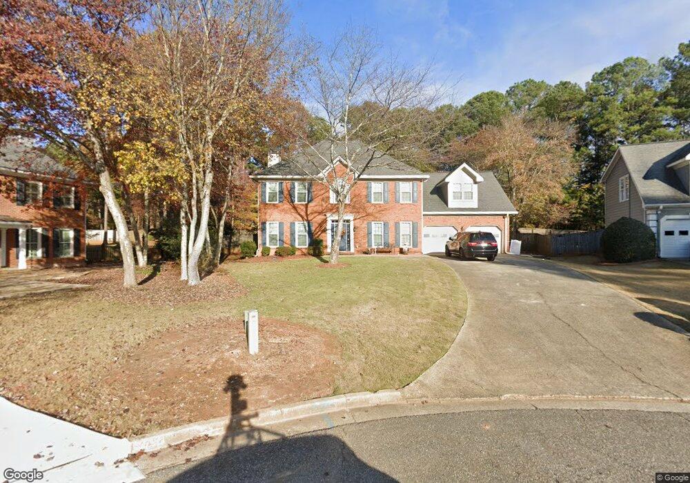
375 Rolling Mist Ct Alpharetta, GA 30022
Estimated Value: $735,000 - $839,000
4
Beds
4
Baths
3,096
Sq Ft
$249/Sq Ft
Est. Value
About This Home
This home is located at 375 Rolling Mist Ct, Alpharetta, GA 30022 and is currently estimated at $769,933, approximately $248 per square foot. 375 Rolling Mist Ct is a home located in Fulton County with nearby schools including Ocee Elementary School, Taylor Road Middle School, and Chattahoochee High School.
Ownership History
Date
Name
Owned For
Owner Type
Purchase Details
Closed on
Apr 12, 1994
Sold by
Callaway Craig F Kerry D
Bought by
Caselli Thomas J
Current Estimated Value
Home Financials for this Owner
Home Financials are based on the most recent Mortgage that was taken out on this home.
Original Mortgage
$85,000
Interest Rate
7.26%
Create a Home Valuation Report for This Property
The Home Valuation Report is an in-depth analysis detailing your home's value as well as a comparison with similar homes in the area
Home Values in the Area
Average Home Value in this Area
Purchase History
| Date | Buyer | Sale Price | Title Company |
|---|---|---|---|
| Caselli Thomas J | $189,000 | -- |
Source: Public Records
Mortgage History
| Date | Status | Borrower | Loan Amount |
|---|---|---|---|
| Closed | Caselli Thomas J | $85,000 | |
| Closed | Caselli Thomas J | $25,000 |
Source: Public Records
Tax History
| Year | Tax Paid | Tax Assessment Tax Assessment Total Assessment is a certain percentage of the fair market value that is determined by local assessors to be the total taxable value of land and additions on the property. | Land | Improvement |
|---|---|---|---|---|
| 2025 | $570 | $286,400 | $56,720 | $229,680 |
| 2023 | $7,295 | $258,440 | $44,600 | $213,840 |
| 2022 | $3,392 | $189,200 | $35,560 | $153,640 |
| 2021 | $3,818 | $166,360 | $31,840 | $134,520 |
| 2020 | $3,840 | $164,480 | $31,880 | $132,600 |
| 2019 | $593 | $161,600 | $31,320 | $130,280 |
| 2018 | $3,819 | $157,760 | $30,560 | $127,200 |
| 2017 | $3,349 | $126,920 | $28,680 | $98,240 |
| 2016 | $3,326 | $126,560 | $28,680 | $97,880 |
| 2015 | $3,866 | $126,560 | $28,680 | $97,880 |
| 2014 | $2,649 | $99,160 | $19,560 | $79,600 |
Source: Public Records
Map
Nearby Homes
- 545 Tadfield Trace
- 105 Kimball Bridge Cove
- 4120 Pineset Dr
- 4330 Hawthorn Cir
- 4275 Hawthorn Cir
- 3920 Brookline Dr
- 500 Willow Lookout
- 710 Country Manor Way
- 11025 Bracebridge Rd
- 4390 Pinewalk Dr
- 710 Mallory Manor Ct
- 10845 Tuxford Dr Unit 1
- 11125 Pinehigh Dr
- 10510 Colony Glen Dr Unit 2
- 785 Hedgewick Trail
- 10570 Buice Rd
- 135 Braided Blanket Bluff
- 4235 Park Brooke Trace Unit 5
- 750 Hedgewick Trail
- 10405 Meadow Crest Ln
- 385 Rolling Mist Ct
- 365 Rolling Mist Ct
- 320 Rolling Mist Ct
- 355 Rolling Mist Ct
- 115 Ridge Run Ave
- 125 Ridge Run Ave
- 310 Rolling Mist Ct
- 345 Rolling Mist Ct
- 10885 S Kimball Bridge Crossing
- 300 Rolling Mist Ct
- 130 Ridge Run Ave
- 10865 S Kimball Bridge Crossing
- 335 Rolling Mist Ct
- 10895 S Kimball Bridge Crossing
- 290 Rolling Mist Ct
- 10855 S Kimball Bridge Crossing
- 10855 Kimball Bridge Cing
- 120 Ridge Run Ave
- 110 Ridge Run Ave
- 10855 Misty Moon Ct
Your Personal Tour Guide
Ask me questions while you tour the home.