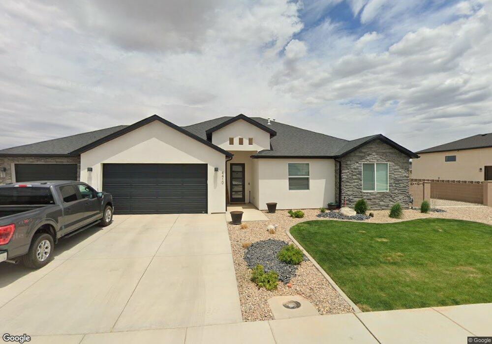
3760 N 250 E Cedar City, UT 84721
Estimated Value: $427,688 - $502,000
Studio
--
Bath
--
Sq Ft
17,860
Sq Ft Lot
About This Home
This home is located at 3760 N 250 E, Cedar City, UT 84721 and is currently estimated at $464,672. 3760 N 250 E is a home with nearby schools including Three Peaks School, Cedar Middle School, and Cedar City High School.
Ownership History
Date
Name
Owned For
Owner Type
Purchase Details
Closed on
May 16, 2018
Sold by
Schroeder James R and Racz Agnes
Bought by
Schroeder James R and Racz Agnes
Current Estimated Value
Purchase Details
Closed on
Jul 17, 2017
Sold by
Williams Development L L C
Bought by
Schroeder James R and Racz Agnes
Home Financials for this Owner
Home Financials are based on the most recent Mortgage that was taken out on this home.
Original Mortgage
$264,000
Outstanding Balance
$219,640
Interest Rate
3.94%
Mortgage Type
New Conventional
Estimated Equity
$245,032
Purchase Details
Closed on
Jan 11, 2017
Sold by
Orton Rodney K
Bought by
Williams Development Llc
Purchase Details
Closed on
Dec 13, 2007
Sold by
Weinward Krista
Bought by
Orton Rodney K
Purchase Details
Closed on
Jul 28, 2005
Sold by
Rko Family Lc
Bought by
Winward Krista
Create a Home Valuation Report for This Property
The Home Valuation Report is an in-depth analysis detailing your home's value as well as a comparison with similar homes in the area
Home Values in the Area
Average Home Value in this Area
Purchase History
| Date | Buyer | Sale Price | Title Company |
|---|---|---|---|
| Schroeder James R | -- | None Available | |
| Schroeder James R | -- | Security Escrow & Title Insu | |
| Williams Development Llc | -- | Southern Utah Title Of Cedar | |
| Orton Rodney K | -- | -- | |
| Winward Krista | -- | -- |
Source: Public Records
Mortgage History
| Date | Status | Borrower | Loan Amount |
|---|---|---|---|
| Open | Schroeder James R | $264,000 |
Source: Public Records
Tax History
| Year | Tax Paid | Tax Assessment Tax Assessment Total Assessment is a certain percentage of the fair market value that is determined by local assessors to be the total taxable value of land and additions on the property. | Land | Improvement |
|---|---|---|---|---|
| 2025 | $1,794 | $245,763 | $45,650 | $200,113 |
| 2023 | $1,805 | $236,575 | $40,600 | $195,975 |
| 2022 | $1,855 | $216,825 | $38,665 | $178,160 |
| 2021 | $1,465 | $171,210 | $22,745 | $148,465 |
| 2020 | $1,467 | $157,470 | $22,745 | $134,725 |
| 2019 | $1,510 | $143,110 | $20,630 | $122,480 |
| 2018 | $1,453 | $137,660 | $18,755 | $118,905 |
| 2017 | $343 | $34,100 | $34,100 | $0 |
| 2016 | $218 | $20,200 | $20,200 | $0 |
| 2015 | $231 | $20,200 | $0 | $0 |
| 2014 | $246 | $20,200 | $0 | $0 |
Source: Public Records
Map
Nearby Homes
- 3643 170 E
- 3870 N Minersville Hwy Unit 35
- 0 Parcel 2 Virgin Vista Ent Subd Unit 26-268178
- 0 Parcel 2 Virgin Vista Ent Subd Unit 114452
- 3879 N Hawks Landing Lp
- 3887 N Hawks Landing Loop Unit 9
- 3887 N Hawks Landing Lp W
- 0 Parcel 3 Virgin Vista Ent-L Unit 25-261080
- 0 Parcel 3 Virgin Vista Ent Subd Unit 111239
- 5 E Sara Ln Unit Lot 10
- 15 E Sara Ln Unit Lot 12
- 3900 Quarterhorse Dr
- 4009 N Sara Ln Unit 3
- 4009 N Sara Ln Unit Lot 3
- 9 E Sara Ln Unit Lot 11
- 4125 N Minersville Hwy
- 800 N Lund Hwy 19 Acres & Water
- 35 Lot Cottonwood Hollow
- 1032 N Fern St
- 800 N Lund Hwy 19 44 Acres & Water
- 3776 N 250 E
- 3744 N 250 E
- 3744 250 E
- 3745 N Minersville Hwy
- 3792 N 250 E
- 3728 N 250 E
- 3759 N 250 E
- 3769 N Minersville Hwy
- 3792 N 250 E
- 3775 N 250 E
- 3733 N Minersville Hwy
- 3743 N 250 E
- 3791 N 250 E
- 3727 N 250 E
- 3711 N Minersville Hwy
- 4942 250 E Unit Dairy Glen lot 20
- 4902 250 E Unit Dairy Glen lot 22
- 4902 250 E
- 4942 250 E
- 4900 250 E
Your Personal Tour Guide
Ask me questions while you tour the home.