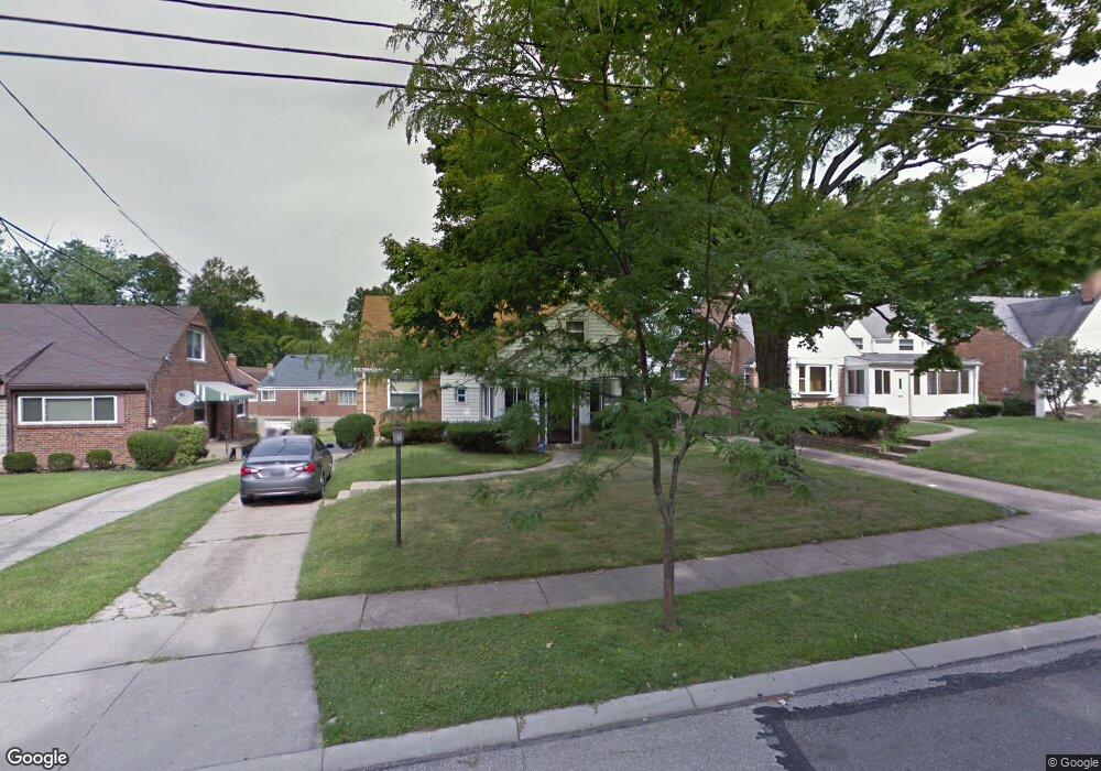
3770 Aikenside Ave Cincinnati, OH 45213
Kennedy Heights NeighborhoodEstimated Value: $295,812 - $320,000
3
Beds
2
Baths
1,646
Sq Ft
$185/Sq Ft
Est. Value
About This Home
This home is located at 3770 Aikenside Ave, Cincinnati, OH 45213 and is currently estimated at $304,953, approximately $185 per square foot. 3770 Aikenside Ave is a home located in Hamilton County with nearby schools including John P. Parker School, Shroder High School, and Clark Montessori High School.
Ownership History
Date
Name
Owned For
Owner Type
Purchase Details
Closed on
Jul 1, 2009
Sold by
Bell Staci and Bell Terrance S
Bought by
Bell Staci and Bell Terrance S
Current Estimated Value
Purchase Details
Closed on
Apr 17, 2007
Sold by
Estate Of Bobbie J Barnes
Bought by
Barnes Thomas B
Create a Home Valuation Report for This Property
The Home Valuation Report is an in-depth analysis detailing your home's value as well as a comparison with similar homes in the area
Home Values in the Area
Average Home Value in this Area
Purchase History
We collect this data history from publicly available records. To have your information removed, we recommend requesting removal directly through your county’s website.
| Date | Buyer | Sale Price | Title Company |
|---|---|---|---|
| Bell Staci | -- | Attorney | |
| Barnes Thomas B | -- | None Available |
Source: Public Records
Tax History
| Year | Tax Paid | Tax Assessment Tax Assessment Total Assessment is a certain percentage of the fair market value that is determined by local assessors to be the total taxable value of land and additions on the property. | Land | Improvement |
|---|---|---|---|---|
| 2025 | $4,032 | $65,346 | $14,781 | $50,565 |
| 2023 | $3,998 | $65,346 | $14,781 | $50,565 |
| 2022 | $3,216 | $47,089 | $11,130 | $35,959 |
| 2021 | $3,092 | $47,089 | $11,130 | $35,959 |
| 2020 | $3,182 | $47,089 | $11,130 | $35,959 |
| 2019 | $3,079 | $41,671 | $9,849 | $31,822 |
| 2018 | $3,084 | $41,671 | $9,849 | $31,822 |
| 2017 | $2,929 | $41,671 | $9,849 | $31,822 |
| 2016 | $3,220 | $45,179 | $9,818 | $35,361 |
| 2015 | $2,903 | $45,179 | $9,818 | $35,361 |
| 2014 | $2,924 | $45,179 | $9,818 | $35,361 |
| 2013 | $2,833 | $43,026 | $9,349 | $33,677 |
Source: Public Records
Map
Nearby Homes
- 5866 Kennedy Ave
- 5846 Robison Rd
- 6097 W Fordham Place
- 3830 Iberis Ave
- 5781 Kennedy Ave
- 3946 Cedarwood Place
- 3837 Iona Ave
- 3765 Iona Ave
- 6207 Coleridge Ave
- 3946 S Fordham Place
- 6211 Coleridge Ave
- 3515 Ravenwood Ave
- 3962 S Fordham Place
- 5913 Kimberly Ave
- 3942 Standish Ave
- 3529 Zinsle Ave
- 3962 Standish Ave
- 6501 Coleridge Ave
- 5907 Woodmont Ave
- 6507 Coleridge Ave
- 3776 Aikenside Ave
- 5849 Pointer Ln
- 5851 Pointer Ln
- 3780 Aikenside Ave
- 3762 Aikenside Ave
- 5847 Pointer Ln
- 5853 Pointer Ln
- 3769 Aikenside Ave
- 3765 Aikenside Ave
- 3775 Aikenside Ave
- 3784 Aikenside Ave
- 3758 Aikenside Ave
- 3816 Aikenside Ave
- 3761 Aikenside Ave
- 3779 Aikenside Ave
- 5843 Pointer Ln
- 5852 Pointer Ln
- 3757 Aikenside Ave
- 3754 Aikenside Ave
- 3783 Aikenside Ave
Your Personal Tour Guide
Ask me questions while you tour the home.