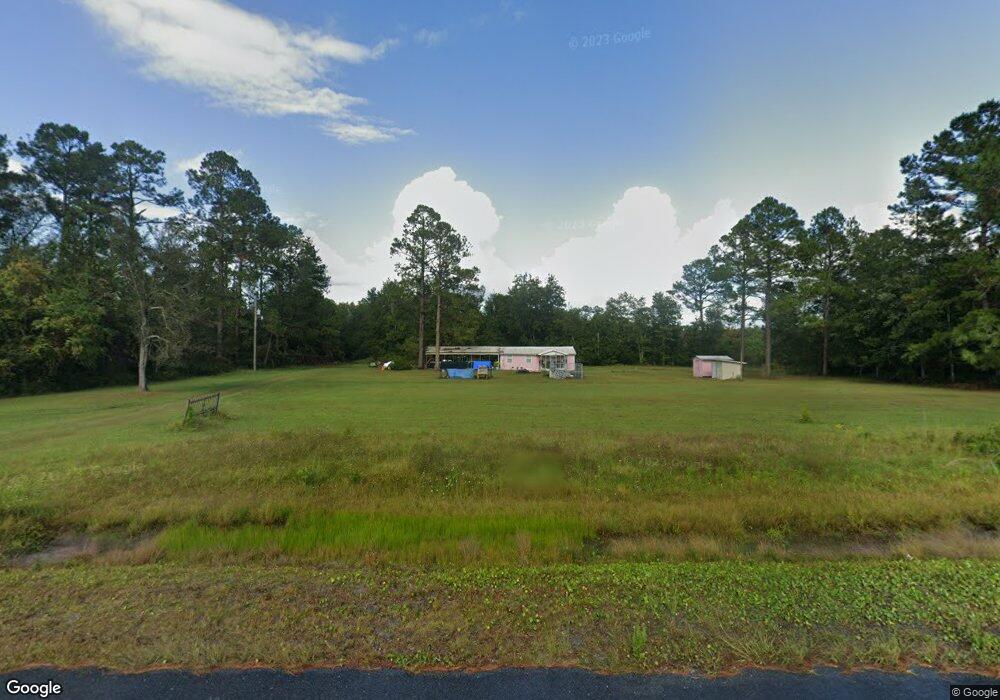
3785 Memorial Dr Waycross, GA 31503
Estimated Value: $93,951 - $126,000
2
Beds
1
Bath
820
Sq Ft
$134/Sq Ft
Est. Value
About This Home
This home is located at 3785 Memorial Dr, Waycross, GA 31503 and is currently estimated at $109,988, approximately $134 per square foot. 3785 Memorial Dr is a home located in Ware County with nearby schools including Memorial Drive Elementary School, Waycross Middle School, and Ware County High School.
Ownership History
Date
Name
Owned For
Owner Type
Purchase Details
Closed on
Sep 21, 2021
Sold by
Smith Leon Robert
Bought by
Foster Lane A
Current Estimated Value
Home Financials for this Owner
Home Financials are based on the most recent Mortgage that was taken out on this home.
Original Mortgage
$72,250
Outstanding Balance
$65,311
Interest Rate
2.8%
Mortgage Type
New Conventional
Estimated Equity
$44,677
Purchase Details
Closed on
Apr 11, 1997
Sold by
Talbot State Bank
Bought by
Smith Leon R
Purchase Details
Closed on
Mar 11, 1997
Sold by
Sanders John Frankli
Bought by
Talbot State Bank
Purchase Details
Closed on
Sep 4, 1991
Bought by
Sanders John Frankli
Purchase Details
Closed on
Dec 23, 1987
Create a Home Valuation Report for This Property
The Home Valuation Report is an in-depth analysis detailing your home's value as well as a comparison with similar homes in the area
Purchase History
| Date | Buyer | Sale Price | Title Company |
|---|---|---|---|
| Foster Lane A | $85,000 | -- | |
| Smith Leon R | $12,400 | -- | |
| Talbot State Bank | $12,400 | -- | |
| Sanders John Frankli | -- | -- | |
| -- | -- | -- |
Source: Public Records
Mortgage History
| Date | Status | Borrower | Loan Amount |
|---|---|---|---|
| Open | Foster Lane A | $72,250 |
Source: Public Records
Tax History
| Year | Tax Paid | Tax Assessment Tax Assessment Total Assessment is a certain percentage of the fair market value that is determined by local assessors to be the total taxable value of land and additions on the property. | Land | Improvement |
|---|---|---|---|---|
| 2025 | $362 | $23,252 | $3,570 | $19,682 |
| 2024 | $362 | $21,772 | $3,570 | $18,202 |
| 2023 | $369 | $20,864 | $5,735 | $15,129 |
| 2022 | $426 | $20,864 | $5,735 | $15,129 |
| 2021 | $382 | $15,184 | $5,702 | $9,482 |
| 2020 | $382 | $15,190 | $5,702 | $9,488 |
| 2019 | $384 | $14,847 | $5,702 | $9,145 |
| 2018 | $381 | $14,504 | $5,702 | $8,802 |
| 2017 | $381 | $14,504 | $5,702 | $8,802 |
| 2016 | $381 | $14,504 | $5,702 | $8,802 |
| 2015 | $385 | $14,504 | $5,702 | $8,802 |
| 2014 | $384 | $14,504 | $5,702 | $8,802 |
| 2013 | -- | $14,504 | $5,702 | $8,801 |
Source: Public Records
Map
Nearby Homes
- 1670 Astoria Rd
- 8.84 Strickland Rd
- 4825 Duck Rd
- 4337 Whitehall Church Rd
- 300 Josephine Park Rd
- 291 Sawdust Trail
- 565 S Oaks Ct
- 0 Brunswick Hwy Unit 1648370
- 2972 Orion Dr
- 664 Saddle Cir
- 606 Stonewall Jackson Place
- 627 Saddle Cir
- 851 Carriage Ln
- 716 Stonewall Jackson Place
- 00 Swamp Rd
- 0 Swamp Rd
- 932 Hitching Post Ln
- 763 Kentland Dr
- 0 Memorial Dr Unit 10716966
- 0 Memorial Dr Unit 10716986
- 3929 Memorial Dr
- 3715 Memorial Dr
- 3810 Memorial Dr
- 3802 Memorial Dr
- 3906 Memorial Dr
- 1475 Mcclellan Rd
- 1520 Mcclelland Rd
- 1504 Bar Pit Rd
- 1525 Mcclelland Rd
- 1493 Astoria Rd
- 3685 Astoria Ln
- 3940 Memorial Dr
- 1425 Astoria Rd
- 3690 Astoria Ln
- 1511 Astoria Rd
- 1530 Bar Pit Rd
- 1555 Frank Cowart Ln
- 1490 Astoria Rd
- 1470 Astoria Rd
- 1502 Astoria Rd
Your Personal Tour Guide
Ask me questions while you tour the home.