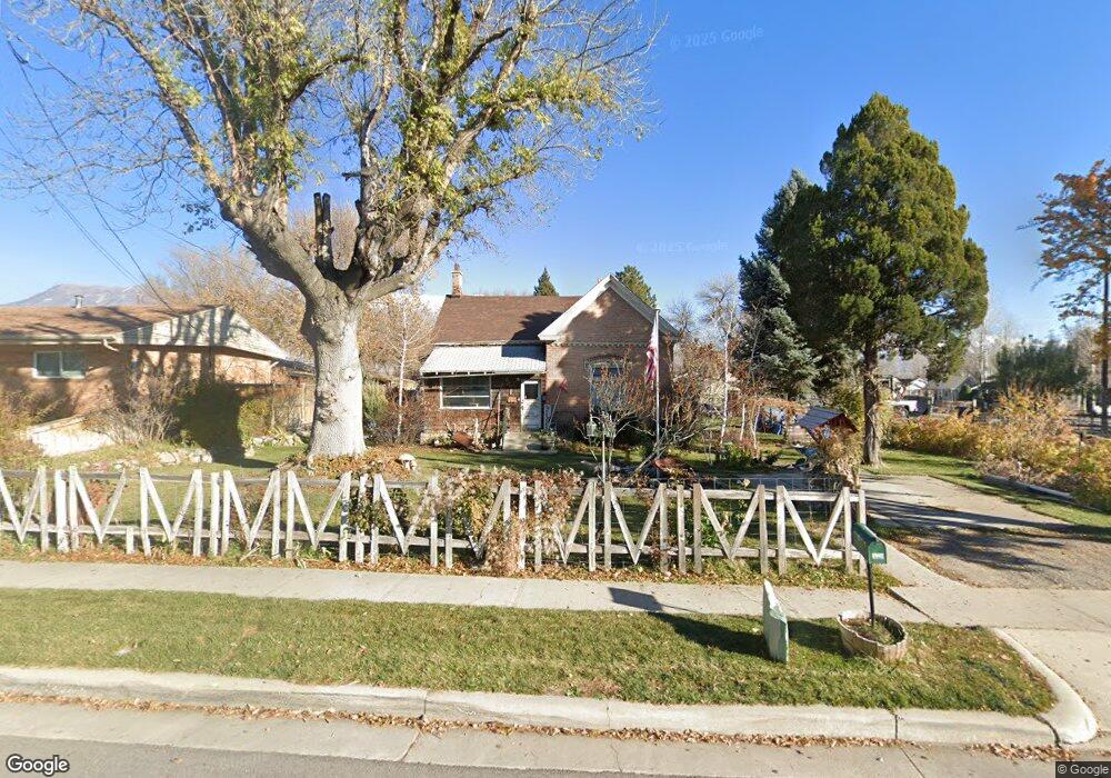
379 S 100 E American Fork, UT 84003
Estimated Value: $477,000 - $634,000
3
Beds
2
Baths
2,139
Sq Ft
$254/Sq Ft
Est. Value
About This Home
This home is located at 379 S 100 E, American Fork, UT 84003 and is currently estimated at $544,278, approximately $254 per square foot. 379 S 100 E is a home located in Utah County with nearby schools including Greenwood Elementary School, American Fork Junior High School, and American Fork High School.
Ownership History
Date
Name
Owned For
Owner Type
Purchase Details
Closed on
Jan 30, 2013
Sold by
Johnson J Michael and Johnson Karen M
Bought by
Johnson James M and Johnson Karen M
Current Estimated Value
Home Financials for this Owner
Home Financials are based on the most recent Mortgage that was taken out on this home.
Original Mortgage
$70,150
Outstanding Balance
$13,761
Interest Rate
3.29%
Mortgage Type
New Conventional
Estimated Equity
$530,517
Purchase Details
Closed on
Dec 23, 2003
Sold by
Mecham Leo J
Bought by
Johnson J Michael and Johnson Karen M
Purchase Details
Closed on
Dec 19, 2003
Sold by
Mecham Crosby E
Bought by
Johnson J Michael and Johnson Karen M
Purchase Details
Closed on
Dec 18, 2003
Sold by
Clark Nina Jo
Bought by
Johnson J Michael and Johnson Karen M
Purchase Details
Closed on
Dec 15, 2003
Sold by
Johnson Karen M
Bought by
Johnson J Michael and Johnson Karen M
Purchase Details
Closed on
Apr 21, 2000
Sold by
Johnson Karen M
Bought by
Johnson James Michael and Johnson Karen M
Home Financials for this Owner
Home Financials are based on the most recent Mortgage that was taken out on this home.
Original Mortgage
$67,600
Interest Rate
8.24%
Purchase Details
Closed on
Apr 20, 2000
Sold by
Mecham Crosby E
Bought by
Johnson James Michael and Johnson Karen M
Home Financials for this Owner
Home Financials are based on the most recent Mortgage that was taken out on this home.
Original Mortgage
$67,600
Interest Rate
8.24%
Purchase Details
Closed on
Apr 13, 2000
Sold by
Mecham Lynn N
Bought by
Johnson James Michael and Johnson Karen M
Home Financials for this Owner
Home Financials are based on the most recent Mortgage that was taken out on this home.
Original Mortgage
$67,600
Interest Rate
8.24%
Create a Home Valuation Report for This Property
The Home Valuation Report is an in-depth analysis detailing your home's value as well as a comparison with similar homes in the area
Home Values in the Area
Average Home Value in this Area
Purchase History
| Date | Buyer | Sale Price | Title Company |
|---|---|---|---|
| Johnson James M | -- | None Available | |
| Johnson J Michael | -- | Backman Stewart Title Servi | |
| Johnson J Michael | -- | Backman Stewart Title Servi | |
| Johnson J Michael | -- | Backman Stewart Title Servi | |
| Johnson J Michael | -- | Backman Stewart Title Servi | |
| Johnson J Michael | -- | Backman Stewart Title Servi | |
| Johnson J Michael | -- | Backman Stewart Title Servi | |
| Johnson James Michael | -- | Equity Title Agency Inc | |
| Johnson James Michael | -- | Equity Title Agency Inc | |
| Johnson James Michael | -- | Equity Title Agency Inc | |
| Johnson James Michael | -- | Equity Title Agency Inc | |
| Johnson James Michael | -- | Equity Title Agency Inc | |
| Johnson James Michael | -- | Equity Title Agency Inc |
Source: Public Records
Mortgage History
| Date | Status | Borrower | Loan Amount |
|---|---|---|---|
| Open | Johnson James M | $70,150 | |
| Previous Owner | Johnson James Michael | $67,600 |
Source: Public Records
Tax History
| Year | Tax Paid | Tax Assessment Tax Assessment Total Assessment is a certain percentage of the fair market value that is determined by local assessors to be the total taxable value of land and additions on the property. | Land | Improvement |
|---|---|---|---|---|
| 2025 | $2,146 | $252,835 | -- | -- |
| 2024 | $2,146 | $238,480 | $0 | $0 |
| 2023 | $2,031 | $239,195 | $0 | $0 |
| 2022 | $2,270 | $263,890 | $0 | $0 |
| 2021 | $1,938 | $351,900 | $168,200 | $183,700 |
| 2020 | $1,810 | $318,700 | $150,200 | $168,500 |
| 2019 | $1,632 | $297,300 | $128,800 | $168,500 |
| 2018 | $1,507 | $262,400 | $115,900 | $146,500 |
| 2017 | $1,469 | $138,050 | $0 | $0 |
| 2016 | $1,349 | $117,810 | $0 | $0 |
| 2015 | $1,337 | $110,825 | $0 | $0 |
| 2014 | $1,222 | $99,880 | $0 | $0 |
Source: Public Records
Map
Nearby Homes
Your Personal Tour Guide
Ask me questions while you tour the home.