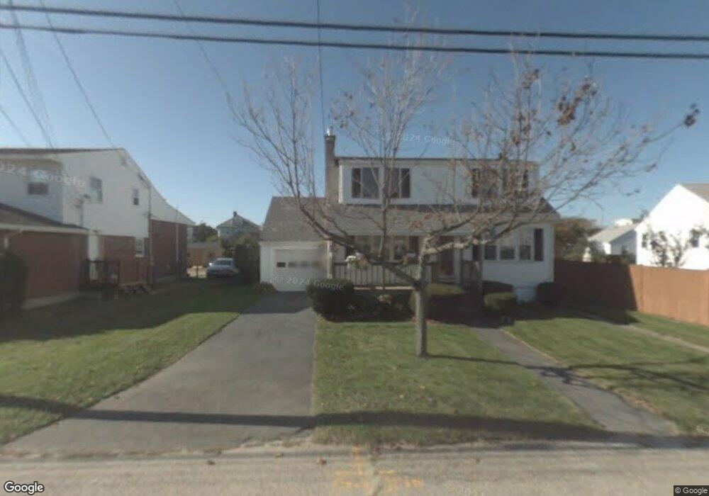
37R Samoset Ave Hull, MA 02045
Whitehead NeighborhoodEstimated Value: $1,001,000 - $1,460,000
4
Beds
4
Baths
2,246
Sq Ft
$502/Sq Ft
Est. Value
About This Home
This home is located at 37R Samoset Ave, Hull, MA 02045 and is currently estimated at $1,127,533, approximately $502 per square foot. 37R Samoset Ave is a home with nearby schools including Lillian M. Jacobs Elementary School, Memorial Middle School, and Hull High School.
Ownership History
Date
Name
Owned For
Owner Type
Purchase Details
Closed on
Aug 29, 2024
Sold by
Conrad-Miller Marcisa and Miller Robert M
Bought by
Miller Ft and Conrad-Miller
Current Estimated Value
Purchase Details
Closed on
Nov 19, 2020
Sold by
Miller Ft 2013 and Conrad-Miller
Bought by
Conrad-Miller Marcia and Miller Robert M
Home Financials for this Owner
Home Financials are based on the most recent Mortgage that was taken out on this home.
Original Mortgage
$329,000
Interest Rate
2.8%
Mortgage Type
New Conventional
Purchase Details
Closed on
Apr 29, 2011
Sold by
Valenti Anthony and Valenti Elke
Bought by
Samoset Dev Corp
Create a Home Valuation Report for This Property
The Home Valuation Report is an in-depth analysis detailing your home's value as well as a comparison with similar homes in the area
Home Values in the Area
Average Home Value in this Area
Purchase History
We collect this data history from publicly available records. To have your information removed, we recommend requesting removal directly through your county’s website.
| Date | Buyer | Sale Price | Title Company |
|---|---|---|---|
| Miller Ft | -- | None Available | |
| Miller Ft | -- | None Available | |
| Conrad-Miller Marcia | -- | None Available | |
| Conrad-Miller Marcia | -- | None Available | |
| Conrad-Miller Marcia | -- | None Available | |
| Samoset Dev Corp | $97,000 | -- | |
| Samoset Dev Corp | $97,000 | -- |
Source: Public Records
Mortgage History
We collect this data history from publicly available records. To have your information removed, we recommend requesting removal directly through your county’s website.
| Date | Status | Borrower | Loan Amount |
|---|---|---|---|
| Previous Owner | Conrad-Miller Marcia | $329,000 |
Source: Public Records
Tax History
| Year | Tax Paid | Tax Assessment Tax Assessment Total Assessment is a certain percentage of the fair market value that is determined by local assessors to be the total taxable value of land and additions on the property. | Land | Improvement |
|---|---|---|---|---|
| 2025 | $8,737 | $780,100 | $293,000 | $487,100 |
| 2024 | $8,649 | $742,400 | $284,900 | $457,500 |
| 2023 | $7,833 | $643,600 | $244,200 | $399,400 |
| 2022 | $7,587 | $605,000 | $227,900 | $377,100 |
| 2021 | $7,313 | $576,700 | $203,500 | $373,200 |
| 2020 | $7,205 | $562,000 | $203,500 | $358,500 |
| 2019 | $7,095 | $543,700 | $195,300 | $348,400 |
| 2018 | $6,536 | $487,000 | $195,300 | $291,700 |
| 2017 | $6,403 | $466,700 | $195,300 | $271,400 |
| 2016 | $6,731 | $499,300 | $227,900 | $271,400 |
| 2015 | $6,111 | $438,400 | $162,800 | $275,600 |
| 2014 | $6,081 | $438,400 | $162,800 | $275,600 |
Source: Public Records
Map
Nearby Homes
- 69 Beach Ave
- 67 Newport Rd
- 107 Newport Rd
- 15 Russell St
- 580 Nantasket Ave
- 5 Vernon Ave
- 6 Touraine Ave
- 439 Newport Rd
- 637 Nantasket Ave
- 50 Prospect Ave
- 63 Halvorsen Ave
- 48A B St
- 47 B St Unit beachside
- 62 C St
- 28 E St
- 77 Salisbury St
- 34 F St
- 202 N Truro St
- 00 George Washington Blvd
- 15 Park Ave Unit 107
- 37-A Samoset Ave
- 37 Samoset Ave
- 37 Samoset Ave
- 00 Massasoit Ave
- 0 Massasoit Ave Unit 71253336
- 39 Samoset Ave
- 12 Malta St
- 10 Malta St Unit 8
- 10 Malta St Yr Rnd Only Unit 5
- 10 Malta St Unit 2
- 10 Malta St Unit 3
- 10 Malta St Unit 5
- 10 Malta St Unit 6
- 10 Malta St Unit 4
- 10 Malta St Unit 7
- 10 Malta St
- 10 Malta St Unit X
- 420 Nantasket Ave
- 41 Samoset Ave Unit September
- 41 Samoset Ave Unit August
Your Personal Tour Guide
Ask me questions while you tour the home.