37W038 Brookside Dr Elgin, IL 60124
Far West Elgin NeighborhoodEstimated Value: $376,000 - $427,324
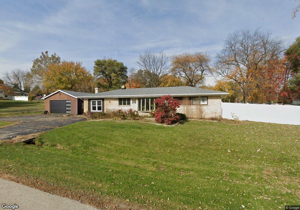
About This Home
This home is located at 37W038 Brookside Dr, Elgin, IL 60124 and is currently estimated at $408,331, approximately $193 per square foot. 37W038 Brookside Dr is a home located in Kane County with nearby schools including Hillcrest Elementary School, Kimball Middle School, and Larkin High School.
Ownership History
We collect this data history from publicly available records. To have your information removed, we recommend requesting removal directly through your county’s website.
Purchase Details
Purchase Details
Home Financials for this Owner
Home Financials are based on the most recent Mortgage that was taken out on this home.Purchase Details
Purchase Details
Purchase Details
Purchase Details
Home Financials for this Owner
Home Financials are based on the most recent Mortgage that was taken out on this home.Purchase Details
Purchase Details
Home Financials for this Owner
Home Financials are based on the most recent Mortgage that was taken out on this home.Home Values in the Area
Average Home Value in this Area
Purchase History
We collect this data history from publicly available records. To have your information removed, we recommend requesting removal directly through your county’s website.
| Date | Buyer | Sale Price | Title Company |
|---|---|---|---|
| -- | Tabor Law Office Pc | ||
| -- | Baird & Warner Title Svcs In | ||
| $235,000 | Baird & Warner Title Svcs In | ||
| -- | None Available | ||
| $146,000 | Central Illinois Title Co | ||
| $478,242 | None Available | ||
| $365,000 | First American Title Ins Co | ||
| -- | None Available | ||
| $175,500 | Chicago Title Insurance Co |
Mortgage History
We collect this data history from publicly available records. To have your information removed, we recommend requesting removal directly through your county’s website.
| Date | Status | Borrower | Loan Amount |
|---|---|---|---|
| Previous Owner | $188,000 | ||
| Previous Owner | $365,000 | ||
| Previous Owner | $140,000 |
Tax History
We collect this data history from publicly available records. To have your information removed, we recommend requesting removal directly through your county’s website.
| Year | Tax Paid | Tax Assessment Tax Assessment Total Assessment is a certain percentage of the fair market value that is determined by local assessors to be the total taxable value of land and additions on the property. | Land | Improvement |
|---|---|---|---|---|
| 2024 | $7,720 | $115,489 | $21,388 | $94,101 |
| 2023 | $7,338 | $104,335 | $19,322 | $85,013 |
| 2022 | $6,960 | $95,135 | $17,618 | $77,517 |
| 2021 | $6,559 | $88,945 | $16,472 | $72,473 |
| 2020 | $6,353 | $84,912 | $15,725 | $69,187 |
| 2019 | $6,111 | $80,884 | $14,979 | $65,905 |
| 2018 | $6,699 | $84,164 | $14,111 | $70,053 |
| 2017 | $7,046 | $79,565 | $13,340 | $66,225 |
| 2016 | $6,768 | $73,815 | $12,376 | $61,439 |
| 2015 | -- | $67,658 | $11,344 | $56,314 |
| 2014 | -- | $63,508 | $13,398 | $50,110 |
| 2013 | -- | $65,183 | $13,751 | $51,432 |
Map
- 11N958 Almora Terrace
- 11N802 Win Haven Dr
- 12N085 Wildmere Dr
- 640 Highland Springs Dr
- Lot 1 Highland Springs Dr
- 2205 Country Knoll Ln
- 40 Acres Randall Rd
- 2789 Randall Ridge Dr
- 2030 Lucca Ct
- 12N320 Jackson Dr
- 88 N Airlite St
- 92 N Airlite St
- 1975 Sandy Creek Dr Unit 22
- 281 Governors Ln
- 637 N Lyle Ave
- 1840 W Highland Ave Unit E-105
- 1905 Salem Rd
- 1900 Powder River Path
- 2153 Jordan Cir
- 530 Cumberland Trail
- 11N936 Randall Rd
- 11N323 Brookside Dr
- 11N935 Hilltop Rd
- Lot 5 Tall Oaks Ct
- 11N911 Hilltop Rd
- 37W055 Brookside Dr
- 11N964 Randall Rd
- 37W075 Brookside Dr
- 401 Tall Oaks Ct
- 403 Tall Oaks Ct
- 403 Tall Oaks Ct Unit 403
- 413 Tall Oaks Ct
- 11N959 Hilltop Rd
- 405 Tall Oaks Ct
- 11N984 Randall Rd
- 37W097 Brookside Dr
- 11N981 Hilltop Rd
- 11N916 Hilltop Rd
- 2401 Tall Oaks Dr
- Lot 1 Brookside Dr
Ask me questions while you tour the home.