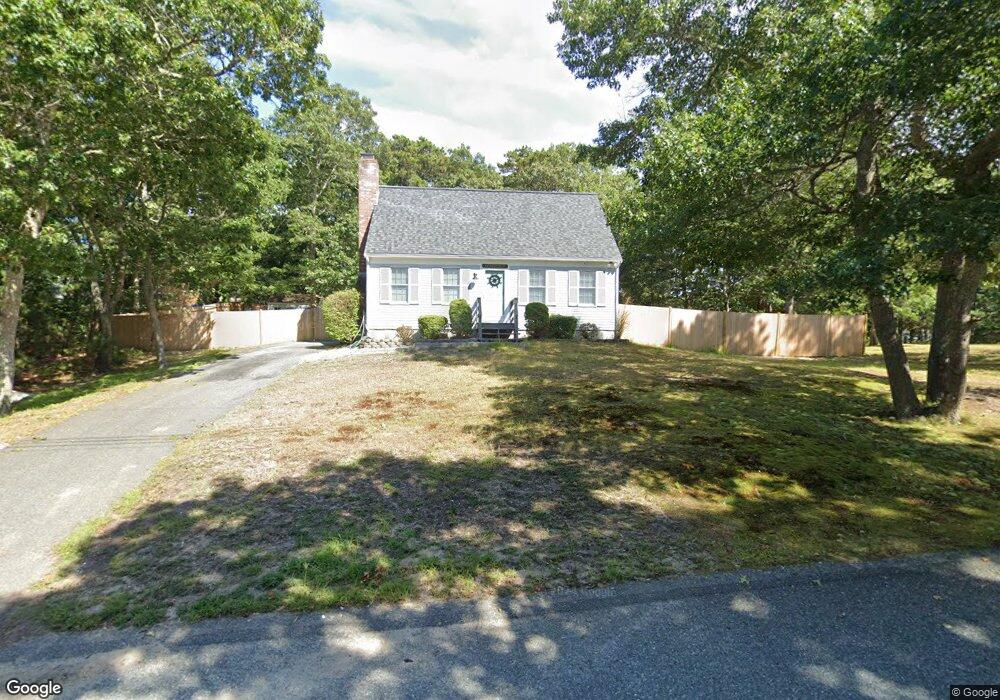
38 Captain Prestons Rd Dennis, MA 02638
Dennis Village NeighborhoodEstimated Value: $618,000 - $750,000
3
Beds
2
Baths
1,380
Sq Ft
$477/Sq Ft
Est. Value
About This Home
This home is located at 38 Captain Prestons Rd, Dennis, MA 02638 and is currently estimated at $658,712, approximately $477 per square foot. 38 Captain Prestons Rd is a home located in Barnstable County with nearby schools including Dennis-Yarmouth Regional High School.
Ownership History
Date
Name
Owned For
Owner Type
Purchase Details
Closed on
Jun 8, 2005
Sold by
Magagnos Kathleen and Magagnos Patrick J
Bought by
Spafford Christopher and Spafford Susan L
Current Estimated Value
Home Financials for this Owner
Home Financials are based on the most recent Mortgage that was taken out on this home.
Original Mortgage
$320,000
Outstanding Balance
$160,896
Interest Rate
5.79%
Mortgage Type
Purchase Money Mortgage
Estimated Equity
$497,816
Purchase Details
Closed on
Jan 28, 2000
Sold by
Staffiere Anthony
Bought by
Magagnos Patrick and Magagnos Kathleen A
Home Financials for this Owner
Home Financials are based on the most recent Mortgage that was taken out on this home.
Original Mortgage
$155,500
Interest Rate
7.83%
Mortgage Type
Purchase Money Mortgage
Create a Home Valuation Report for This Property
The Home Valuation Report is an in-depth analysis detailing your home's value as well as a comparison with similar homes in the area
Home Values in the Area
Average Home Value in this Area
Purchase History
| Date | Buyer | Sale Price | Title Company |
|---|---|---|---|
| Spafford Christopher | $400,000 | -- | |
| Magagnos Patrick | $56,000 | -- |
Source: Public Records
Mortgage History
| Date | Status | Borrower | Loan Amount |
|---|---|---|---|
| Open | Spafford Christopher | $320,000 | |
| Previous Owner | Magagnos Patrick | $155,500 |
Source: Public Records
Tax History
| Year | Tax Paid | Tax Assessment Tax Assessment Total Assessment is a certain percentage of the fair market value that is determined by local assessors to be the total taxable value of land and additions on the property. | Land | Improvement |
|---|---|---|---|---|
| 2025 | $2,371 | $547,600 | $176,400 | $371,200 |
| 2024 | $2,362 | $538,000 | $177,700 | $360,300 |
| 2023 | $2,285 | $489,200 | $161,600 | $327,600 |
| 2022 | $2,116 | $377,800 | $132,300 | $245,500 |
| 2021 | $1,971 | $326,800 | $129,700 | $197,100 |
| 2020 | $2,166 | $355,000 | $129,700 | $225,300 |
| 2019 | $2,117 | $343,100 | $139,900 | $203,200 |
| 2018 | $1,984 | $312,900 | $121,100 | $191,800 |
| 2017 | $1,924 | $312,900 | $121,100 | $191,800 |
| 2016 | $2,056 | $314,800 | $151,300 | $163,500 |
| 2015 | $2,015 | $314,800 | $151,300 | $163,500 |
| 2014 | $1,775 | $279,500 | $121,100 | $158,400 |
Source: Public Records
Map
Nearby Homes
- 59 Main St Unit 7-3
- 59 Main St Unit 19-2
- 59 Route 6a Unit 9-2
- 59 Route 6a Unit 7-3
- 59 Massachusetts 6a Unit 19-2
- 14 S Yarmouth Rd
- 568 Route 6a
- 39 Whittier Dr
- 26 S West Dr
- 268 Main St
- 20 Bray Farm Rd S
- 15 Jonquil Rd
- 15 Musket Ln
- 54 Kates Path Unit 54
- 16 Hazelwood Rd
- 15 John Hall Cartway Unit 15
- 10 Uncle Bills Way
- 480 Main St
- 6 Thomas Ct
- 15 Signal Hill Dr
- 44 Captain Preston's Rd
- 44 Captain Prestons Rd
- 65 S Yarmouth Rd
- 32 Captain Prestons Rd
- 43 Captain Prestons Rd
- 61 S Yarmouth Rd
- 73 S Yarmouth Rd
- 1 Marian Way
- 37 Captain Prestons Rd
- 26 Captain Prestons Rd
- 74 S Yarmouth Rd
- 50 Captain Prestons Rd
- 53 S Yarmouth Rd
- 81 S Yarmouth Rd
- 70 S Yarmouth Rd
- 78 S Yarmouth Rd
- 3 Marian Way
- 66 S Yarmouth Rd
- 29 Captain Prestons Rd
- 62 S Yarmouth Rd
Your Personal Tour Guide
Ask me questions while you tour the home.