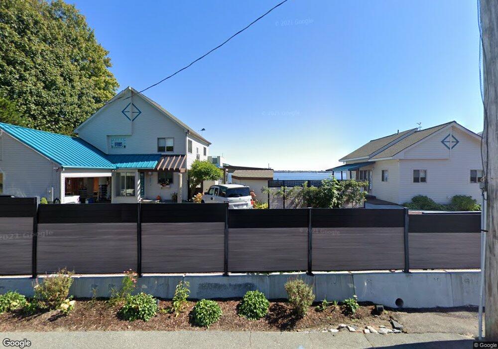
38 E Shore Rd Jamestown, RI 02835
East Shore Road NeighborhoodEstimated Value: $1,640,994 - $2,040,000
3
Beds
3
Baths
2,546
Sq Ft
$741/Sq Ft
Est. Value
About This Home
This home is located at 38 E Shore Rd, Jamestown, RI 02835 and is currently estimated at $1,886,999, approximately $741 per square foot. 38 E Shore Rd is a home located in Newport County with nearby schools including Melrose Avenue School and Lawn Avenue School.
Ownership History
Date
Name
Owned For
Owner Type
Purchase Details
Closed on
Dec 21, 2012
Sold by
Piccoli David L and Piccoli Dianne M
Bought by
David L & D M Piccoli Ft
Current Estimated Value
Purchase Details
Closed on
Mar 20, 1990
Sold by
Walton Louis
Bought by
Piccoli David
Create a Home Valuation Report for This Property
The Home Valuation Report is an in-depth analysis detailing your home's value as well as a comparison with similar homes in the area
Home Values in the Area
Average Home Value in this Area
Purchase History
We collect this data history from publicly available records. To have your information removed, we recommend requesting removal directly through your county’s website.
| Date | Buyer | Sale Price | Title Company |
|---|---|---|---|
| David L & D M Piccoli Ft | -- | -- | |
| Piccoli David | $305,000 | -- |
Source: Public Records
Mortgage History
We collect this data history from publicly available records. To have your information removed, we recommend requesting removal directly through your county’s website.
| Date | Status | Borrower | Loan Amount |
|---|---|---|---|
| Previous Owner | Piccoli David | $355,000 | |
| Previous Owner | Piccoli David | $692,300 | |
| Previous Owner | Piccoli David | $284,500 | |
| Previous Owner | Piccoli David | $150,000 |
Source: Public Records
Tax History
| Year | Tax Paid | Tax Assessment Tax Assessment Total Assessment is a certain percentage of the fair market value that is determined by local assessors to be the total taxable value of land and additions on the property. | Land | Improvement |
|---|---|---|---|---|
| 2025 | $8,417 | $1,492,300 | $924,200 | $568,100 |
| 2024 | $7,804 | $1,088,400 | $700,200 | $388,200 |
| 2023 | $7,598 | $1,088,500 | $700,200 | $388,300 |
| 2022 | $7,391 | $1,088,500 | $700,200 | $388,300 |
| 2021 | $8,288 | $1,001,000 | $521,600 | $479,400 |
| 2020 | $8,078 | $1,001,000 | $521,600 | $479,400 |
| 2019 | $8,058 | $1,001,000 | $521,600 | $479,400 |
| 2018 | $7,310 | $826,000 | $464,200 | $361,800 |
| 2017 | $7,153 | $826,000 | $464,200 | $361,800 |
| 2016 | $7,087 | $826,000 | $464,200 | $361,800 |
| 2015 | $6,522 | $742,800 | $455,000 | $287,800 |
| 2014 | $6,500 | $742,800 | $455,000 | $287,800 |
Source: Public Records
Map
Nearby Homes
- 10 Coulter St
- 5 Decatur Ave
- 14 Hulls Ct
- 150 Bay View Dr Unit 14
- 150 Bay View Dr Unit 8
- 150 Bay View Dr Unit 2
- 150 Bay View Dr Unit 4
- 150 Bay View Dr Unit 1
- 150 Bay View Dr Unit 9
- 150 Bay View Dr Unit 19
- 150 Bay View Dr Unit 17
- 150 Bay View Dr Unit 6
- 150 Bay View Dr Unit 11
- 150 Bay View Dr Unit 3
- 150 Bay View Dr Unit 7
- 150 Bay View Dr Unit 13
- 150 Bay View Dr Unit 5
- 150 Bay View Dr Unit 18
- 150 Bay View Dr Unit 16
- 150 Bay View Dr Unit 10
Your Personal Tour Guide
Ask me questions while you tour the home.