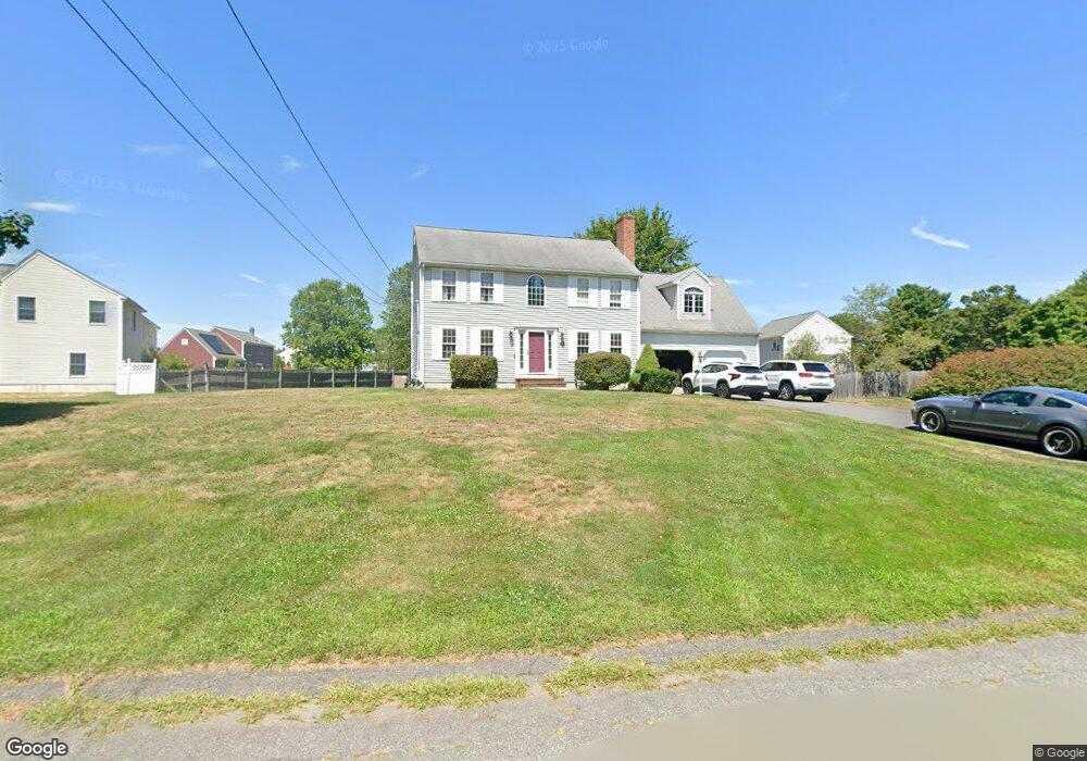
38 Frontier Dr Attleboro, MA 02703
Estimated Value: $615,495 - $690,000
About This Home
This home is located at 38 Frontier Dr, Attleboro, MA 02703 and is currently estimated at $655,874, approximately $401 per square foot. 38 Frontier Dr is a home located in Bristol County with nearby schools including Thomas E. Willett School, Cyril K. Brennan Middle School, and Attleboro High School.
Ownership History
We collect this data history from publicly available records. To have your information removed, we recommend requesting removal directly through your county’s website.
Purchase Details
Home Financials for this Owner
Home Financials are based on the most recent Mortgage that was taken out on this home.Home Values in the Area
Average Home Value in this Area
Purchase History
We collect this data history from publicly available records. To have your information removed, we recommend requesting removal directly through your county’s website.
| Date | Buyer | Sale Price | Title Company |
|---|---|---|---|
| $166,900 | -- |
Mortgage History
We collect this data history from publicly available records. To have your information removed, we recommend requesting removal directly through your county’s website.
| Date | Status | Borrower | Loan Amount |
|---|---|---|---|
| Open | $82,000 | ||
| Closed | $40,000 | ||
| Open | $158,550 |
Tax History
We collect this data history from publicly available records. To have your information removed, we recommend requesting removal directly through your county’s website.
| Year | Tax Paid | Tax Assessment Tax Assessment Total Assessment is a certain percentage of the fair market value that is determined by local assessors to be the total taxable value of land and additions on the property. | Land | Improvement |
|---|---|---|---|---|
| 2025 | $6,589 | $525,000 | $189,000 | $336,000 |
| 2024 | $6,687 | $525,300 | $207,800 | $317,500 |
| 2023 | $6,050 | $441,900 | $182,400 | $259,500 |
| 2022 | $5,646 | $390,700 | $161,200 | $229,500 |
| 2021 | $5,691 | $384,500 | $155,000 | $229,500 |
| 2020 | $5,405 | $371,200 | $147,000 | $224,200 |
| 2019 | $5,255 | $371,100 | $144,200 | $226,900 |
| 2018 | $5,103 | $344,300 | $140,000 | $204,300 |
| 2017 | $5,095 | $350,200 | $145,600 | $204,600 |
| 2016 | $4,923 | $332,200 | $136,000 | $196,200 |
| 2015 | $4,793 | $325,800 | $136,000 | $189,800 |
| 2014 | $4,728 | $318,400 | $130,800 | $187,600 |
Map
- 361 Richardson Ave
- 11 Village Way Unit F
- 39 Division St
- 7 Village Way Unit C
- 925 Pleasant St
- 19 Mathewson Ave
- 933 Pleasant St
- 238 N Worcester St
- 82 N Worcester St
- 83 N Worcester St
- 10 Anna Way
- 49 Pheasant Hill Rd
- 214 Pike Ave
- 42 Colts Way
- 0 Pike Ave
- 11 Cherry Tree Ln
- 0 Oak St
- 38 Hope St
- 49 Steeple Chase Cir Unit 2
- 25 Claire Dr
- 39 Frontier Dr
- 45 Frontier Dr
- 33 Frontier Dr
- 51 Frontier Dr
- 32 Frontier Dr
- 27 Frontier Dr
- 41 Plain St
- 26 Frontier Dr
- 21 Frontier Dr
- 35 Plain St
- 20 Frontier Dr
- 54 Frontier Dr
- 15 Frontier Dr
- 63 Frontier Dr
- 309 Richardson Ave
- 309 Richardson Ave Unit 1
- 29 Plain St
- 14 Frontier Dr
- 305 Richardson Ave
- 48 Plain St
Ask me questions while you tour the home.