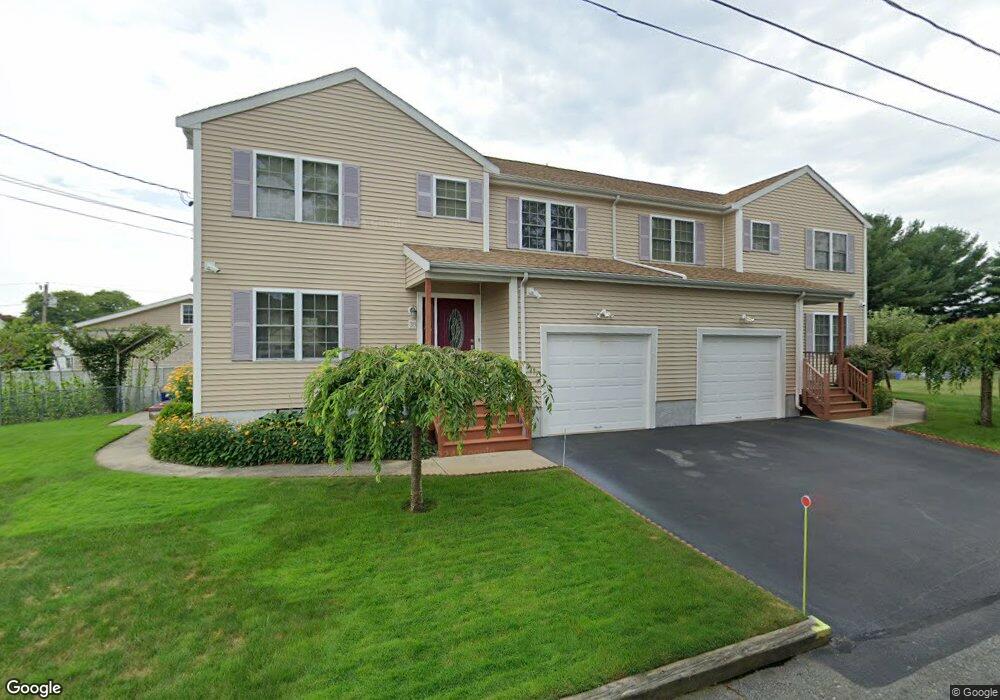
38 Schofield St Unit 40 New Bedford, MA 02740
The South End NeighborhoodEstimated Value: $512,000 - $795,000
6
Beds
4
Baths
3,224
Sq Ft
$209/Sq Ft
Est. Value
About This Home
This home is located at 38 Schofield St Unit 40, New Bedford, MA 02740 and is currently estimated at $673,954, approximately $209 per square foot. 38 Schofield St Unit 40 is a home located in Bristol County with nearby schools including Betsey B. Winslow Elementary School, Keith Middle School, and New Bedford High School.
Ownership History
Date
Name
Owned For
Owner Type
Purchase Details
Closed on
Jan 22, 2002
Sold by
Cardoso Kevin
Bought by
Oliveira Manuel A and Oliveira Maria M
Current Estimated Value
Home Financials for this Owner
Home Financials are based on the most recent Mortgage that was taken out on this home.
Original Mortgage
$60,000
Outstanding Balance
$22,618
Interest Rate
6.84%
Mortgage Type
Purchase Money Mortgage
Estimated Equity
$651,336
Purchase Details
Closed on
May 2, 2001
Sold by
Smick Lucille
Bought by
Cardoso Kevin
Create a Home Valuation Report for This Property
The Home Valuation Report is an in-depth analysis detailing your home's value as well as a comparison with similar homes in the area
Home Values in the Area
Average Home Value in this Area
Purchase History
| Date | Buyer | Sale Price | Title Company |
|---|---|---|---|
| Oliveira Manuel A | $259,900 | -- | |
| Oliveira Manuel | $259,900 | -- | |
| Cardoso Kevin | $35,000 | -- | |
| Cardoso Kevin | $35,000 | -- |
Source: Public Records
Mortgage History
| Date | Status | Borrower | Loan Amount |
|---|---|---|---|
| Open | Oliveira Manuel | $60,000 | |
| Closed | Cardoso Kevin | $60,000 |
Source: Public Records
Tax History
| Year | Tax Paid | Tax Assessment Tax Assessment Total Assessment is a certain percentage of the fair market value that is determined by local assessors to be the total taxable value of land and additions on the property. | Land | Improvement |
|---|---|---|---|---|
| 2025 | $8,187 | $723,900 | $114,100 | $609,800 |
| 2024 | $7,108 | $592,300 | $116,000 | $476,300 |
| 2023 | $7,029 | $491,900 | $100,100 | $391,800 |
| 2022 | $6,390 | $409,900 | $95,100 | $314,800 |
| 2021 | $6,390 | $409,900 | $95,100 | $314,800 |
| 2020 | $6,464 | $400,000 | $95,100 | $304,900 |
| 2019 | $6,456 | $392,000 | $95,100 | $296,900 |
| 2018 | $6,146 | $369,600 | $95,100 | $274,500 |
| 2017 | $5,569 | $333,700 | $95,100 | $238,600 |
| 2016 | $5,465 | $331,400 | $95,100 | $236,300 |
| 2015 | $4,603 | $292,600 | $95,100 | $197,500 |
| 2014 | $4,365 | $287,900 | $89,400 | $198,500 |
Source: Public Records
Map
Nearby Homes
- 0 Victoria St Unit 73457953
- 32 Priscilla St
- 125 Stackhouse St
- 303 Maple St
- 379 W Clinton St
- 493 Rivet St
- 21 James St
- 278 W Mccabe St
- 35 Larch St
- 32 Sagamore St
- 24 Larch St Unit 5
- 18 Bliss St
- 28 Borden St
- 143-145 Fair St
- 77 Dartmouth St
- 29 Elizabeth Ct
- 12 Sears St
- 69 Maple St
- 494 Union St
- 128 Osborne St Unit 128
- 63 Winterville Rd Unit 65
- 28 Schofield St
- 71 Winterville Rd Unit 73
- 59 Winterville Rd
- 31 Schofield St
- 62 Winterville Rd
- 56 Schofield St
- 70 Winterville Rd
- 36 Westbrook St
- 49 Winterville Rd
- 91 Winterville Rd
- 48 Westbrook St
- 60 Winterville Rd Unit 2
- 56 Winterville Rd
- 0 Winterville Rd (Ss)
- 28 Westbrook St
- 52 Westbrook St
- 88 Winterville Rd
- 45 Schofield St
- 22 Westbrook St
Your Personal Tour Guide
Ask me questions while you tour the home.