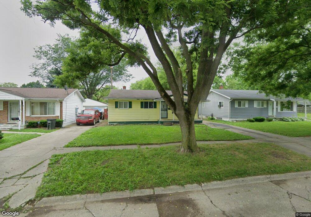
3801 Sunridge Dr Flint, MI 48506
Potter Longway NeighborhoodEstimated Value: $59,493 - $83,000
3
Beds
1
Bath
1,020
Sq Ft
$73/Sq Ft
Est. Value
About This Home
This home is located at 3801 Sunridge Dr, Flint, MI 48506 and is currently estimated at $74,123, approximately $72 per square foot. 3801 Sunridge Dr is a home located in Genesee County with nearby schools including Potter School, Richfield Public School Academy, and Richfield Early Learning Center.
Ownership History
Date
Name
Owned For
Owner Type
Purchase Details
Closed on
Aug 25, 2015
Sold by
Bell Christopher Lee
Bought by
Walker Tyvon Xavier
Current Estimated Value
Purchase Details
Closed on
Jun 10, 2015
Sold by
Smith Kevin E
Bought by
Bell Christopher Lee
Purchase Details
Closed on
Dec 28, 2011
Sold by
Zerka John
Bought by
Smith Kevin
Purchase Details
Closed on
Nov 14, 2011
Sold by
Genesee County Treasurer
Bought by
Zerka John
Purchase Details
Closed on
May 22, 2002
Sold by
Martin Charles Gordon
Bought by
Martin Charles Gordon and Martin Faye Marie
Create a Home Valuation Report for This Property
The Home Valuation Report is an in-depth analysis detailing your home's value as well as a comparison with similar homes in the area
Home Values in the Area
Average Home Value in this Area
Purchase History
| Date | Buyer | Sale Price | Title Company |
|---|---|---|---|
| Walker Tyvon Xavier | -- | Attorney | |
| Bell Christopher Lee | -- | Attorney | |
| Smith Kevin | -- | None Available | |
| Zerka John | $500 | None Available | |
| Martin Charles Gordon | -- | -- |
Source: Public Records
Tax History
| Year | Tax Paid | Tax Assessment Tax Assessment Total Assessment is a certain percentage of the fair market value that is determined by local assessors to be the total taxable value of land and additions on the property. | Land | Improvement |
|---|---|---|---|---|
| 2025 | $1,126 | $27,400 | $0 | $0 |
| 2024 | $1,044 | $22,800 | $0 | $0 |
| 2023 | $1,020 | $19,300 | $0 | $0 |
| 2022 | $0 | $15,900 | $0 | $0 |
| 2021 | $1,034 | $15,500 | $0 | $0 |
| 2020 | $952 | $12,500 | $0 | $0 |
| 2019 | $1,395 | $11,100 | $0 | $0 |
| 2018 | $1,854 | $11,000 | $0 | $0 |
| 2017 | $2,470 | $0 | $0 | $0 |
| 2016 | $896 | $0 | $0 | $0 |
| 2015 | -- | $0 | $0 | $0 |
| 2014 | -- | $0 | $0 | $0 |
| 2012 | -- | $12,600 | $0 | $0 |
Source: Public Records
Map
Nearby Homes
- 3210 Wyoming Ave
- 3010 Wyoming Ave
- 2935 Richfield Rd
- 00 Richfield Rd
- 3021 Oklahoma Ave
- 3016 Oklahoma Ave
- 2908 Douglas Ave
- 3018 Dakota Ave
- 3413 Dakota Ave
- 2719 Branch Rd
- 3291 Drexel Ave
- 2601 Dakota Ave
- 2701 Branch Rd
- 3734 Craig Dr
- 3602 Dakota Ave
- 3401 N Center Rd
- 2806 Epsilon Trail
- 4907 Delta Dr
- 2217 Maryland Ave
- 3149 Whittier Ave
- 3715 Sunridge Dr
- 3805 Sunridge Dr
- 3809 Sunridge Dr
- 3709 Sunridge Dr
- 3718 Branch Rd
- 3806 Branch Rd
- 3802 Sunridge Dr
- 3813 Sunridge Dr
- 3806 Sunridge Dr
- 3705 Sunridge Dr
- 3716 Sunridge Dr
- 3810 Branch Rd
- 3810 Sunridge Dr
- 3710 Sunridge Dr
- 3817 Sunridge Dr
- 3706 Branch Rd
- 3701 Sunridge Dr
- 3814 Sunridge Dr
- 3814 Branch Rd
- 3706 Sunridge Dr
Your Personal Tour Guide
Ask me questions while you tour the home.