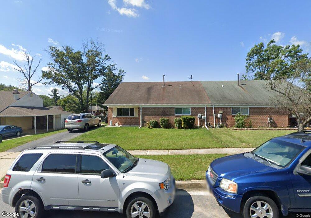
3810 Nemo Rd Randallstown, MD 21133
Estimated Value: $299,000 - $378,000
Studio
3
Baths
1,984
Sq Ft
$176/Sq Ft
Est. Value
About This Home
This home is located at 3810 Nemo Rd, Randallstown, MD 21133 and is currently estimated at $348,739, approximately $175 per square foot. 3810 Nemo Rd is a home located in Baltimore County with nearby schools including Church Lane Elementary Technology School, Northwest Academy of Health Sciences, and Randallstown High School.
Ownership History
Date
Name
Owned For
Owner Type
Purchase Details
Closed on
Aug 25, 2021
Sold by
Johnson Joseph K
Bought by
Johnson Sharon B
Current Estimated Value
Purchase Details
Closed on
Oct 26, 2005
Sold by
Matz Harold
Bought by
Johnson Joseph K and Johnson Sharon B
Purchase Details
Closed on
Oct 14, 2005
Sold by
Matz Harold
Bought by
Johnson Joseph K and Johnson Sharon B
Purchase Details
Closed on
Mar 10, 1975
Sold by
Brenbrook Constr Uction Company
Bought by
Matz Harold
Create a Home Valuation Report for This Property
The Home Valuation Report is an in-depth analysis detailing your home's value as well as a comparison with similar homes in the area
Home Values in the Area
Average Home Value in this Area
Purchase History
We collect this data history from publicly available records. To have your information removed, we recommend requesting removal directly through your county’s website.
| Date | Buyer | Sale Price | Title Company |
|---|---|---|---|
| Johnson Sharon B | -- | Moskowitz Daniel | |
| Johnson Joseph K | $207,000 | -- | |
| Johnson Joseph K | $207,000 | -- | |
| Matz Harold | $38,300 | -- |
Source: Public Records
Tax History
| Year | Tax Paid | Tax Assessment Tax Assessment Total Assessment is a certain percentage of the fair market value that is determined by local assessors to be the total taxable value of land and additions on the property. | Land | Improvement |
|---|---|---|---|---|
| 2025 | $3,800 | $270,000 | -- | -- |
| 2024 | $3,800 | $248,200 | $73,300 | $174,900 |
| 2023 | $1,847 | $241,433 | $0 | $0 |
| 2022 | $3,661 | $234,667 | $0 | $0 |
| 2021 | $3,259 | $227,900 | $55,300 | $172,600 |
| 2020 | $2,637 | $217,600 | $0 | $0 |
| 2019 | $2,512 | $207,300 | $0 | $0 |
| 2018 | $3,010 | $197,000 | $55,300 | $141,700 |
| 2017 | $2,822 | $185,900 | $0 | $0 |
| 2016 | $2,343 | $174,800 | $0 | $0 |
| 2015 | $2,343 | $163,700 | $0 | $0 |
| 2014 | $2,343 | $163,700 | $0 | $0 |
Source: Public Records
Map
Nearby Homes
- 3919 Brenbrook Dr
- 8912 Maplebrook Rd
- 8907 Maplebrook Rd
- 8819 Sonya Rd
- 7 Francine Ct
- 4048 Carthage Rd
- 3709 Lamoine Rd
- 3947 Susanna Rd
- 3708 Cassen Rd
- 4100 Hunters Hill Cir
- 20 Sunrise Ct
- 26 Arabian Ct
- 9207 Allenswood Rd
- 3910 Carthage Rd
- 3829 Elmcroft Rd
- 9110 Meadow Heights Rd
- 3506 Bayer Ave
- 4226 Huntshire Rd
- 9202 Samoset Rd
- 4234 Huntshire Rd
- 3808 Nemo Rd
- 3812 Nemo Rd
- 8835 Meadow Heights Rd
- 3806 Nemo Rd
- 3827 Brenbrook Dr
- 3829 Brenbrook Dr
- 3811 Nemo Rd
- 3825 Brenbrook Dr
- 8829 Meadow Heights Rd
- 3809 Nemo Rd
- 3804 Nemo Rd
- 3823 Brenbrook Dr
- 3900 Nemo Rd
- 3807 Nemo Rd
- 8827 Meadow Heights Rd
- 8836 Meadow Heights Rd
- 8838 Meadow Heights Rd
- 3802 Nemo Rd
- 3821 Brenbrook Dr
- 8840 Meadow Heights Rd
Your Personal Tour Guide
Ask me questions while you tour the home.