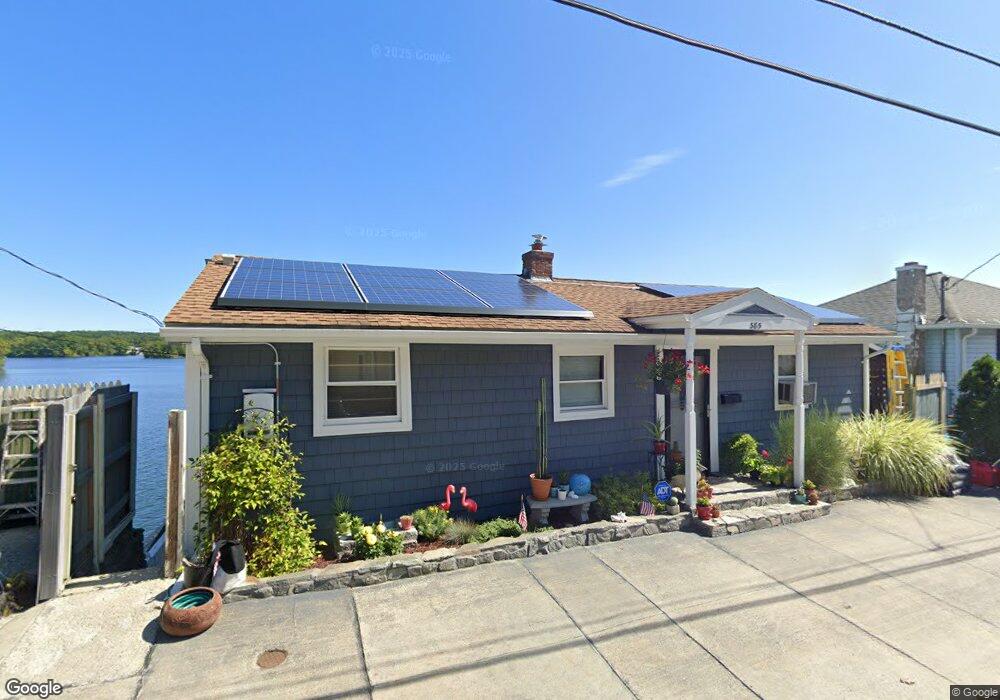
385 Bridle Path Worcester, MA 01604
Grafton Hill NeighborhoodEstimated Value: $400,000 - $576,000
2
Beds
2
Baths
912
Sq Ft
$561/Sq Ft
Est. Value
About This Home
This home is located at 385 Bridle Path, Worcester, MA 01604 and is currently estimated at $511,367, approximately $560 per square foot. 385 Bridle Path is a home located in Worcester County with nearby schools including Jacob Hiatt Magnet School, Chandler Magnet, and Lake View Elementary School.
Ownership History
Date
Name
Owned For
Owner Type
Purchase Details
Closed on
Nov 18, 2022
Sold by
Coons John
Bought by
Hlp Llc
Current Estimated Value
Purchase Details
Closed on
Jul 19, 2013
Sold by
Roux Dennis
Bought by
Coons John
Home Financials for this Owner
Home Financials are based on the most recent Mortgage that was taken out on this home.
Original Mortgage
$260,000
Interest Rate
3.92%
Mortgage Type
New Conventional
Purchase Details
Closed on
Jan 19, 1994
Sold by
Stepsis Frank and Stepsis Linda
Bought by
Roux Dennis
Create a Home Valuation Report for This Property
The Home Valuation Report is an in-depth analysis detailing your home's value as well as a comparison with similar homes in the area
Home Values in the Area
Average Home Value in this Area
Purchase History
| Date | Buyer | Sale Price | Title Company |
|---|---|---|---|
| Hlp Llc | $450,000 | None Available | |
| Coons John | $300,000 | -- | |
| Roux Dennis | $50,000 | -- |
Source: Public Records
Mortgage History
| Date | Status | Borrower | Loan Amount |
|---|---|---|---|
| Previous Owner | Coons John | $260,000 | |
| Previous Owner | Roux Dennis | $50,000 | |
| Previous Owner | Roux Dennis | $30,000 | |
| Previous Owner | Roux Dennis | $60,000 |
Source: Public Records
Tax History
| Year | Tax Paid | Tax Assessment Tax Assessment Total Assessment is a certain percentage of the fair market value that is determined by local assessors to be the total taxable value of land and additions on the property. | Land | Improvement |
|---|---|---|---|---|
| 2025 | $6,535 | $495,484 | $290,284 | $205,200 |
| 2024 | $6,561 | $477,184 | $290,284 | $186,900 |
| 2023 | $6,336 | $441,813 | $247,713 | $194,100 |
| 2022 | $5,530 | $363,546 | $198,146 | $165,400 |
| 2021 | $5,037 | $309,425 | $158,525 | $150,900 |
| 2020 | $5,034 | $296,100 | $158,200 | $137,900 |
| 2019 | $5,096 | $283,100 | $155,400 | $127,700 |
| 2018 | $5,087 | $269,000 | $155,400 | $113,600 |
| 2017 | $5,111 | $265,900 | $155,400 | $110,500 |
| 2016 | $4,872 | $236,400 | $126,700 | $109,700 |
| 2015 | $4,544 | $226,400 | $126,700 | $99,700 |
| 2014 | $4,424 | $226,400 | $126,700 | $99,700 |
Source: Public Records
Map
Nearby Homes
- 469 Lake Ave
- 81 Bay View Dr
- 13 Pocasset St
- 143 Commonwealth Ave
- 7 Atlas St
- 33 Lakeside Dr
- 2 Salisbury St
- 16-18 Fairfax St
- 15 Lakeside Dr
- 270 Sunderland Rd Unit 2
- 12 Bruce St
- 496 Hamilton St
- 11 Point Rd Unit 2
- Lot B Crawford St
- 19 Middlesex Ave
- 340 Sunderland Rd Unit 28
- 190 S Quinsigamond Ave Unit 102
- 1195 Grafton St Unit 19
- 1195 Grafton St Unit 39
- 1205 Grafton St Unit 31
- 387 Bridle Path
- 382 Bridle Path
- 379 Bridle Path
- 380 Bridle Path
- 384 Bridle Path
- 389 Bridle Path
- 389 Bridle Path Unit 1
- 389 Bridle Path Unit 2
- 386 Bridle Path
- 385 Lake Ave Unit 1
- 385 Lake Ave
- 388 Bridle Path
- 383 Lake Ave
- 391 Bridle Path
- 391 Bridle Path Unit 1
- 391 Bridle Path Unit 2
- 381 Lake Ave
- 373 Bridle Path
- 390 Bridle Path
- 393 Bridle Path
Your Personal Tour Guide
Ask me questions while you tour the home.