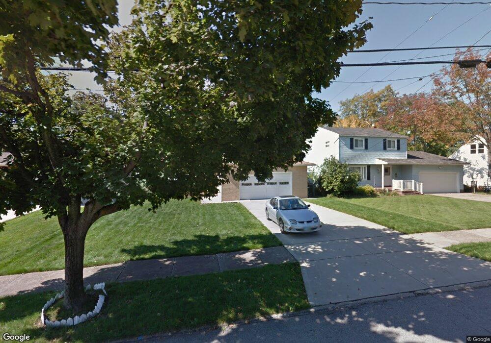
385 Kenyon Ave Bedford, OH 44146
Estimated Value: $205,000 - $217,632
About This Home
This home is located at 385 Kenyon Ave, Bedford, OH 44146 and is currently estimated at $210,908, approximately $101 per square foot. 385 Kenyon Ave is a home located in Cuyahoga County with nearby schools including Heskett Middle School, Bedford High School, and Ohio College Preparatory School.
Ownership History
We collect this data history from publicly available records. To have your information removed, we recommend requesting removal directly through your county’s website.
Purchase Details
Home Financials for this Owner
Home Financials are based on the most recent Mortgage that was taken out on this home.Purchase Details
Purchase Details
Purchase Details
Home Values in the Area
Average Home Value in this Area
Purchase History
We collect this data history from publicly available records. To have your information removed, we recommend requesting removal directly through your county’s website.
| Date | Buyer | Sale Price | Title Company |
|---|---|---|---|
| -- | Titlexperts Agency Inc | ||
| $122,500 | Titlexperts Agency Inc | ||
| -- | -- | ||
| $59,000 | -- | ||
| -- | -- |
Mortgage History
We collect this data history from publicly available records. To have your information removed, we recommend requesting removal directly through your county’s website.
| Date | Status | Borrower | Loan Amount |
|---|---|---|---|
| Open | $121,498 |
Tax History
We collect this data history from publicly available records. To have your information removed, we recommend requesting removal directly through your county’s website.
| Year | Tax Paid | Tax Assessment Tax Assessment Total Assessment is a certain percentage of the fair market value that is determined by local assessors to be the total taxable value of land and additions on the property. | Land | Improvement |
|---|---|---|---|---|
| 2025 | $4,183 | $64,120 | $12,005 | $52,115 |
| 2024 | $4,157 | $64,120 | $12,005 | $52,115 |
| 2023 | $3,409 | $47,190 | $10,820 | $36,370 |
| 2022 | $3,046 | $47,180 | $10,820 | $36,370 |
| 2021 | $2,961 | $47,180 | $10,820 | $36,370 |
| 2020 | $3,363 | $39,660 | $9,100 | $30,560 |
| 2019 | $3,275 | $113,300 | $26,000 | $87,300 |
| 2018 | $3,235 | $39,660 | $9,100 | $30,560 |
| 2017 | $3,249 | $37,390 | $7,040 | $30,350 |
| 2016 | $3,221 | $37,390 | $7,040 | $30,350 |
| 2015 | $3,299 | $37,390 | $7,040 | $30,350 |
| 2014 | $3,299 | $40,640 | $7,630 | $33,010 |
Map
- 22 Natalie Rd
- 419 Center Rd
- 0 Hubbell Cir
- 54 Hubbell Way
- 66 Hubbell Way
- 58 Hubbell Way
- 62 Hubbell Way
- 54 Willard Ave
- 57 Hubbell Way
- 61 Hubbell Way
- 475 Lamson Ave
- 443 Broadway Ave
- 132 Greencroft Rd
- 5571 Oakwood Ave
- 20648 Donny Brook Rd
- 18811 Waterbury Ave
- 94 Avalon Dr
- 78 W Glendale St
- 59 Elm St
- 79 W Grace St
Ask me questions while you tour the home.