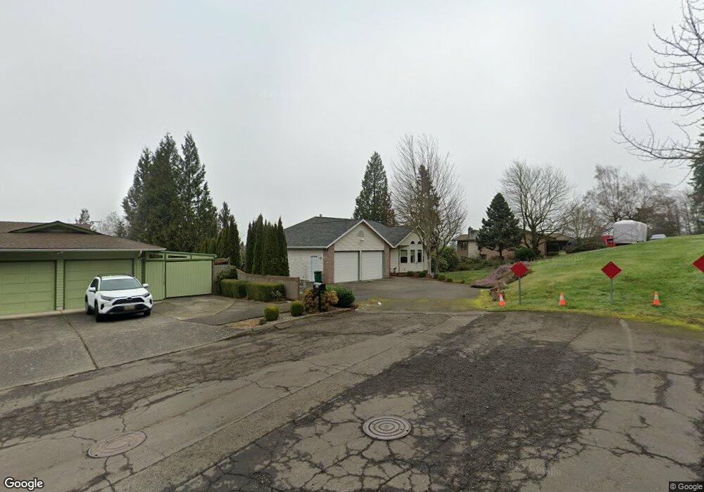
385 SW 7th St Gresham, OR 97080
Gresham Butte NeighborhoodEstimated Value: $579,000 - $635,000
4
Beds
3
Baths
2,604
Sq Ft
$236/Sq Ft
Est. Value
About This Home
This home is located at 385 SW 7th St, Gresham, OR 97080 and is currently estimated at $615,027, approximately $236 per square foot. 385 SW 7th St is a home located in Multnomah County with nearby schools including Dexter McCarty Middle School, Gresham High School, and Gresham Arthur Academy.
Ownership History
Date
Name
Owned For
Owner Type
Purchase Details
Closed on
Aug 18, 2006
Sold by
Alderman Ronald D
Bought by
Afdahl David M
Current Estimated Value
Home Financials for this Owner
Home Financials are based on the most recent Mortgage that was taken out on this home.
Original Mortgage
$225,000
Outstanding Balance
$133,946
Interest Rate
6.7%
Mortgage Type
Purchase Money Mortgage
Estimated Equity
$481,081
Purchase Details
Closed on
Sep 11, 2001
Sold by
Bauman Marion J
Bought by
Alderman Ronald D and Alderman Allison M
Create a Home Valuation Report for This Property
The Home Valuation Report is an in-depth analysis detailing your home's value as well as a comparison with similar homes in the area
Home Values in the Area
Average Home Value in this Area
Purchase History
| Date | Buyer | Sale Price | Title Company |
|---|---|---|---|
| Afdahl David M | $405,000 | Fidelity Natl Title Co Of Or | |
| Alderman Ronald D | $239,900 | Chicago Title Insurance Co |
Source: Public Records
Mortgage History
| Date | Status | Borrower | Loan Amount |
|---|---|---|---|
| Open | Afdahl David M | $225,000 |
Source: Public Records
Tax History
| Year | Tax Paid | Tax Assessment Tax Assessment Total Assessment is a certain percentage of the fair market value that is determined by local assessors to be the total taxable value of land and additions on the property. | Land | Improvement |
|---|---|---|---|---|
| 2025 | $7,877 | $387,090 | -- | -- |
| 2024 | $7,540 | $375,820 | -- | -- |
| 2023 | $6,870 | $364,880 | $0 | $0 |
| 2022 | $6,678 | $354,260 | $0 | $0 |
| 2021 | $6,510 | $343,950 | $0 | $0 |
| 2020 | $6,125 | $333,940 | $0 | $0 |
| 2019 | $5,965 | $324,220 | $0 | $0 |
| 2018 | $5,687 | $314,780 | $0 | $0 |
| 2017 | $5,457 | $305,620 | $0 | $0 |
| 2016 | $4,811 | $296,720 | $0 | $0 |
Source: Public Records
Map
Nearby Homes
- 1407 SW Walters Dr
- 415 SE Roberts Ave
- 159 SW Florence Ave Unit 64
- 159 SW Florence Ave
- 0 SW Miller Ct Unit 470855683
- 1414 SE Beech Place
- 345 NW Norman Ave
- 318 NE Roberts Ave Unit 308
- 318 NE Roberts Ave Unit 203
- 329 SE Linden Ct
- 0 NE 5th St
- 1175 SW Chastain Dr
- 511 SE 15th St
- 210 NE 5th St
- 1472 SW 14th St
- 1326 SE Linden Ct
- 1120 SE Spruce Ct
- 1488 SW 17th Ct Unit N
- 824 NW Mignonette Ave
- 491 NE Elliott Ave
- 407 SW 7th St
- 360 SW 6th St
- 350 SW 7th St
- 436 SW 6th St
- 416 SW 6th St
- 645 SW Walters Dr
- 730 SW Eastman Ave
- 421 SW 7th St
- 625 SW Walters Dr
- 715 SW Walters Dr
- 466 SW 6th St
- 433 SW 7th St
- 375 SW 6th St
- 426 SW 7th St
- 749 SW Eastman Ave
- 345 SW 6th St
- 395 SW 6th St
- 0 SW Walters Dr Unit 2014138
- 0 SW Walters Dr Unit 21102287
- 0 SW Walters Dr Unit 11489064
Your Personal Tour Guide
Ask me questions while you tour the home.