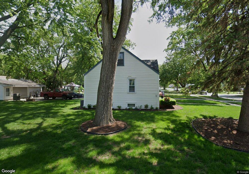
3866 217th St Matteson, IL 60443
Old Matteson NeighborhoodEstimated Value: $143,000 - $192,000
4
Beds
2
Baths
1,061
Sq Ft
$155/Sq Ft
Est. Value
About This Home
This home is located at 3866 217th St, Matteson, IL 60443 and is currently estimated at $164,617, approximately $155 per square foot. 3866 217th St is a home located in Cook County with nearby schools including Illinois School, Matteson Elementary School, and Sauk Elementary School.
Ownership History
Date
Name
Owned For
Owner Type
Purchase Details
Closed on
Dec 10, 2010
Sold by
Hasler Rivera Elizabeth Margaret and Hasler Elizabeth Margaret
Bought by
Hasler Frank J
Current Estimated Value
Home Financials for this Owner
Home Financials are based on the most recent Mortgage that was taken out on this home.
Original Mortgage
$55,000
Interest Rate
4.22%
Mortgage Type
New Conventional
Purchase Details
Closed on
Oct 11, 2005
Sold by
Hasler Frank J
Bought by
Hasler Elizabeth Margaret
Purchase Details
Closed on
Sep 26, 2005
Sold by
Painter Virginia and Hildeman Noreen
Bought by
Hasler Frank J
Create a Home Valuation Report for This Property
The Home Valuation Report is an in-depth analysis detailing your home's value as well as a comparison with similar homes in the area
Home Values in the Area
Average Home Value in this Area
Purchase History
We collect this data history from publicly available records. To have your information removed, we recommend requesting removal directly through your county’s website.
| Date | Buyer | Sale Price | Title Company |
|---|---|---|---|
| Hasler Frank J | $75,000 | None Available | |
| Hasler Elizabeth Margaret | -- | -- | |
| Hasler Frank J | -- | -- |
Source: Public Records
Mortgage History
We collect this data history from publicly available records. To have your information removed, we recommend requesting removal directly through your county’s website.
| Date | Status | Borrower | Loan Amount |
|---|---|---|---|
| Closed | Hasler Frank J | $55,000 |
Source: Public Records
Tax History
| Year | Tax Paid | Tax Assessment Tax Assessment Total Assessment is a certain percentage of the fair market value that is determined by local assessors to be the total taxable value of land and additions on the property. | Land | Improvement |
|---|---|---|---|---|
| 2025 | $4,003 | $13,000 | $2,592 | $10,408 |
| 2024 | $4,003 | $13,000 | $2,592 | $10,408 |
| 2023 | $2,215 | $13,000 | $2,592 | $10,408 |
| 2022 | $2,215 | $7,505 | $2,268 | $5,237 |
| 2021 | $2,295 | $7,504 | $2,268 | $5,236 |
| 2020 | $2,242 | $7,504 | $2,268 | $5,236 |
| 2019 | $3,026 | $9,276 | $2,106 | $7,170 |
| 2018 | $3,022 | $9,276 | $2,106 | $7,170 |
| 2017 | $2,931 | $9,276 | $2,106 | $7,170 |
| 2016 | $2,326 | $7,228 | $1,944 | $5,284 |
| 2015 | $3,523 | $7,228 | $1,944 | $5,284 |
| 2014 | $3,699 | $7,833 | $1,944 | $5,889 |
| 2013 | $3,517 | $8,149 | $1,944 | $6,205 |
Source: Public Records
Map
Nearby Homes
- 3865 216th Place
- 3817 216th Place
- 3812 216th St
- 21616 Richmond Rd
- 4101 216th St
- 21835 1/2 Richton Rd
- 21406 S Jean Ave
- 3704 214th Place
- 3802 213th Place
- 21701 Governors Hwy
- 21607 Main St
- 2033 Lioncrest Dr
- 3704 Linden Rd
- 5085 Euclid Ln
- 2064 Lioncrest Dr
- 5015 Euclid Ln
- 21955 Millard Ave
- 4430 Maple Ave
- 182 Washington St
- 22100 Karlov Ave
- 3862 217th St
- 3858 217th St
- 3854 217th St
- 3861 216th Place
- 3857 216th Place
- 3850 217th St
- 21644 Richton Rd
- 21640 Richton Rd
- 3853 216th Place
- 21650 Richton Rd
- 21636 Richton Rd
- 3865 217th St
- 3861 217th St
- 3849 216th Place
- 21702 Richton Rd
- 3857 217th St
- 21626 Richton Rd
- 3853 217th St
- 3845 216th Place
- 21706 Richton Rd
Your Personal Tour Guide
Ask me questions while you tour the home.