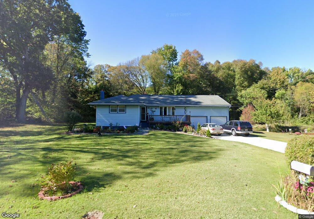
39 Access Rd Lawnside, NJ 08045
Estimated Value: $234,000 - $294,280
About This Home
This home is located at 39 Access Rd, Lawnside, NJ 08045 and is currently estimated at $272,320, approximately $246 per square foot. 39 Access Rd is a home located in Camden County with nearby schools including Lawnside Public Elementary School.
Ownership History
We collect this data history from publicly available records. To have your information removed, we recommend requesting removal directly through your county’s website.
Purchase Details
Home Financials for this Owner
Home Financials are based on the most recent Mortgage that was taken out on this home.Home Values in the Area
Average Home Value in this Area
Purchase History
We collect this data history from publicly available records. To have your information removed, we recommend requesting removal directly through your county’s website.
| Date | Buyer | Sale Price | Title Company |
|---|---|---|---|
| $75,000 | -- |
Mortgage History
We collect this data history from publicly available records. To have your information removed, we recommend requesting removal directly through your county’s website.
| Date | Status | Borrower | Loan Amount |
|---|---|---|---|
| Open | $71,250 |
Tax History
We collect this data history from publicly available records. To have your information removed, we recommend requesting removal directly through your county’s website.
| Year | Tax Paid | Tax Assessment Tax Assessment Total Assessment is a certain percentage of the fair market value that is determined by local assessors to be the total taxable value of land and additions on the property. | Land | Improvement |
|---|---|---|---|---|
| 2025 | $6,124 | $125,600 | $42,100 | $83,500 |
| 2024 | $5,670 | $125,600 | $42,000 | $83,600 |
| 2023 | $5,670 | $125,600 | $42,000 | $83,600 |
| 2022 | $5,514 | $125,600 | $42,000 | $83,600 |
| 2021 | $5,184 | $125,600 | $42,000 | $83,600 |
| 2020 | $5,320 | $125,600 | $42,000 | $83,600 |
| 2019 | $5,234 | $125,600 | $42,000 | $83,600 |
| 2018 | $5,130 | $125,600 | $42,000 | $83,600 |
| 2017 | $5,044 | $125,600 | $42,000 | $83,600 |
| 2016 | $4,922 | $125,600 | $42,000 | $83,600 |
| 2015 | $4,907 | $125,600 | $42,000 | $83,600 |
| 2014 | $4,826 | $125,600 | $42,000 | $83,600 |
Map
- 1237 Oakwood Rd
- 0 Company St
- 320 Company St
- 111 Hemmings Way
- 213 Bryant Ave
- 234 Thomas Ave N
- 0 Bell Ave
- 122 W Emlen Ave
- 36 Mott St
- 125 Tillman St
- 361 Independence Blvd
- 23 Gloucester Ave
- 145 Gloucester Ave
- 425 Peltoma Rd
- 300 Hutchinson Ave
- 224 Highland Ave
- 12 Page Ave
- 1 Page Ave
- 95 Lane of Acres
- 120 Glenwood Rd
- 9 Access Rd
- 13 Access Rd
- 5 Access Rd
- 422 Warwick Rd N
- 428 Warwick Rd N
- 434 Warwick Rd N
- 71 Access Rd
- 37 Cherry St
- 1240 Chesterfield Rd
- 415 Warwick Rd N
- 419 Warwick Rd N
- 1241 Oakwood Rd
- 423 Warwick Rd N
- 87 Access Rd
- 427 Warwick Rd N
- 413 Warwick Rd N
- 0000 Fox Chase Way
- 405 Warwick Rd N
- 433 Warwick Rd N
- 1236 Chesterfield Rd
Ask me questions while you tour the home.