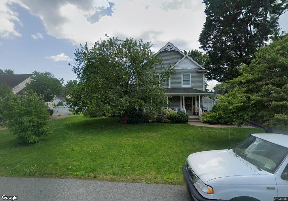
39 Cameron Ave Pompton Plains, NJ 07444
Estimated Value: $789,938 - $963,000
Studio
--
Bath
2,960
Sq Ft
$294/Sq Ft
Est. Value
About This Home
This home is located at 39 Cameron Ave, Pompton Plains, NJ 07444 and is currently estimated at $868,985, approximately $293 per square foot. 39 Cameron Ave is a home located in Morris County with nearby schools including Pequannock Twp High School, Holy Spirit School, and Netherlands Reformed Christian School.
Ownership History
Date
Name
Owned For
Owner Type
Purchase Details
Closed on
Jul 2, 1998
Sold by
Field Karl J and Field Nanette M
Bought by
Battista Joseph A and Battista Beth M
Current Estimated Value
Home Financials for this Owner
Home Financials are based on the most recent Mortgage that was taken out on this home.
Original Mortgage
$211,000
Outstanding Balance
$43,255
Interest Rate
7.02%
Estimated Equity
$825,730
Create a Home Valuation Report for This Property
The Home Valuation Report is an in-depth analysis detailing your home's value as well as a comparison with similar homes in the area
Home Values in the Area
Average Home Value in this Area
Purchase History
We collect this data history from publicly available records. To have your information removed, we recommend requesting removal directly through your county’s website.
| Date | Buyer | Sale Price | Title Company |
|---|---|---|---|
| Battista Joseph A | $265,000 | Ticor Title Insurance Compan |
Source: Public Records
Mortgage History
We collect this data history from publicly available records. To have your information removed, we recommend requesting removal directly through your county’s website.
| Date | Status | Borrower | Loan Amount |
|---|---|---|---|
| Open | Battista Joseph A | $211,000 |
Source: Public Records
Tax History
| Year | Tax Paid | Tax Assessment Tax Assessment Total Assessment is a certain percentage of the fair market value that is determined by local assessors to be the total taxable value of land and additions on the property. | Land | Improvement |
|---|---|---|---|---|
| 2025 | $11,872 | $661,400 | $310,800 | $350,600 |
| 2024 | $11,092 | $650,500 | $306,300 | $344,200 |
| 2023 | $11,092 | $603,500 | $265,800 | $337,700 |
| 2022 | $11,771 | $471,400 | $202,300 | $269,100 |
| 2021 | $11,771 | $471,400 | $202,300 | $269,100 |
| 2020 | $11,620 | $471,400 | $202,300 | $269,100 |
| 2019 | $11,243 | $471,400 | $202,300 | $269,100 |
| 2018 | $10,819 | $471,400 | $202,300 | $269,100 |
| 2017 | $10,470 | $471,400 | $202,300 | $269,100 |
| 2016 | $10,140 | $471,400 | $202,300 | $269,100 |
| 2015 | $10,093 | $471,400 | $202,300 | $269,100 |
| 2014 | $9,852 | $471,400 | $202,300 | $269,100 |
Source: Public Records
Map
Nearby Homes
- 34 Cameron Ave
- 11 White Birch Ave
- 397 Newark Pompton Turnpike
- 1 Chalen Ct
- 35 Payson Rd
- 19 4th St
- 11 Meyer Place
- 47 Colfax Dr
- 520 Turnpike C112 Unit C112
- 86 Greenwood Ave
- 8 Duncan Ave
- 45 Village Rd
- 19 Colfax Dr
- 63 Duncan Ave
- 43 Madison St
- 83 Village Rd
- 13 West Pkwy
- 29 Brookside Ave
- 5 Brookside Ave
- 23 Slingerland Ave
Your Personal Tour Guide
Ask me questions while you tour the home.