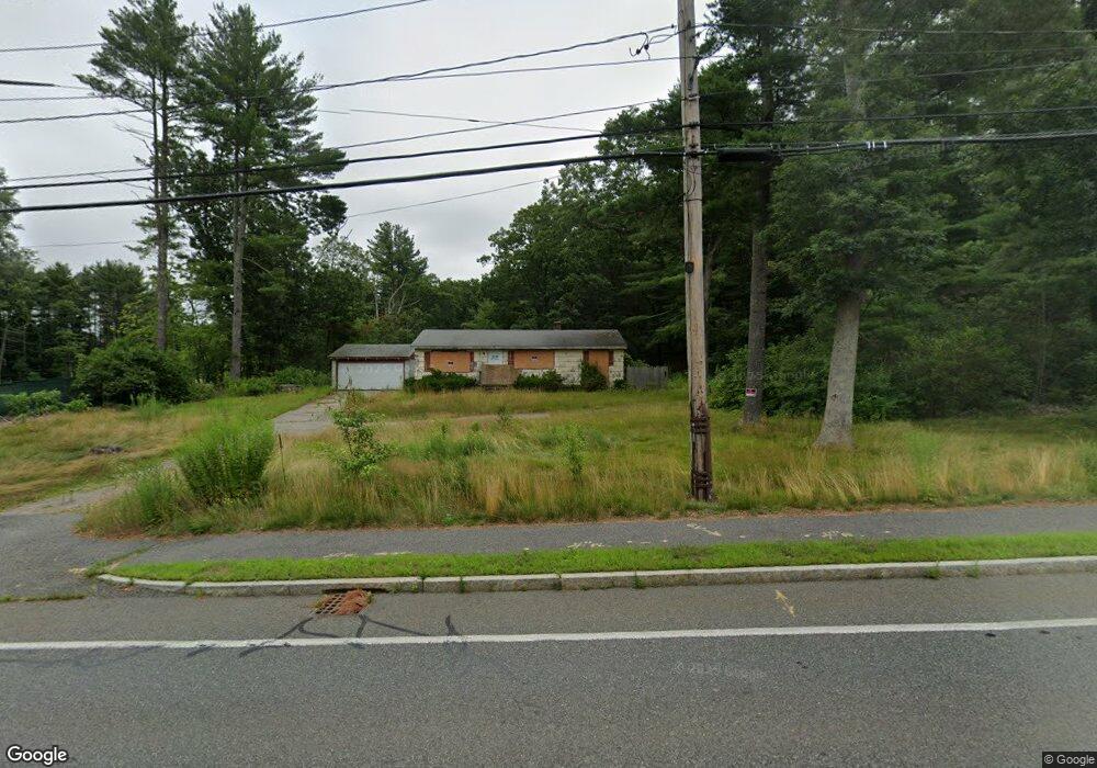
39 Pine St Norfolk, MA 02056
Estimated Value: $492,000 - $549,801
3
Beds
1
Bath
1,008
Sq Ft
$514/Sq Ft
Est. Value
About This Home
This home is located at 39 Pine St, Norfolk, MA 02056 and is currently estimated at $517,700, approximately $513 per square foot. 39 Pine St is a home located in Norfolk County with nearby schools including H. Olive Day School, Freeman-Kennedy School, and Foxborough Regional Charter School.
Ownership History
Date
Name
Owned For
Owner Type
Purchase Details
Closed on
Mar 16, 2026
Sold by
Hill St Partner Dev Two Llc
Bought by
Pondville Crossing Llc
Current Estimated Value
Home Financials for this Owner
Home Financials are based on the most recent Mortgage that was taken out on this home.
Original Mortgage
$2,400,000
Outstanding Balance
$2,397,652
Interest Rate
6.09%
Mortgage Type
Purchase Money Mortgage
Estimated Equity
-$1,879,952
Purchase Details
Closed on
Mar 17, 2023
Sold by
Bremilst Tatyana
Bought by
Hill St Partner Dev Two
Home Financials for this Owner
Home Financials are based on the most recent Mortgage that was taken out on this home.
Original Mortgage
$450,000
Interest Rate
6.09%
Mortgage Type
Purchase Money Mortgage
Create a Home Valuation Report for This Property
The Home Valuation Report is an in-depth analysis detailing your home's value as well as a comparison with similar homes in the area
Home Values in the Area
Average Home Value in this Area
Purchase History
We collect this data history from publicly available records. To have your information removed, we recommend requesting removal directly through your county’s website.
| Date | Buyer | Sale Price | Title Company |
|---|---|---|---|
| Pondville Crossing Llc | -- | -- | |
| Pondville Crossing Llc | -- | -- | |
| Hill St Partner Dev Two | $500,000 | None Available | |
| Hill St Partner Dev Two | $500,000 | None Available |
Source: Public Records
Mortgage History
We collect this data history from publicly available records. To have your information removed, we recommend requesting removal directly through your county’s website.
| Date | Status | Borrower | Loan Amount |
|---|---|---|---|
| Open | Pondville Crossing Llc | $2,400,000 | |
| Previous Owner | Hill St Partner Dev Two | $450,000 |
Source: Public Records
Tax History
| Year | Tax Paid | Tax Assessment Tax Assessment Total Assessment is a certain percentage of the fair market value that is determined by local assessors to be the total taxable value of land and additions on the property. | Land | Improvement |
|---|---|---|---|---|
| 2025 | $6,152 | $385,200 | $218,400 | $166,800 |
| 2024 | $5,974 | $383,700 | $218,400 | $165,300 |
| 2023 | $5,799 | $353,400 | $218,400 | $135,000 |
| 2022 | $5,950 | $326,900 | $204,400 | $122,500 |
| 2021 | $5,140 | $285,700 | $198,500 | $87,200 |
| 2020 | $5,091 | $273,100 | $180,300 | $92,800 |
| 2019 | $4,858 | $265,600 | $180,300 | $85,300 |
| 2018 | $4,428 | $237,800 | $165,900 | $71,900 |
| 2017 | $4,356 | $239,100 | $165,900 | $73,200 |
| 2016 | $4,131 | $228,500 | $162,400 | $66,100 |
| 2015 | $3,910 | $221,400 | $154,700 | $66,700 |
| 2014 | $4,044 | $232,000 | $154,700 | $77,300 |
Source: Public Records
Map
Nearby Homes
- 723 Dedham St
- 71 Pond St
- 8 Weber Farm Rd Unit 8
- 4 Weber Farm Rd Unit 4
- 131 Washington St Unit 32
- 131 Washington St Unit 42
- 131 Washington St Unit 29
- 131 Washington St Unit 50
- 131 Washington St Unit 51
- 59 Geordan Ave
- Lot 1 Eisenhauer
- 315 Summer St
- 8 Conway Ln
- 0 W Birch Rd
- 13 Old Colony Rd
- 260 Summer St
- 16R Eldor Dr
- 19 King St
- 25 King St
- 30 Neponset St
Your Personal Tour Guide
Ask me questions while you tour the home.