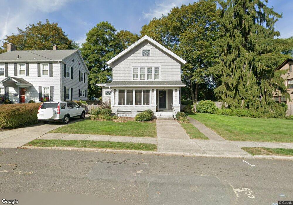
39 Wellesley Rd Holyoke, MA 01040
Estimated Value: $324,267 - $427,000
3
Beds
1
Bath
1,784
Sq Ft
$217/Sq Ft
Est. Value
About This Home
This home is located at 39 Wellesley Rd, Holyoke, MA 01040 and is currently estimated at $387,567, approximately $217 per square foot. 39 Wellesley Rd is a home located in Hampden County with nearby schools including E.N. White Elementary School, Lt. Clayre Sullivan Elementary School, and Holyoke High School.
Ownership History
Date
Name
Owned For
Owner Type
Purchase Details
Closed on
Jun 28, 2002
Sold by
Alkam Ahmad A and Alkam Mervat
Bought by
Ross Ernest J and Ross Kerry M
Current Estimated Value
Home Financials for this Owner
Home Financials are based on the most recent Mortgage that was taken out on this home.
Original Mortgage
$155,000
Outstanding Balance
$64,109
Interest Rate
6.92%
Mortgage Type
Purchase Money Mortgage
Estimated Equity
$323,458
Purchase Details
Closed on
Feb 6, 1997
Sold by
Taylor Dene H and Taylor Sheila A
Bought by
Alkam Ahmad A and Alkam Mervat
Purchase Details
Closed on
Nov 16, 1987
Sold by
Grass William H
Bought by
Taylor Dene H
Home Financials for this Owner
Home Financials are based on the most recent Mortgage that was taken out on this home.
Original Mortgage
$103,900
Interest Rate
11.13%
Mortgage Type
Purchase Money Mortgage
Create a Home Valuation Report for This Property
The Home Valuation Report is an in-depth analysis detailing your home's value as well as a comparison with similar homes in the area
Home Values in the Area
Average Home Value in this Area
Purchase History
| Date | Buyer | Sale Price | Title Company |
|---|---|---|---|
| Ross Ernest J | $155,000 | -- | |
| Alkam Ahmad A | $106,000 | -- | |
| Taylor Dene H | $129,900 | -- |
Source: Public Records
Mortgage History
| Date | Status | Borrower | Loan Amount |
|---|---|---|---|
| Open | Taylor Dene H | $155,000 | |
| Previous Owner | Taylor Dene H | $70,000 | |
| Previous Owner | Taylor Dene H | $103,900 |
Source: Public Records
Tax History
| Year | Tax Paid | Tax Assessment Tax Assessment Total Assessment is a certain percentage of the fair market value that is determined by local assessors to be the total taxable value of land and additions on the property. | Land | Improvement |
|---|---|---|---|---|
| 2025 | $4,946 | $283,300 | $76,300 | $207,000 |
| 2024 | $4,753 | $250,800 | $72,700 | $178,100 |
| 2023 | $4,559 | $243,000 | $72,700 | $170,300 |
| 2022 | $4,418 | $229,400 | $72,700 | $156,700 |
| 2021 | $2,042 | $221,000 | $72,700 | $148,300 |
| 2020 | $4,056 | $212,600 | $72,700 | $139,900 |
| 2019 | $3,665 | $209,600 | $72,700 | $136,900 |
| 2018 | $1,859 | $202,500 | $72,700 | $129,800 |
| 2017 | $3,554 | $202,500 | $72,700 | $129,800 |
| 2016 | $3,853 | $201,500 | $74,800 | $126,700 |
| 2015 | $3,837 | $201,500 | $74,800 | $126,700 |
Source: Public Records
Map
Nearby Homes
- 31 Wellesley Rd
- 41 Dartmouth St
- 61 Cleveland St
- 50 Nonotuck St
- 53 Nonotuck St
- 60 Hampton Knolls Rd
- 154 Madison Ave
- 1177 Northampton St
- 76 Nonotuck St
- 129 Morgan St
- 352 Pleasant St
- 68 Fairfield Ave
- 391 Pleasant St
- 151 Lincoln St
- 1022-1024 Hampden St
- 1225 Hampden St
- 77 Central Park Dr
- 121 W Meadowview Rd
- 43 W Summit St Unit A10
- 15-17 Oconnor Ave
- 43 Wellesley Rd
- 47 Wellesley Rd
- 43 Amherst St
- 23 Wellesley Rd
- 30 Jefferson St
- 32 Jefferson St
- 44 Amherst St
- 55 Wellesley Rd
- 34 Jefferson St
- 28 Jefferson St
- 28 Stanford St
- 35 Amherst St
- 34 Amherst St
- 19 Wellesley Rd
- 61 Harvard St
- 61 Wellesley Rd
- 36 Jefferson St
- 30 Amherst St
- 26 Stanford St
- 31 Amherst St
Your Personal Tour Guide
Ask me questions while you tour the home.