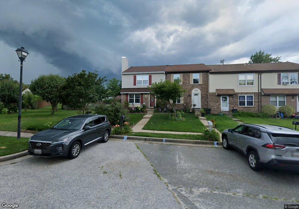
3900 Link Ave Nottingham, MD 21236
Estimated Value: $299,000 - $341,000
Studio
2
Baths
1,600
Sq Ft
$201/Sq Ft
Est. Value
About This Home
This home is located at 3900 Link Ave, Nottingham, MD 21236 and is currently estimated at $321,671, approximately $201 per square foot. 3900 Link Ave is a home located in Baltimore County with nearby schools including Perry Hall Elementary School, Perry Hall Middle School, and Perry Hall High School.
Ownership History
Date
Name
Owned For
Owner Type
Purchase Details
Closed on
Jun 5, 2018
Sold by
Wittstadt Susanna P
Bought by
Witt Stadt Susanna P
Current Estimated Value
Purchase Details
Closed on
Apr 6, 2016
Sold by
Wittstadt Susanna P and Senft Susanna P
Bought by
Wittstadt Susanna P and Senft John
Purchase Details
Closed on
Jul 15, 1999
Sold by
Baumgardner Sharon K
Bought by
Senft Susanna P
Purchase Details
Closed on
May 10, 1995
Sold by
Weyforth Robert T
Bought by
Baumgardner Sharon K
Home Financials for this Owner
Home Financials are based on the most recent Mortgage that was taken out on this home.
Original Mortgage
$80,800
Interest Rate
8.31%
Purchase Details
Closed on
Apr 20, 1989
Sold by
Smith Loretta
Bought by
Weyforth Robert T
Create a Home Valuation Report for This Property
The Home Valuation Report is an in-depth analysis detailing your home's value as well as a comparison with similar homes in the area
Home Values in the Area
Average Home Value in this Area
Purchase History
| Date | Buyer | Sale Price | Title Company |
|---|---|---|---|
| Witt Stadt Susanna P | -- | None Available | |
| Wittstadt Susanna P | -- | Attorney | |
| Senft Susanna P | $107,900 | -- | |
| Baumgardner Sharon K | $101,000 | -- | |
| Weyforth Robert T | $86,500 | -- |
Source: Public Records
Mortgage History
| Date | Status | Borrower | Loan Amount |
|---|---|---|---|
| Previous Owner | Baumgardner Sharon K | $80,800 |
Source: Public Records
Tax History
| Year | Tax Paid | Tax Assessment Tax Assessment Total Assessment is a certain percentage of the fair market value that is determined by local assessors to be the total taxable value of land and additions on the property. | Land | Improvement |
|---|---|---|---|---|
| 2025 | $3,276 | $254,400 | -- | -- |
| 2024 | $3,276 | $240,200 | $0 | $0 |
| 2023 | $1,542 | $226,000 | $66,000 | $160,000 |
| 2022 | $2,991 | $210,167 | $0 | $0 |
| 2021 | $2,825 | $194,333 | $0 | $0 |
| 2020 | $2,825 | $178,500 | $66,000 | $112,500 |
| 2019 | $2,148 | $177,200 | $0 | $0 |
| 2018 | $2,875 | $175,900 | $0 | $0 |
| 2017 | $3,121 | $174,600 | $0 | $0 |
| 2016 | $5,004 | $171,200 | $0 | $0 |
| 2015 | $5,004 | $167,800 | $0 | $0 |
| 2014 | $5,004 | $164,400 | $0 | $0 |
Source: Public Records
Map
Nearby Homes
- 3702 Timahoe Cir
- 27 Cavan Green
- 13 Leinster Garth
- 3702 E Joppa Rd
- 8876 Paddock Ln
- 4106 Link Ave
- 19 Derwood Ct
- 9036 Simms Ct
- 8713 Belair Rd
- 4213 Mispillion Rd
- 9 Slavin Ct
- 3 Slavin Ct
- 4231 Plumer Ave
- 25 Arwell Ct
- 3505 E Joppa Rd
- 24 Lerner Ct
- 9046 Naygall Rd
- 9318 Hines Estates Dr
- 4234 Necker Ave
- 9727 Denrob Ct
- 3902 Link Ave
- 3904 Link Ave
- 3804 Link Ave
- 3906 Link Ave
- 3908 Link Ave
- 3910 Link Ave
- 3912 Link Ave
- 19 Kilbeggan Green
- 21 Kilbeggan Green
- 23 Kilbeggan Green
- 3802 Link Ave
- 3914 Link Ave
- 3805 Link Ave
- 25 Kilbeggan Green
- 3803 Link Ave
- 3916 Link Ave
- 27 Kilbeggan Green
- 3901 Link Ave
- 17 Kilbeggan Green
- 29 Kilbeggan Green
Your Personal Tour Guide
Ask me questions while you tour the home.