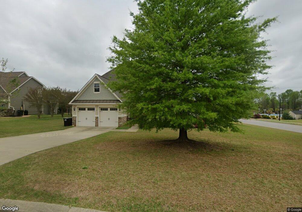
391 Adams Point Dr Garner, NC 27529
Estimated Value: $485,655 - $527,000
About This Home
This home is located at 391 Adams Point Dr, Garner, NC 27529 and is currently estimated at $511,164, approximately $161 per square foot. 391 Adams Point Dr is a home located in Johnston County with nearby schools including West View Elementary School, Cleveland Middle School, and West Johnston High School.
Ownership History
We collect this data history from publicly available records. To have your information removed, we recommend requesting removal directly through your county’s website.
Purchase Details
Home Financials for this Owner
Home Financials are based on the most recent Mortgage that was taken out on this home.Purchase Details
Purchase Details
Home Financials for this Owner
Home Financials are based on the most recent Mortgage that was taken out on this home.Purchase Details
Home Financials for this Owner
Home Financials are based on the most recent Mortgage that was taken out on this home.Home Values in the Area
Average Home Value in this Area
Purchase History
We collect this data history from publicly available records. To have your information removed, we recommend requesting removal directly through your county’s website.
| Date | Buyer | Sale Price | Title Company |
|---|---|---|---|
| -- | Fidelity National Agency Sol | ||
| $269,500 | Barristers Title Services | ||
| -- | Transtar National Title | ||
| $292,000 | None Available |
Mortgage History
We collect this data history from publicly available records. To have your information removed, we recommend requesting removal directly through your county’s website.
| Date | Status | Borrower | Loan Amount |
|---|---|---|---|
| Open | $535,937,000 | ||
| Previous Owner | $224,800 | ||
| Previous Owner | $233,600 |
Tax History
We collect this data history from publicly available records. To have your information removed, we recommend requesting removal directly through your county’s website.
| Year | Tax Paid | Tax Assessment Tax Assessment Total Assessment is a certain percentage of the fair market value that is determined by local assessors to be the total taxable value of land and additions on the property. | Land | Improvement |
|---|---|---|---|---|
| 2025 | $3,066 | $482,890 | $70,000 | $412,890 |
| 2024 | $2,500 | $308,700 | $48,000 | $260,700 |
| 2023 | $2,416 | $308,700 | $48,000 | $260,700 |
| 2022 | $2,539 | $308,700 | $48,000 | $260,700 |
| 2021 | $2,539 | $308,700 | $48,000 | $260,700 |
| 2020 | $2,570 | $308,700 | $48,000 | $260,700 |
| 2019 | $2,570 | $308,700 | $48,000 | $260,700 |
| 2018 | $2,449 | $287,260 | $44,000 | $243,260 |
| 2017 | $2,449 | $287,260 | $44,000 | $243,260 |
| 2016 | $2,449 | $287,260 | $44,000 | $243,260 |
| 2015 | $2,449 | $287,260 | $44,000 | $243,260 |
| 2014 | $2,449 | $287,260 | $44,000 | $243,260 |
Map
- 58 Trailblazer Ln
- 296 Shadowbark Dr
- 83 Birdo Point Way
- 109 Dandy Flush Ct
- 110 Dandy Flush Ct
- 210 Ivey Gate Ln
- 68 Longhorn Dr
- 13 W Currituck Cir
- 1 Cornwallis Rd
- 188 Flight Pattern Way
- 7000 Scarlett Ln
- 17 Belgian Blue Dr
- 125 Wolf Den Dr
- 0 Southfort Dr
- 304 Artic Cir
- 908 Olive Dr
- 116 Hogan Dr
- 200 Lema Dr
- 116 Nicklaus Dr
- 121 Hogan Dr
- 373 Adams Point Dr
- 429 Adams Point Dr
- 1434 Fieldtrial Cir
- 351 Adams Point Dr
- 1416 Fieldtrial Cir Unit CAROL
- 386 Adams Point Dr
- 1396 Fieldtrial Cir
- 368 Adams Point Dr
- 428 Adams Point Dr
- 447 Adams Point Dr Unit CARLO
- 331 Adams Point Dr
- 346 Adams Point Dr
- 1372 Fieldtrial Cir
- 450 Adams Point Dr
- 313 Adams Point Dr
- 328 Adams Point Dr
- 475 Adams Point Dr
- 165 Fieldtrial Cir Unit CAROL
- 165 Fieldtrial Cir
- 466 Adams Point Dr Unit BELLE
Ask me questions while you tour the home.