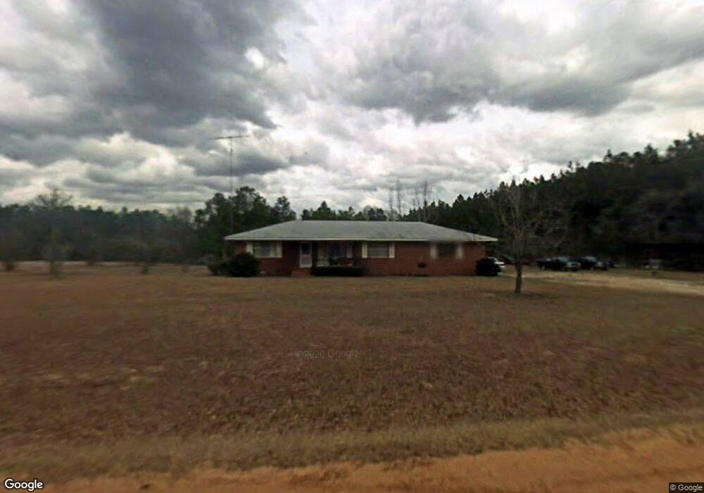
391 Tower Rd Soperton, GA 30457
Estimated Value: $134,000 - $203,000
Studio
2
Baths
1,305
Sq Ft
$122/Sq Ft
Est. Value
About This Home
This home is located at 391 Tower Rd, Soperton, GA 30457 and is currently estimated at $159,145, approximately $121 per square foot. 391 Tower Rd is a home located in Treutlen County with nearby schools including Treutlen Elementary School and Treutlen Middle/High School.
Ownership History
Date
Name
Owned For
Owner Type
Purchase Details
Closed on
Oct 13, 2022
Sold by
Steptoe Fred W Estate
Bought by
Pate Christopher and Pate Shaunna
Current Estimated Value
Home Financials for this Owner
Home Financials are based on the most recent Mortgage that was taken out on this home.
Original Mortgage
$105,000
Outstanding Balance
$100,400
Interest Rate
6.02%
Mortgage Type
New Conventional
Estimated Equity
$58,745
Purchase Details
Closed on
Jul 3, 1990
Bought by
Steptoe Fred
Create a Home Valuation Report for This Property
The Home Valuation Report is an in-depth analysis detailing your home's value as well as a comparison with similar homes in the area
Purchase History
| Date | Buyer | Sale Price | Title Company |
|---|---|---|---|
| Pate Christopher | $140,000 | -- | |
| Steptoe Fred | -- | -- |
Source: Public Records
Mortgage History
| Date | Status | Borrower | Loan Amount |
|---|---|---|---|
| Open | Pate Christopher | $105,000 |
Source: Public Records
Tax History
| Year | Tax Paid | Tax Assessment Tax Assessment Total Assessment is a certain percentage of the fair market value that is determined by local assessors to be the total taxable value of land and additions on the property. | Land | Improvement |
|---|---|---|---|---|
| 2025 | $896 | $32,080 | $8,720 | $23,360 |
| 2024 | $897 | $32,080 | $8,720 | $23,360 |
| 2023 | $865 | $32,080 | $8,720 | $23,360 |
| 2022 | $642 | $30,920 | $8,720 | $22,200 |
| 2021 | $641 | $30,920 | $8,720 | $22,200 |
| 2020 | $641 | $30,920 | $8,720 | $22,200 |
| 2019 | $641 | $30,920 | $8,720 | $22,200 |
| 2018 | $735 | $30,040 | $8,720 | $21,320 |
| 2017 | $608 | $30,040 | $8,720 | $21,320 |
| 2016 | $598 | $30,040 | $8,720 | $21,320 |
| 2015 | -- | $30,040 | $8,720 | $21,320 |
| 2014 | -- | $30,040 | $8,720 | $21,320 |
| 2013 | -- | $30,040 | $8,720 | $21,320 |
Source: Public Records
Map
Nearby Homes
- 0 Lake Helen Loop Unit 10640271
- 2005 Thairdell Rd
- 2131 Rockledge Rd
- 0 Knox Mill Rd Unit 10640244
- 0 Muskogee Trail Unit LOT 84
- 0 Muskogee Trail Unit 30570
- 0 Raymond Wilkes Rd
- 2576 Georgia 29
- 2576 Ga Highway 29 S
- 0 Oscar Beacham Rd
- 2618 Georgia 86
- 0 Lloyd Hester Rd Unit 10706887
- 46 Georgia 46
- 0 Hwy 297 - Tract 2 & 3
- 1578 Edsel Senn Rd
- 1310 Outlaw Grove Way
- 4281 Ga Highway 46
- 4281 Sr-46
- 121 Canary Cir
- 1869 Florida Ave
- 306 Tower Rd
- 243 Tower Rd
- 201 Tower Rd
- 180 Tower Rd
- 304 Orland Station Rd
- 10002 Ga Highway 29
- 658 Spivey Cemetery Rd
- 10222 Ga Highway 29
- 1470 Pecan Point
- 507 Sterling Mill Rd
- 10113 Ga Highway 29
- 10163 Ga Highway 29
- 312 Orland Station Rd
- 95 Knox Mill Rd
- 221 Knox Mill Rd
- 227 Knox Mill Rd
- 26 American Way
- 10385 Ga Highway 29
- 10311 Ga Highway 29
- 335 Spivey Cemetery Rd
Your Personal Tour Guide
Ask me questions while you tour the home.